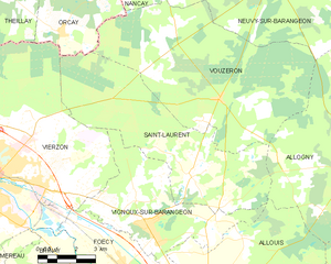
Allogny (Allogny)

- commune in Cher, France
- Country:

- Postal Code: 18110
- Coordinates: 47° 13' 34" N, 2° 19' 23" E


- GPS tracks (wikiloc): [Link]
- Area: 49.53 sq km
- Population: 1010
- Web site: http://www.allogny.fr
- Wikipedia en: wiki(en)
- Wikipedia: wiki(fr)
- Wikidata storage: Wikidata: Q1139966
- Wikipedia Commons Category: [Link]
- Freebase ID: [/m/03mfb_m]
- GeoNames ID: Alt: [3038094]
- SIREN number: [211800040]
- BnF ID: [15249350k]
- PACTOLS thesaurus ID: [pcrtIhu5Ww0Qzp]
- INSEE municipality code: 18004
Shares border with regions:
Saint-Martin-d'Auxigny
- commune in Cher, France
- Country:
- Postal Code: 18110
- Coordinates: 47° 12' 14" N, 2° 25' 0" E
- GPS tracks (wikiloc): [Link]
- Area: 24.08 sq km
- Population: 2340
Saint-Éloy-de-Gy
- commune in Cher, France
- Country:
- Postal Code: 18110
- Coordinates: 47° 9' 22" N, 2° 20' 33" E
- GPS tracks (wikiloc): [Link]
- Area: 31.2 sq km
- Population: 1547


Vouzeron
- commune in Cher, France
- Country:
- Postal Code: 18330
- Coordinates: 47° 15' 37" N, 2° 13' 19" E
- GPS tracks (wikiloc): [Link]
- Area: 52.63 sq km
- Population: 553
- Web site: [Link]


Neuvy-sur-Barangeon
- commune in Cher, France
- Country:
- Postal Code: 18330
- Coordinates: 47° 18' 56" N, 2° 15' 14" E
- GPS tracks (wikiloc): [Link]
- Area: 67.34 sq km
- Population: 1243


Méry-ès-Bois
- commune in Cher, France
- Country:
- Postal Code: 18380
- Coordinates: 47° 18' 51" N, 2° 21' 47" E
- GPS tracks (wikiloc): [Link]
- Area: 91.59 sq km
- Population: 579
- Web site: [Link]


Allouis
- commune in Cher, France
- Country:
- Postal Code: 18500
- Coordinates: 47° 9' 57" N, 2° 13' 37" E
- GPS tracks (wikiloc): [Link]
- Area: 35.59 sq km
- Population: 1050

Saint-Laurent
- commune in Cher, France
- Country:
- Postal Code: 18330
- Coordinates: 47° 13' 30" N, 2° 12' 7" E
- GPS tracks (wikiloc): [Link]
- AboveSeaLevel: 115 м m
- Area: 38.72 sq km
- Population: 494
- Web site: [Link]