Alt-Treptow (Alt-Treptow)

- locality of Berlin
 Hiking in Alt-Treptow
Alt-Treptow, a district in Berlin, offers a variety of hiking and walking opportunities, particularly along the banks of the Spree River and through its green parks. While it may not be as rugged as traditional hiking destinations, it provides pleasant routes for leisurely walks, nature walks, and urban hiking experiences. Here are some highlights for hiking in Alt-Treptow:
1.
- The banks of the Spree River offer a scenic route with pathways that are perfect for walking or cycling. You can enjoy views of the water, nearby parks, and the city's architecture.
2.
- This large park is a focal point in Alt-Treptow. It features well-maintained paths, expansive green spaces, and beautiful lake views. Within the park, you can find the Soviet War Memorial, which is an important historical site.
3.
- Located just a bit further from Alt-Treptow, Wuhlheide offers a more forested area for hiking. The park includes wooded paths, meadows, and a lake, making for a more nature-oriented hike.
4.
- Several small conservation areas and parks, like the Rummelsburger See and the nearby Lietzenseepark, provide opportunities to observe diverse flora and fauna while hiking.
5.
- If you enjoy urban environments, you can incorporate hiking into a city exploration by walking to points of interest such as the Alt-Treptower churches, local shops, and cafes.
6.
- The area is easily accessible via public transport, making it convenient to reach various starting points for your hikes.
Tips for Hiking in Alt-Treptow:
- Footwear: Wear comfortable walking shoes, as some paths may be uneven.
- Stay Hydrated: Bring water with you, especially during warmer months.
- Plan Ahead: While Alt-Treptow is urban, having a map or GPS can help you navigate to points of interest.
Overall, hiking in Alt-Treptow may not provide wilderness experiences but offers a unique combination of urban charm and natural beauty. It's ideal for those looking for a relaxing day outdoors without venturing too far from the city.
- Country:

- Coordinates: 52° 29' 24" N, 13° 26' 58" E


- GPS tracks (wikiloc): [Link]
- AboveSeaLevel: 36 м m
- Area: 2.31 sq km
- Population: 10859
- Wikipedia en: wiki(en)
- Wikipedia: wiki(de)
- Wikidata storage: Wikidata: Q702517
- Wikipedia Commons Gallery: [Link]
- Wikipedia Commons Category: [Link]
- Wikipedia Commons Maps Category: [Link]
- Freebase ID: [/m/09rvwq1]
- GeoNames ID: Alt: [2821292]
- OSM relation ID: [55762]
- archINFORM location ID: [3617]
Shares border with regions:

Neukölln
- locality of the borough Neukölln of Berlin, Germany
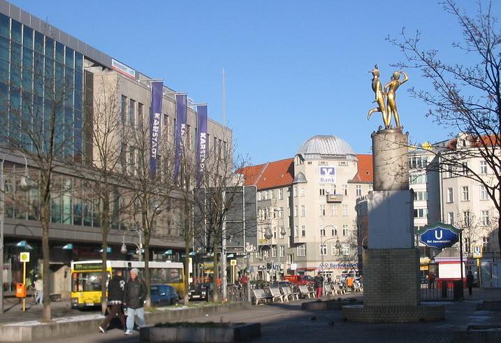
Hiking in Neukölln
Neukölln, a vibrant district in Berlin, Germany, is not typically known for traditional hiking trails like those found in mountainous regions. However, there are several spots within and around Neukölln where you can enjoy nature walks, green spaces, and urban hiking experiences....
- Country:
- Postal Code: 12059; 12057; 12055; 12053; 12051; 12049; 12047; 12045; 12043
- Coordinates: 52° 28' 53" N, 13° 26' 7" E
- GPS tracks (wikiloc): [Link]
- AboveSeaLevel: 55 м m
- Area: 11.7 sq km
- Population: 167248

Kreuzberg
- locality of Berlin, Germany
Hiking in Kreuzberg
Kreuzberg is a vibrant neighborhood in Berlin, Germany, known for its diverse culture, arts, and nightlife. While it’s primarily an urban area, there are some great outdoor spaces for walking and hiking enthusiasts....
- Country:
- Postal Code: 10969; 10999; 10997; 10967; 10965; 10963; 10961
- Coordinates: 52° 29' 15" N, 13° 23' 0" E
- GPS tracks (wikiloc): [Link]
- AboveSeaLevel: 52 м m
- Area: 10.38 sq km
- Population: 153887


Friedrichshain
- locality of Berlin
Hiking in Friedrichshain
Friedrichshain is a vibrant neighborhood in Berlin, Germany, known more for its urban atmosphere, parks, and nightlife than for traditional hiking trails. However, there are still plenty of opportunities for walking and enjoying the outdoors in this area....
- Country:
- Postal Code: 10317; 10179; 10178; 10249; 10247; 10245; 10243
- Coordinates: 52° 30' 57" N, 13° 27' 15" E
- GPS tracks (wikiloc): [Link]
- AboveSeaLevel: 41 м m
- Area: 9.78 sq km
- Population: 125169

Plänterwald
- locality of Berlin
Hiking in Plänterwald
Plänterwald is a beautiful green area located in Berlin, Germany, particularly known for its scenic landscapes and unique blend of nature and urban environment. While it may not be the first location that comes to mind for hiking, it offers a number of trails and paths that can be enjoyable for walkers and nature enthusiasts....
- Country:
- Coordinates: 52° 28' 47" N, 13° 28' 31" E
- GPS tracks (wikiloc): [Link]
- AboveSeaLevel: 31 м m
- Area: 3.01 sq km