Amaro, Friuli (Amaro)
- Italian comune
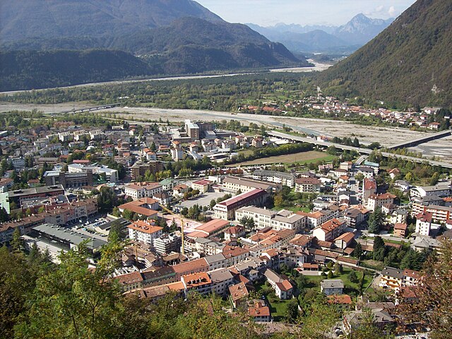
Amaro, located in the Friuli Venezia Giulia region of northern Italy, is a fantastic destination for hiking enthusiasts. Nestled in the foothills of the Julian Alps, it offers breathtaking scenery, diverse landscapes, and a variety of trails catering to different skill levels. Here are some key highlights for hiking in the area:
Trails and Routes
- Sentiero del Rio Bujas: A scenic route that follows the Bujas River, offering beautiful views of the surrounding forest and wildlife.
- Mount Coglians: As the highest peak in the Carnic Alps, hiking to Mount Coglians provides an exhilarating challenge along with stunning panoramic views.
- Altipiano del Montasio: This area boasts a range of trails that wind through alpine meadows and offer spectacular vistas of the steep cliffs and the surrounding peaks.
Flora and Fauna
The region is rich in biodiversity. Hikers can encounter various alpine flora, such as blooming wildflowers in the summer and possibly spot wildlife like chamois or deer.
Seasonality
- Summer: The best time for hiking is typically from late spring to early autumn when the weather is favorable.
- Winter: In winter, the area is popular for snowshoeing and ski touring, with several trails accessible for those looking to explore in a wintery landscape.
Practical Tips
- Gear: Ensure you wear appropriate hiking gear, including sturdy boots, weather-appropriate clothing, and carry plenty of water.
- Maps and Guides: It’s a good idea to have a trail map or guidebook. Local tourist offices can be excellent resources for both maps and information on trail conditions.
- Safety: Check the weather forecast before heading out, as conditions can change rapidly in mountain areas.
Local Culture
Hiking in Amaro also allows you to experience local culture. After a hike, you can explore nearby towns and sample traditional Friuli cuisine, which is a fantastic way to relax and enjoy the regional flavors.
In summary, hiking in Amaro, Friuli, presents a wonderful opportunity to experience stunning natural landscapes, diverse trails, and the rich cultural tapestry of northern Italy. Whether you are an experienced hiker or a beginner, there’s something for everyone in this beautiful part of the Alps.
- Country:

- Postal Code: 33020
- Local Dialing Code: 0433
- Licence Plate Code: UD
- Coordinates: 46° 22' 30" N, 13° 5' 47" E


- GPS tracks (wikiloc): [Link]
- AboveSeaLevel: 296 м m
- Area: 33.26 sq km
- Population: 857
- Web site: http://www.comune.amaro.ud.it
- Wikipedia en: wiki(en)
- Wikipedia: wiki(it)
- Wikidata storage: Wikidata: Q53213
- Wikipedia Commons Category: [Link]
- Freebase ID: [/m/0gk83l]
- GeoNames ID: Alt: [6538360]
- OSM relation ID: [79286]
- Quora topic ID: [Amaro]
- UN/LOCODE: [ITAM8]
- ISTAT ID: 030002
- Italian cadastre code: A254
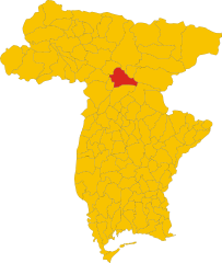
Shares border with regions:


Cavazzo Carnico
- Italian comune
Cavazzo Carnico, located in the Friuli Venezia Giulia region of northeastern Italy, is a fantastic destination for hiking enthusiasts. Nestled between the beautiful Julian Alps and the Carnic Alps, the area is known for its stunning landscapes, diverse flora and fauna, and rich cultural heritage....
- Country:

- Postal Code: 33020
- Local Dialing Code: 0433
- Licence Plate Code: UD
- Coordinates: 46° 22' 0" N, 13° 2' 0" E


- GPS tracks (wikiloc): [Link]
- AboveSeaLevel: 290 м m
- Area: 39.44 sq km
- Population: 1024
- Web site: [Link]


Moggio Udinese
- Italian comune
Moggio Udinese, located in the Friuli-Venezia Giulia region of northeastern Italy, is a charming destination for hiking enthusiasts. Nestled in the Julian Alps, the area is characterized by lush landscapes, picturesque valleys, and majestic mountain views. Here are some highlights and tips for hiking in and around Moggio Udinese:...
- Country:

- Postal Code: 33015
- Local Dialing Code: 0433
- Licence Plate Code: UD
- Coordinates: 46° 25' 0" N, 13° 12' 0" E


- GPS tracks (wikiloc): [Link]
- AboveSeaLevel: 341 м m
- Area: 142.44 sq km
- Population: 1703
- Web site: [Link]


Tolmezzo
- Italian comune
Tolmezzo, located in the Carnia region of the Friuli Venezia Giulia area of northeastern Italy, is a fantastic destination for hiking enthusiasts. Surrounded by the stunning Carnic Alps and lush valleys, it offers a variety of trails catering to all experience levels, from beginners to seasoned hikers....
- Country:

- Postal Code: 33028
- Local Dialing Code: 0433 487911
- Licence Plate Code: UD
- Coordinates: 46° 24' 0" N, 13° 1' 0" E


- GPS tracks (wikiloc): [Link]
- AboveSeaLevel: 323 м m
- Area: 64.62 sq km
- Population: 10191
- Web site: [Link]


Venzone
- Italian comune
Venzone is a picturesque town located in the Friuli Venezia Giulia region of northeastern Italy. Surrounded by stunning natural landscapes, it offers a great base for hiking enthusiasts. Here’s what you can expect when hiking in and around Venzone:...
- Country:

- Postal Code: 33010
- Local Dialing Code: 0432
- Licence Plate Code: UD
- Coordinates: 46° 19' 49" N, 13° 8' 18" E


- GPS tracks (wikiloc): [Link]
- AboveSeaLevel: 230 м m
- Area: 54.55 sq km
- Population: 2011
- Web site: [Link]

