Ambillou (Ambillou)

- commune in Indre-et-Loire, France
- Country:

- Postal Code: 37340
- Coordinates: 47° 27' 5" N, 0° 26' 51" E


- GPS tracks (wikiloc): [Link]
- Area: 48.85 sq km
- Population: 1846
- Wikipedia en: wiki(en)
- Wikipedia: wiki(fr)
- Wikidata storage: Wikidata: Q1136119
- Wikipedia Commons Category: [Link]
- Freebase ID: [/m/03nvc70]
- GeoNames ID: Alt: [6452285]
- SIREN number: [213700024]
- BnF ID: [152575547]
- PACTOLS thesaurus ID: [pcrtZvZpnwULNp]
- INSEE municipality code: 37002
Shares border with regions:


Cléré-les-Pins
- commune in Indre-et-Loire, France
- Country:
- Postal Code: 37340
- Coordinates: 47° 25' 31" N, 0° 23' 27" E
- GPS tracks (wikiloc): [Link]
- Area: 35.62 sq km
- Population: 1423
- Web site: [Link]

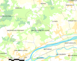
Saint-Étienne-de-Chigny
- commune in Indre-et-Loire, France
- Country:
- Postal Code: 37230
- Coordinates: 47° 22' 12" N, 0° 30' 58" E
- GPS tracks (wikiloc): [Link]
- Area: 21.11 sq km
- Population: 1542


Pernay
- commune in Indre-et-Loire, France
- Country:
- Postal Code: 37230
- Coordinates: 47° 26' 37" N, 0° 29' 58" E
- GPS tracks (wikiloc): [Link]
- Area: 17.61 sq km
- Population: 1300
- Web site: [Link]


Sonzay
- commune in Indre-et-Loire, France
- Country:
- Postal Code: 37360
- Coordinates: 47° 31' 38" N, 0° 27' 44" E
- GPS tracks (wikiloc): [Link]
- Area: 48.34 sq km
- Population: 1403


Souvigné
- commune in Indre-et-Loire, France
- Country:
- Postal Code: 37330
- Coordinates: 47° 31' 15" N, 0° 23' 54" E
- GPS tracks (wikiloc): [Link]
- Area: 24.41 sq km
- Population: 833


Luynes
- commune in Indre-et-Loire, France
- Country:
- Postal Code: 37230
- Coordinates: 47° 23' 5" N, 0° 33' 16" E
- GPS tracks (wikiloc): [Link]
- Area: 34.01 sq km
- Population: 5153
- Web site: [Link]


Mazières-de-Touraine
- commune in Indre-et-Loire, France
- Country:
- Postal Code: 37130
- Coordinates: 47° 22' 59" N, 0° 25' 33" E
- GPS tracks (wikiloc): [Link]
- Area: 34.18 sq km
- Population: 1291
- Web site: [Link]