canton of Château-la-Vallière (canton de Château-la-Vallière)
- canton of France (until March 2015)
- Country:

- Capital: Château-la-Vallière
- Coordinates: 47° 30' 33" N, 0° 18' 33" E


- GPS tracks (wikiloc): [Link]
- Wikidata storage: Wikidata: Q1310732
- INSEE canton code: [3705]
Includes regions:


Brèches
- commune in Indre-et-Loire, France
- Country:
- Postal Code: 37330
- Coordinates: 47° 34' 11" N, 0° 23' 19" E
- GPS tracks (wikiloc): [Link]
- Area: 11.63 sq km
- Population: 301

Ambillou
- commune in Indre-et-Loire, France
- Country:
- Postal Code: 37340
- Coordinates: 47° 27' 5" N, 0° 26' 51" E
- GPS tracks (wikiloc): [Link]
- Area: 48.85 sq km
- Population: 1846


Braye-sur-Maulne
- commune in Indre-et-Loire, France
- Country:
- Postal Code: 37330
- Coordinates: 47° 33' 20" N, 0° 14' 55" E
- GPS tracks (wikiloc): [Link]
- Area: 11.84 sq km
- Population: 178


Saint-Laurent-de-Lin
- commune in Indre-et-Loire, France
- Country:
- Postal Code: 37330
- Coordinates: 47° 30' 25" N, 0° 15' 29" E
- GPS tracks (wikiloc): [Link]
- Area: 13.86 sq km
- Population: 324


Lublé
- commune in Indre-et-Loire, France
- Country:
- Postal Code: 37330
- Coordinates: 47° 30' 53" N, 0° 14' 42" E
- GPS tracks (wikiloc): [Link]
- Area: 12.6 sq km
- Population: 146


Rillé
- commune in Indre-et-Loire, France
- Country:
- Postal Code: 37340
- Coordinates: 47° 27' 1" N, 0° 14' 54" E
- GPS tracks (wikiloc): [Link]
- Area: 23.96 sq km
- Population: 312


Couesmes
- commune in Indre-et-Loire, France
- Country:
- Postal Code: 37330
- Coordinates: 47° 33' 50" N, 0° 20' 30" E
- GPS tracks (wikiloc): [Link]
- Area: 19.12 sq km
- Population: 481
- Web site: [Link]

Marcilly-sur-Maulne
- commune in Indre-et-Loire, France
- Country:
- Postal Code: 37330
- Coordinates: 47° 33' 3" N, 0° 14' 29" E
- GPS tracks (wikiloc): [Link]
- Area: 14.6 sq km
- Population: 235
- Web site: [Link]


Courcelles-de-Touraine
- commune in Indre-et-Loire, France
- Country:
- Postal Code: 37330
- Coordinates: 47° 28' 56" N, 0° 18' 30" E
- GPS tracks (wikiloc): [Link]
- Area: 25.71 sq km
- Population: 506


Souvigné
- commune in Indre-et-Loire, France
- Country:
- Postal Code: 37330
- Coordinates: 47° 31' 15" N, 0° 23' 54" E
- GPS tracks (wikiloc): [Link]
- Area: 24.41 sq km
- Population: 833

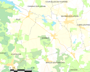
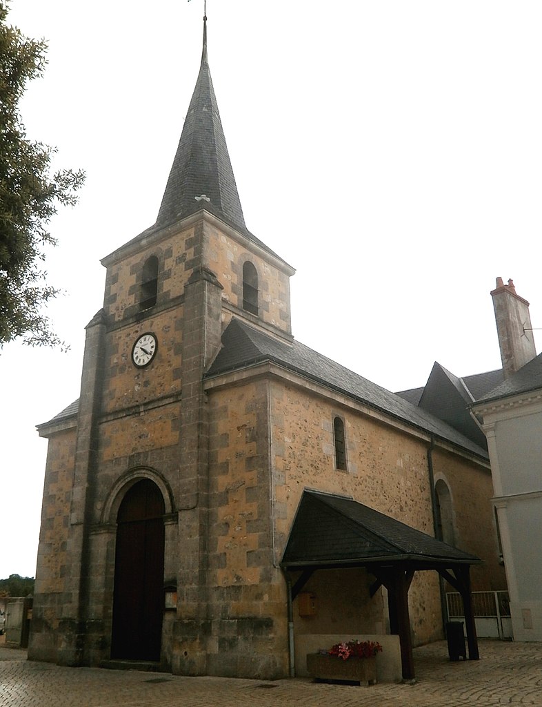
Hommes
- commune in Indre-et-Loire, France
- Country:
- Postal Code: 37340
- Coordinates: 47° 25' 33" N, 0° 17' 48" E
- GPS tracks (wikiloc): [Link]
- Area: 29.59 sq km
- Population: 882
- Web site: [Link]

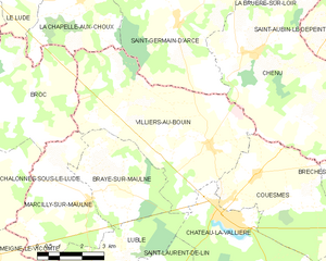
Villiers-au-Bouin
- commune in Indre-et-Loire, France
- Country:
- Postal Code: 37330
- Coordinates: 47° 34' 29" N, 0° 18' 46" E
- GPS tracks (wikiloc): [Link]
- Area: 29.83 sq km
- Population: 763


Savigné-sur-Lathan
- commune in Indre-et-Loire, France
- Country:
- Postal Code: 37340
- Coordinates: 47° 26' 40" N, 0° 19' 13" E
- GPS tracks (wikiloc): [Link]
- Area: 17.61 sq km
- Population: 1365

Channay-sur-Lathan
- commune in Indre-et-Loire, France
- Country:
- Postal Code: 37330
- Coordinates: 47° 28' 48" N, 0° 15' 49" E
- GPS tracks (wikiloc): [Link]
- Area: 28.71 sq km
- Population: 824


Château-la-Vallière
- commune in Indre-et-Loire, France
- Country:
- Postal Code: 37330
- Coordinates: 47° 32' 49" N, 0° 19' 30" E
- GPS tracks (wikiloc): [Link]
- Area: 21.94 sq km
- Population: 1768
- Web site: [Link]