Anoux (Anoux)

- commune in Meurthe-et-Moselle, France
- Country:

- Postal Code: 54150
- Coordinates: 49° 16' 31" N, 5° 52' 7" E


- GPS tracks (wikiloc): [Link]
- Area: 9.88 sq km
- Population: 255
- Wikipedia en: wiki(en)
- Wikipedia: wiki(fr)
- Wikidata storage: Wikidata: Q576623
- Wikipedia Commons Category: [Link]
- Freebase ID: [/m/03hlfcj]
- Freebase ID: [/m/03hlfcj]
- Freebase ID: [/m/03hlfcj]
- GeoNames ID: Alt: [6449688]
- GeoNames ID: Alt: [6449688]
- GeoNames ID: Alt: [6449688]
- SIREN number: [215400185]
- SIREN number: [215400185]
- SIREN number: [215400185]
- BnF ID: [152640879]
- BnF ID: [152640879]
- BnF ID: [152640879]
- INSEE municipality code: 54018
- INSEE municipality code: 54018
- INSEE municipality code: 54018
Shares border with regions:


Tucquegnieux
- commune in Meurthe-et-Moselle, France
- Country:
- Postal Code: 54640
- Coordinates: 49° 18' 38" N, 5° 53' 59" E
- GPS tracks (wikiloc): [Link]
- Area: 9.16 sq km
- Population: 2502
- Web site: [Link]

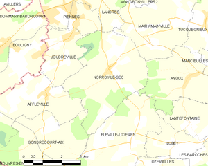
Norroy-le-Sec
- commune in Meurthe-et-Moselle, France
- Country:
- Postal Code: 54150
- Coordinates: 49° 16' 48" N, 5° 48' 39" E
- GPS tracks (wikiloc): [Link]
- Area: 13.77 sq km
- Population: 417

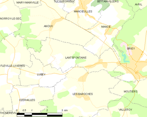
Lantéfontaine
- commune in Meurthe-et-Moselle, France
- Country:
- Postal Code: 54150
- Coordinates: 49° 15' 0" N, 5° 54' 32" E
- GPS tracks (wikiloc): [Link]
- Area: 8.06 sq km
- Population: 761


Mairy-Mainville
- commune in Meurthe-et-Moselle, France
- Country:
- Postal Code: 54150
- Coordinates: 49° 18' 13" N, 5° 51' 32" E
- GPS tracks (wikiloc): [Link]
- AboveSeaLevel: 200 м m
- Area: 12.42 sq km
- Population: 561


Mance
- former commune in Meurthe-et-Moselle, France
- Country:
- Postal Code: 54150
- Coordinates: 49° 16' 7" N, 5° 54' 59" E
- GPS tracks (wikiloc): [Link]
- Area: 7.39 sq km
- Population: 599


Fléville-Lixières
- commune in Meurthe-et-Moselle, France
- Country:
- Postal Code: 54150
- Coordinates: 49° 14' 43" N, 5° 49' 23" E
- GPS tracks (wikiloc): [Link]
- Area: 14.38 sq km
- Population: 307


Mancieulles
- former commune in Meurthe-et-Moselle, France
- Country:
- Postal Code: 54790
- Coordinates: 49° 17' 1" N, 5° 53' 34" E
- GPS tracks (wikiloc): [Link]
- Area: 4.39 sq km
- Population: 1875