Lantéfontaine (Lantéfontaine)

- commune in Meurthe-et-Moselle, France
- Country:

- Postal Code: 54150
- Coordinates: 49° 15' 0" N, 5° 54' 32" E


- GPS tracks (wikiloc): [Link]
- Area: 8.06 sq km
- Population: 761
- Wikipedia en: wiki(en)
- Wikipedia: wiki(fr)
- Wikidata storage: Wikidata: Q1060546
- Wikipedia Commons Category: [Link]
- Freebase ID: [/m/03qdkyb]
- Freebase ID: [/m/03qdkyb]
- Freebase ID: [/m/03qdkyb]
- GeoNames ID: Alt: [6436697]
- GeoNames ID: Alt: [6436697]
- GeoNames ID: Alt: [6436697]
- SIREN number: [215403023]
- SIREN number: [215403023]
- SIREN number: [215403023]
- BnF ID: [15264371r]
- BnF ID: [15264371r]
- BnF ID: [15264371r]
- PACTOLS thesaurus ID: [pcrtdSPvPDiRNr]
- PACTOLS thesaurus ID: [pcrtdSPvPDiRNr]
- PACTOLS thesaurus ID: [pcrtdSPvPDiRNr]
- INSEE municipality code: 54302
- INSEE municipality code: 54302
- INSEE municipality code: 54302
Shares border with regions:


Les Baroches
- commune in Meurthe-et-Moselle, France
- Country:
- Postal Code: 54150
- Coordinates: 49° 13' 48" N, 5° 53' 32" E
- GPS tracks (wikiloc): [Link]
- Area: 13.28 sq km
- Population: 362


Lubey
- commune in Meurthe-et-Moselle, France
- Country:
- Postal Code: 54150
- Coordinates: 49° 14' 41" N, 5° 51' 19" E
- GPS tracks (wikiloc): [Link]
- Area: 3.93 sq km
- Population: 232


Mance
- former commune in Meurthe-et-Moselle, France
- Country:
- Postal Code: 54150
- Coordinates: 49° 16' 7" N, 5° 54' 59" E
- GPS tracks (wikiloc): [Link]
- Area: 7.39 sq km
- Population: 599


Fléville-Lixières
- commune in Meurthe-et-Moselle, France
- Country:
- Postal Code: 54150
- Coordinates: 49° 14' 43" N, 5° 49' 23" E
- GPS tracks (wikiloc): [Link]
- Area: 14.38 sq km
- Population: 307
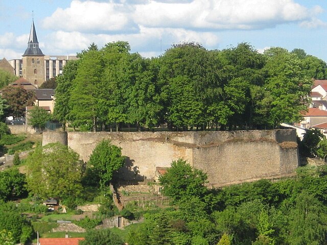
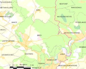
Briey
- former commune in Meurthe-et-Moselle, France
- Country:
- Postal Code: 54150
- Coordinates: 49° 14' 55" N, 5° 56' 22" E
- GPS tracks (wikiloc): [Link]
- AboveSeaLevel: 240 м m
- Area: 27.13 sq km
- Population: 5819
- Web site: [Link]


Anoux
- commune in Meurthe-et-Moselle, France
- Country:
- Postal Code: 54150
- Coordinates: 49° 16' 31" N, 5° 52' 7" E
- GPS tracks (wikiloc): [Link]
- Area: 9.88 sq km
- Population: 255