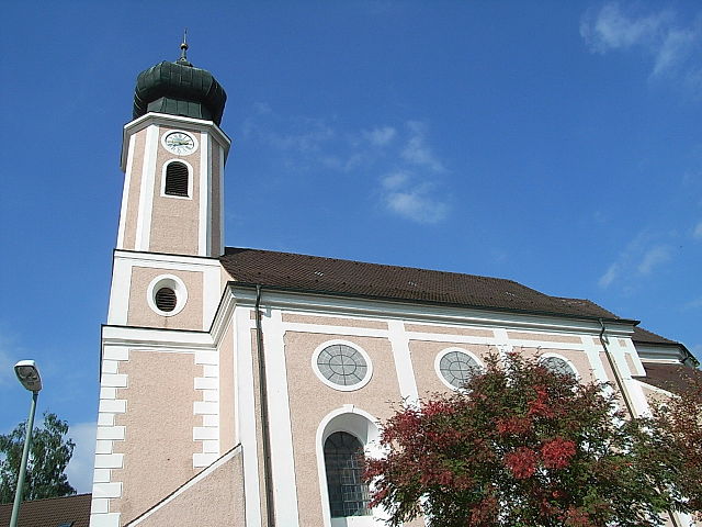
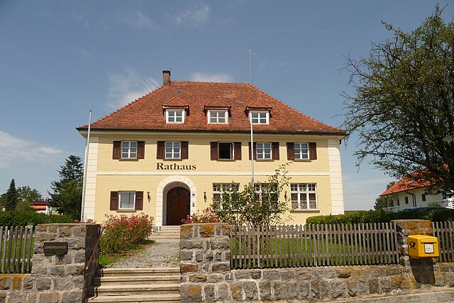
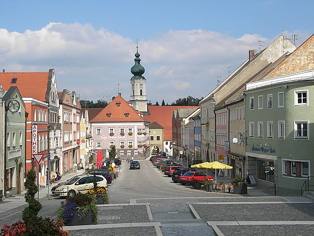
Pocking (Pocking)

- municipality of Germany
 Hiking in Pocking
Pocking is a town located in Bavaria, Germany, near the border with Austria. While it may not be as widely recognized for hiking as other regions in Bavaria, it offers access to some lovely trails and scenic landscapes.
Hiking Opportunities in Pocking:
-
Surrounding Nature: The area around Pocking is characterized by rolling hills, forests, and farmlands. It’s an excellent place for leisurely hikes, nature walks, and enjoying the tranquility of the countryside.
-
Thermal Spa Trails: Nearby towns such as Bad Füssing, known for its thermal baths, often have dedicated walking and hiking paths that can be explored. These trails can be combined with spa visits if you want to relax after a hike.
-
Regional Trails: The Bavarian Forest National Park isn’t too far from Pocking. While you might need to drive a bit, it offers stunning trails through dense woods, offering a chance to hike in a more rugged terrain with beautiful views.
-
Local Trails: Check with local tourism information for maps and recommendations on specific trails in the area. Many local communities maintain marked hiking routes, and these can often be explored in a few hours.
-
Cycling and Hiking: If you're an outdoor enthusiast, consider combining hiking with biking, as many trails support both activities. The landscapes around Pocking can be enjoyed from various perspectives.
Tips for Hiking in Pocking:
- Weather Check: Always check the weather forecast before heading out, as conditions can change rapidly in this region.
- Footwear: Wear sturdy hiking shoes, especially if you plan to walk on uneven terrain.
- Hydration and Snacks: Bring enough water and snacks for your hike.
- Maps: Carry a local map or download a hiking app that works in the area.
- Respect Nature: Stick to marked trails to minimize your impact on the environment.
Whether you’re a seasoned hiker or just looking to enjoy a leisurely walk, Pocking and its surroundings offer an inviting escape into nature. Happy hiking!
- Country:

- Postal Code: 94060
- Local Dialing Code: 08531
- Licence Plate Code: PA
- Coordinates: 48° 23' 59" N, 13° 19' 0" E


- GPS tracks (wikiloc): [Link]
- AboveSeaLevel: 323 м m
- Area: 68.86 sq km
- Population: 11152
- Web site: https://www.pocking.de/
- Wikipedia en: wiki(en)
- Wikipedia: wiki(de)
- Wikidata storage: Wikidata: Q279629
- Wikipedia Commons Category: [Link]
- Freebase ID: [/m/0dlt8q]
- GeoNames ID: Alt: [2853065]
- BnF ID: [14620967x]
- VIAF ID: Alt: [137312738]
- OSM relation ID: [958087]
- GND ID: Alt: [4115577-4]
- archINFORM location ID: [11424]
- Library of Congress authority ID: Alt: [n88155695]
- Quora topic ID: [Pocking]
- Historical Gazetteer (GOV) ID: [POCIN1JN68PJ]
- Digital Atlas of the Roman Empire ID: [7109]
- Bavarikon ID: [ODB_A00001569]
- German municipality key: 09275141
Shares border with regions:
Kirchham
- municipality of Germany
Hiking in Kirchham
Kirchham is a charming village located in Austria, near the Danube River, and it offers several hiking opportunities for outdoor enthusiasts. The region is characterized by its picturesque landscapes, rolling hills, and scenic views, making it an appealing destination for hikers of all levels....
- Country:
- Postal Code: 94148
- Local Dialing Code: 08533
- Licence Plate Code: PA
- Coordinates: 48° 21' 0" N, 13° 16' 0" E
- GPS tracks (wikiloc): [Link]
- AboveSeaLevel: 335 м m
- Area: 18.47 sq km
- Population: 1969
- Web site: [Link]

Ruhstorf an der Rott
- municipality in the district of Passau in Bavaria
Hiking in Ruhstorf an der Rott
Ruhstorf an der Rott is a picturesque village located in Bavaria, Germany, and offers a charming environment for hiking enthusiasts. The surrounding region is characterized by rolling hills, lush meadows, and scenic woodlands, making it an excellent destination for various outdoor activities. Here are some highlights and tips for hiking in and around Ruhstorf an der Rott:...
- Country:
- Postal Code: 94099
- Local Dialing Code: 08531
- Licence Plate Code: PA
- Coordinates: 48° 26' 0" N, 13° 20' 0" E
- GPS tracks (wikiloc): [Link]
- AboveSeaLevel: 317 м m
- Area: 51.46 sq km
- Population: 5844
- Web site: [Link]


Tettenweis
- municipality of Germany
Hiking in Tettenweis
Tettenweis, a picturesque village in Bavaria, Germany, is surrounded by beautiful landscapes and offers various hiking opportunities for outdoor enthusiasts. The region features gentle rolling hills, lush forests, and charming agricultural landscapes, making it ideal for both casual and experienced hikers....
- Country:
- Postal Code: 94167
- Local Dialing Code: 08534
- Licence Plate Code: PA
- Coordinates: 48° 26' 0" N, 13° 16' 0" E
- GPS tracks (wikiloc): [Link]
- AboveSeaLevel: 335 м m
- Area: 28.7 sq km
- Population: 1658
- Web site: [Link]


Bad Füssing
- municipality of Germany
Hiking in Bad Füssing
Bad Füssing, located in Bavaria, Germany, is predominantly known for its thermal spas, but it also provides excellent opportunities for hiking amidst beautiful natural landscapes. The region is characterized by its gentle hills, lush forests, and the scenic landscape of the Isar valley. Here are some highlights of hiking in Bad Füssing:...
- Country:
- Postal Code: 94072
- Local Dialing Code: 08531
- Licence Plate Code: PA
- Coordinates: 48° 21' 0" N, 13° 18' 0" E
- GPS tracks (wikiloc): [Link]
- AboveSeaLevel: 320 м m
- Area: 55.06 sq km
- Population: 6994
- Web site: [Link]

Neuhaus am Inn
- municipality of Germany
Hiking in Neuhaus am Inn
Neuhaus am Inn is a charming town located in Bavaria, Germany, near the border with Austria. Surrounded by beautiful landscapes, it serves as an excellent base for hiking enthusiasts. Here are some highlights and tips to consider when hiking in this area:...
- Country:
- Postal Code: 94152
- Local Dialing Code: 08503
- Licence Plate Code: PA
- Coordinates: 48° 27' 38" N, 13° 25' 13" E
- GPS tracks (wikiloc): [Link]
- AboveSeaLevel: 323 м m
- Area: 31.07 sq km
- Population: 3415
- Web site: [Link]

Rotthalmünster
- municipality of Germany
Hiking in Rotthalmünster
Rotthalmünster is a picturesque village located in Bavaria, Germany, offering a variety of hiking opportunities amid beautiful landscapes. When planning a hiking trip in and around Rotthalmünster, here are some highlights and tips to consider:...
- Country:
- Postal Code: 94094
- Local Dialing Code: 08533
- Licence Plate Code: PA
- Coordinates: 48° 21' 35" N, 13° 12' 10" E
- GPS tracks (wikiloc): [Link]
- AboveSeaLevel: 405 м m
- Area: 44.55 sq km
- Population: 4538
- Web site: [Link]

Antiesenhofen
- municipality in Austria
Hiking in Antiesenhofen
Antiesenhofen is a small municipality located in the Upper Austria region of Austria. While it may not be as widely recognized as some of the larger hiking destinations in Austria, it offers a tranquil and scenic environment perfect for nature lovers and those looking to escape into the outdoors....
- Country:

- Postal Code: 4980
- Local Dialing Code: 07759
- Licence Plate Code: RI
- Coordinates: 48° 20' 33" N, 13° 23' 52" E
- GPS tracks (wikiloc): [Link]
- AboveSeaLevel: 346 м m
- Area: 8.6 sq km
- Population: 1091
- Web site: [Link]

Sankt Marienkirchen bei Schärding
- municipality in Austria
Hiking in Sankt Marienkirchen bei Schärding
Sankt Marienkirchen bei Schärding, located in Austria, offers a beautiful backdrop for hiking enthusiasts. Nestled in the scenic Innviertel region, it features a mix of gentle hills, lush green landscapes, and stunning views of the surrounding countryside, including the nearby River Inn....
- Country:
- Postal Code: 4774
- Local Dialing Code: 07711
- Licence Plate Code: SD
- Coordinates: 48° 23' 0" N, 13° 27' 0" E
- GPS tracks (wikiloc): [Link]
- AboveSeaLevel: 338 м m
- Area: 25 sq km
- Population: 1832
- Web site: [Link]

Suben
- municipality in Austria
Hiking in Suben
Suben is a small town in Austria, located in the Upper Austria region. It's known for its scenic landscapes, including lush forests and rolling hills, which can provide some lovely hiking opportunities. When exploring hiking in and around Suben, here are a few things to consider:...
- Country:
- Postal Code: 4975
- Local Dialing Code: 07711
- Licence Plate Code: SD
- Coordinates: 48° 25' 0" N, 13° 26' 0" E
- GPS tracks (wikiloc): [Link]
- AboveSeaLevel: 329 м m
- Area: 6 sq km
- Population: 1508
- Web site: [Link]