Apremont-sur-Allier (Apremont-sur-Allier)

- commune in Cher, France
- Country:

- Postal Code: 18150
- Coordinates: 46° 54' 21" N, 3° 2' 52" E


- GPS tracks (wikiloc): [Link]
- AboveSeaLevel: 176 м m
- Area: 30.69 sq km
- Population: 71
- Web site: http://www.apremont-sur-allier.com
- Wikipedia en: wiki(en)
- Wikipedia: wiki(fr)
- Wikidata storage: Wikidata: Q621803
- Wikipedia Commons Category: [Link]
- Freebase ID: [/m/0bkp06]
- GeoNames ID: Alt: [6616030]
- SIREN number: [211800073]
- BnF ID: [15249353m]
- VIAF ID: Alt: [234819365]
- GND ID: Alt: [7644981-6]
- INSEE municipality code: 18007
Shares border with regions:

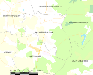
La Chapelle-Hugon
- commune in Cher, France
- Country:
- Postal Code: 18150
- Coordinates: 46° 54' 25" N, 2° 56' 54" E
- GPS tracks (wikiloc): [Link]
- Area: 16.16 sq km
- Population: 394


Cuffy
- commune in Cher, France
- Country:
- Postal Code: 18150
- Coordinates: 46° 57' 39" N, 3° 3' 9" E
- GPS tracks (wikiloc): [Link]
- Area: 34.57 sq km
- Population: 1097
- Web site: [Link]


La Guerche-sur-l'Aubois
- commune in Cher, France
- Country:
- Postal Code: 18150
- Coordinates: 46° 57' 4" N, 2° 56' 51" E
- GPS tracks (wikiloc): [Link]
- Area: 52.7 sq km
- Population: 3322
- Web site: [Link]
Neuvy-le-Barrois
- commune in Cher, France
- Country:
- Postal Code: 18600
- Coordinates: 46° 51' 53" N, 3° 2' 14" E
- GPS tracks (wikiloc): [Link]
- Area: 41.98 sq km
- Population: 148


Saincaize-Meauce
- commune in Nièvre, France
- Country:
- Postal Code: 58470
- Coordinates: 46° 55' 39" N, 3° 4' 21" E
- GPS tracks (wikiloc): [Link]
- Area: 21.48 sq km
- Population: 394


Gimouille
- commune in Nièvre, France
- Country:
- Postal Code: 58470
- Coordinates: 46° 56' 37" N, 3° 5' 6" E
- GPS tracks (wikiloc): [Link]
- Area: 14.26 sq km
- Population: 463