Cuffy (Cuffy)

- commune in Cher, France
- Country:

- Postal Code: 18150
- Coordinates: 46° 57' 39" N, 3° 3' 9" E


- GPS tracks (wikiloc): [Link]
- Area: 34.57 sq km
- Population: 1097
- Web site: http://www.mairiedecuffy.com/
- Wikipedia en: wiki(en)
- Wikipedia: wiki(fr)
- Wikidata storage: Wikidata: Q1142471
- Wikipedia Commons Category: [Link]
- Freebase ID: [/m/03mfcpl]
- GeoNames ID: Alt: [6447471]
- SIREN number: [211800826]
- BnF ID: [15249428p]
- INSEE municipality code: 18082
Shares border with regions:

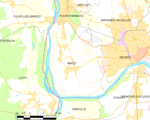
Marzy
- commune in Nièvre, France
- Country:
- Postal Code: 58180
- Coordinates: 46° 58' 51" N, 3° 5' 36" E
- GPS tracks (wikiloc): [Link]
- Area: 24.41 sq km
- Population: 3661
- Web site: [Link]
Le Chautay
- commune in Cher, France
- Country:
- Postal Code: 18150
- Coordinates: 46° 58' 37" N, 2° 58' 0" E
- GPS tracks (wikiloc): [Link]
- Area: 14.74 sq km
- Population: 304


La Guerche-sur-l'Aubois
- commune in Cher, France
- Country:
- Postal Code: 18150
- Coordinates: 46° 57' 4" N, 2° 56' 51" E
- GPS tracks (wikiloc): [Link]
- Area: 52.7 sq km
- Population: 3322
- Web site: [Link]
Torteron
- commune in Cher, France
- Country:
- Postal Code: 18320
- Coordinates: 47° 1' 21" N, 2° 57' 57" E
- GPS tracks (wikiloc): [Link]
- Area: 13.53 sq km
- Population: 803
- Web site: [Link]
Cours-les-Barres
- commune in Cher, France
- Country:
- Postal Code: 18320
- Coordinates: 47° 1' 29" N, 3° 1' 53" E
- GPS tracks (wikiloc): [Link]
- Area: 21.16 sq km
- Population: 1054

Apremont-sur-Allier
- commune in Cher, France
- Country:
- Postal Code: 18150
- Coordinates: 46° 54' 21" N, 3° 2' 52" E
- GPS tracks (wikiloc): [Link]
- AboveSeaLevel: 176 м m
- Area: 30.69 sq km
- Population: 71
- Web site: [Link]


Gimouille
- commune in Nièvre, France
- Country:
- Postal Code: 58470
- Coordinates: 46° 56' 37" N, 3° 5' 6" E
- GPS tracks (wikiloc): [Link]
- Area: 14.26 sq km
- Population: 463