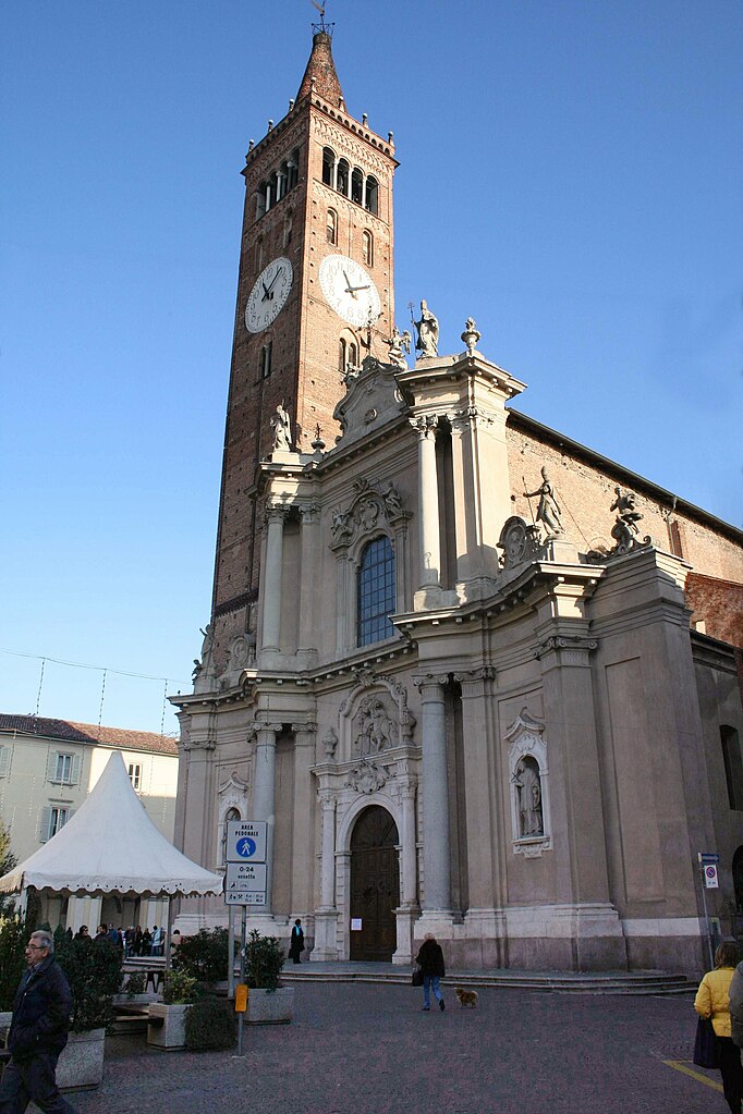
Arcene (Arcene)
.svg)
- Italian comune
 Hiking in Arcene
It seems like there might be a small mix-up with the name "Arcene." If you meant "Arcen" in the Netherlands or potentially another location, I can provide general guidance on hiking in that area, or if you are referring to a different destination, please clarify!
If we take Arcen as an example, it's known for its beautiful landscapes, including forests and rolling hills. Here are some tips and highlights for hiking in such regions:
-
Trails: Look for trails that suit your fitness level. In Arcen, you'll find a mix of easy and moderate pathways that can lead you through scenic spots including parks and nature reserves.
-
Nature Reserves: Make sure to check out local nature reserves. For instance, De Maasduinen National Park is close to Arcen and offers various hiking routes where you can enjoy unique flora and fauna.
-
Maps and Guides: It’s always helpful to bring a local map or download a hiking app that details the trails. Many areas have marked hiking routes, so you can follow signs easily.
-
Packing Essentials: Always pack water, snacks, a first-aid kit, sunscreen, and a hat, especially during warmer months.
-
Weather Awareness: Check the weather before you set out, and be prepared for changes. Bring appropriate clothing for the conditions.
-
Respect Nature: Stay on marked trails, and carry out what you bring in to maintain the natural beauty of the area.
If you're looking for a specific destination or more information about a different hiking area, just let me know!
- Country:

- Postal Code: 24040
- Local Dialing Code: 035
- Licence Plate Code: BG
- Coordinates: 45° 34' 34" N, 9° 36' 51" E


- GPS tracks (wikiloc): [Link]
- AboveSeaLevel: 152 м m
- Area: 4.35 sq km
- Population: 4868
- Web site: http://www.comune.arcene.bg.it
- Wikipedia en: wiki(en)
- Wikipedia: wiki(it)
- Wikidata storage: Wikidata: Q95071
- Wikipedia Commons Gallery: [Link]
- Wikipedia Commons Category: [Link]
- Freebase ID: [/m/0gj8kp]
- GeoNames ID: Alt: [6540594]
- VIAF ID: Alt: [130640107]
- OSM relation ID: [45338]
- UN/LOCODE: [IT2C8]
- ISTAT ID: 016011
- Italian cadastre code: A365
Shares border with regions:


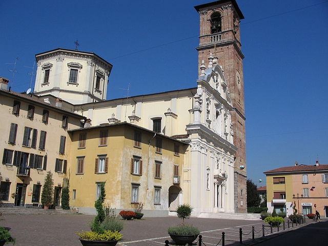
Castel Rozzone
- Italian comune
Hiking in Castel Rozzone
Castel Rozzone, located in the province of Bergamo in Italy, offers a mix of natural beauty and historical intrigue for hikers. While it may not be as widely recognized as some other hiking destinations, it provides a variety of trails suited for different skill levels, surrounded by picturesque landscapes of the Lombardy region....
- Country:
- Postal Code: 24040
- Local Dialing Code: 0363
- Licence Plate Code: BG
- Coordinates: 45° 33' 0" N, 9° 38' 0" E
- GPS tracks (wikiloc): [Link]
- AboveSeaLevel: 140 м m
- Area: 1.71 sq km
- Population: 2849
- Web site: [Link]


Ciserano
- Italian comune
Hiking in Ciserano
Ciserano is a small town located in the Lombardy region of Italy, not far from Bergamo. While it may not be the first place that comes to mind for hiking, there are several opportunities for outdoor activities in the surrounding areas. Here are some aspects you might consider if you're planning a hiking trip near Ciserano:...
- Country:
- Postal Code: 24040
- Local Dialing Code: 035
- Licence Plate Code: BG
- Coordinates: 45° 35' 0" N, 9° 36' 0" E
- GPS tracks (wikiloc): [Link]
- AboveSeaLevel: 159 м m
- Area: 5.31 sq km
- Population: 5696
- Web site: [Link]


Lurano
- Italian comune
Hiking in Lurano
Lurano, a small municipality in Italy, may not be widely known as a hiking destination compared to some of the more popular regions, but it can offer some serene and picturesque trails suitable for those looking to explore nature away from the crowds....
- Country:
- Postal Code: 24050
- Local Dialing Code: 035
- Licence Plate Code: BG
- Coordinates: 45° 34' 0" N, 9° 38' 0" E
- GPS tracks (wikiloc): [Link]
- AboveSeaLevel: 147 м m
- Area: 4.05 sq km
- Population: 2841
- Web site: [Link]


Pognano
- Italian comune
Hiking in Pognano
Pognano, located in the province of Bergamo in northern Italy, is a charming town that provides access to beautiful landscapes and hiking opportunities. While Pognano itself is not a major hiking destination, it is situated near scenic areas in the Lombardy region, which hosts numerous trails suitable for various skill levels....
- Country:
- Postal Code: 24040
- Local Dialing Code: 035
- Licence Plate Code: BG
- Coordinates: 45° 35' 13" N, 9° 38' 27" E
- GPS tracks (wikiloc): [Link]
- AboveSeaLevel: 157 м m
- Area: 3.29 sq km
- Population: 1625
- Web site: [Link]


Pontirolo Nuovo
- Italian comune
Hiking in Pontirolo Nuovo
Pontirolo Nuovo, a small town in the Lombardy region of Italy, is not specifically known as a hiking destination, but it is surrounded by a countryside that offers some opportunities for walking and outdoor activities. Here are some suggestions and information relevant to hiking in and around Pontirolo Nuovo:...
- Country:
- Postal Code: 24040
- Local Dialing Code: 0363
- Licence Plate Code: BG
- Coordinates: 45° 34' 9" N, 9° 34' 2" E
- GPS tracks (wikiloc): [Link]
- AboveSeaLevel: 155 м m
- Area: 11.1 sq km
- Population: 4983
- Web site: [Link]

Treviglio
- Italian comune
Hiking in Treviglio
Treviglio is located in the Lombardy region of northern Italy, not far from Milan. While Treviglio itself may not be a major hiking destination, it serves as a good base for accessing nearby natural areas and hiking trails in the surrounding region....
- Country:
- Postal Code: 24047
- Local Dialing Code: 0363
- Licence Plate Code: BG
- Coordinates: 45° 31' 17" N, 9° 35' 34" E
- GPS tracks (wikiloc): [Link]
- AboveSeaLevel: 125 м m
- Area: 32.22 sq km
- Population: 29815
- Web site: [Link]

Verdello
- Italian comune
Hiking in Verdello
Verdello is a small town in Italy, located in the Lombardy region, close to the city of Bergamo. While it may not be as famous for hiking as the larger nearby mountain ranges, such as the Orobie Alps, there are still some opportunities for outdoor activities and exploring the natural beauty of the region....
- Country:
- Postal Code: 24049
- Local Dialing Code: 035
- Licence Plate Code: BG
- Coordinates: 45° 36' 18" N, 9° 37' 47" E
- GPS tracks (wikiloc): [Link]
- AboveSeaLevel: 173 м m
- Area: 7.34 sq km
- Population: 8082
- Web site: [Link]