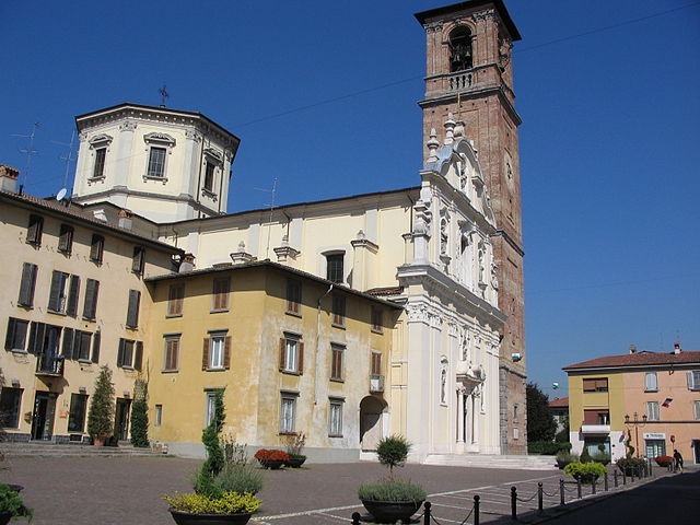
Ciserano (Ciserano)
.svg)
- Italian comune
 Hiking in Ciserano
Ciserano is a small town located in the Lombardy region of Italy, not far from Bergamo. While it may not be the first place that comes to mind for hiking, there are several opportunities for outdoor activities in the surrounding areas. Here are some aspects you might consider if you're planning a hiking trip near Ciserano:
Nearby Hikes
-
Parco dei Colli di Bergamo: Just a short drive away, this park offers various trails with stunning views of the surrounding hills and valleys. The paths vary in difficulty and length, making it suitable for both novice and experienced hikers.
-
Monte Poieto: This mountain is accessible from various points nearby and provides a well-marked trail that leads to breathtaking views of Lake Iseo and the surrounding area.
-
Sentiero dei Faggi: This trail is located within the Bergamo hills and showcases the beautiful beech forests. It's a great place for a peaceful hike surrounded by nature.
Hiking Tips
- Prepare for Weather: The weather in Lombardy can change quickly, especially in the mountainous areas. Make sure to check the forecast and bring appropriate gear.
- Trail Etiquette: Always follow marked trails to protect local flora and fauna. It's also a good practice to yield to other hikers and bikers.
- Hydration and Snacks: Bring plenty of water and some snacks to keep your energy up during your hikes.
Safety
- Always inform someone about your hiking plans, especially if you are going into more remote areas.
- A map or GPS device can be helpful as some trails may not have mobile coverage.
Local Culture
Exploring the region around Ciserano can also give you a chance to enjoy local cuisine and culture. Don't hesitate to visit nearby towns to experience traditional Lombard dishes, such as polenta or casoncelli.
Conclusion
While Ciserano itself may not be a primary hiking destination, the surrounding areas offer beautiful trails and outdoor experiences that fully capture the charm of the Lombardy region. Always plan ahead and enjoy your hike!
- Country:

- Postal Code: 24040
- Local Dialing Code: 035
- Licence Plate Code: BG
- Coordinates: 45° 35' 0" N, 9° 36' 0" E


- GPS tracks (wikiloc): [Link]
- AboveSeaLevel: 159 м m
- Area: 5.31 sq km
- Population: 5696
- Web site: http://www.comune.ciserano.bg.it
- Wikipedia en: wiki(en)
- Wikipedia: wiki(it)
- Wikidata storage: Wikidata: Q100371
- Wikipedia Commons Gallery: [Link]
- Wikipedia Commons Category: [Link]
- Freebase ID: [/m/0gj9s2]
- GeoNames ID: Alt: [6536536]
- VIAF ID: Alt: [147474674]
- OSM relation ID: [45409]
- WOEID: [714140]
- UN/LOCODE: [ITCQQ]
- ISTAT ID: 016075
- Italian cadastre code: C730
Shares border with regions:


Pontirolo Nuovo
- Italian comune
Hiking in Pontirolo Nuovo
Pontirolo Nuovo, a small town in the Lombardy region of Italy, is not specifically known as a hiking destination, but it is surrounded by a countryside that offers some opportunities for walking and outdoor activities. Here are some suggestions and information relevant to hiking in and around Pontirolo Nuovo:...
- Country:
- Postal Code: 24040
- Local Dialing Code: 0363
- Licence Plate Code: BG
- Coordinates: 45° 34' 9" N, 9° 34' 2" E
- GPS tracks (wikiloc): [Link]
- AboveSeaLevel: 155 м m
- Area: 11.1 sq km
- Population: 4983
- Web site: [Link]
Verdellino
- Italian comune
Hiking in Verdellino
Verdellino is a village located in the Lombardy region of northern Italy, specifically in the province of Bergamo. While Verdellino itself is more urban and suburban in nature, there are several outdoor and hiking opportunities in the surrounding areas, particularly in the nearby hills and mountains....
- Country:
- Postal Code: 24040
- Local Dialing Code: 035
- Licence Plate Code: BG
- Coordinates: 45° 36' 7" N, 9° 36' 32" E
- GPS tracks (wikiloc): [Link]
- AboveSeaLevel: 172 м m
- Area: 3.82 sq km
- Population: 7569
- Web site: [Link]

Verdello
- Italian comune
Hiking in Verdello
Verdello is a small town in Italy, located in the Lombardy region, close to the city of Bergamo. While it may not be as famous for hiking as the larger nearby mountain ranges, such as the Orobie Alps, there are still some opportunities for outdoor activities and exploring the natural beauty of the region....
- Country:
- Postal Code: 24049
- Local Dialing Code: 035
- Licence Plate Code: BG
- Coordinates: 45° 36' 18" N, 9° 37' 47" E
- GPS tracks (wikiloc): [Link]
- AboveSeaLevel: 173 м m
- Area: 7.34 sq km
- Population: 8082
- Web site: [Link]


Arcene
- Italian comune
Hiking in Arcene
It seems like there might be a small mix-up with the name "Arcene." If you meant "Arcen" in the Netherlands or potentially another location, I can provide general guidance on hiking in that area, or if you are referring to a different destination, please clarify!...
- Country:
- Postal Code: 24040
- Local Dialing Code: 035
- Licence Plate Code: BG
- Coordinates: 45° 34' 34" N, 9° 36' 51" E
- GPS tracks (wikiloc): [Link]
- AboveSeaLevel: 152 м m
- Area: 4.35 sq km
- Population: 4868
- Web site: [Link]


Boltiere
- Italian comune
Hiking in Boltiere
Boltiere is a small town located in the Lombardy region of Italy, primarily known for its agricultural landscape and proximity to larger cities like Bergamo. While Boltiere itself may not be a major hiking destination, the surrounding areas offer excellent opportunities for outdoor activities, including hiking....
- Country:
- Postal Code: 24040
- Local Dialing Code: 035
- Licence Plate Code: BG
- Coordinates: 45° 36' 0" N, 9° 35' 0" E
- GPS tracks (wikiloc): [Link]
- AboveSeaLevel: 171 м m
- Area: 4.21 sq km
- Population: 6102
- Web site: [Link]