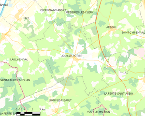
Ardon (Ardon)

- commune in Loiret, France
- Country:

- Postal Code: 45160
- Coordinates: 47° 46' 42" N, 1° 52' 26" E


- GPS tracks (wikiloc): [Link]
- Area: 53.65 sq km
- Population: 1137
- Web site: http://www.ardon45.fr
- Wikipedia en: wiki(en)
- Wikipedia: wiki(fr)
- Wikidata storage: Wikidata: Q1432296
- Wikipedia Commons Category: [Link]
- Freebase ID: [/m/03nwfd_]
- GeoNames ID: Alt: [6452335]
- SIREN number: [214500068]
- BnF ID: [152603995]
- INSEE municipality code: 45006
Shares border with regions:


Mézières-lez-Cléry
- commune in Loiret, France
- Country:
- Postal Code: 45370
- Coordinates: 47° 49' 7" N, 1° 48' 15" E
- GPS tracks (wikiloc): [Link]
- Area: 27.01 sq km
- Population: 825
- Web site: [Link]


Saint-Cyr-en-Val
- commune in Loiret, France
- Country:
- Postal Code: 45590
- Coordinates: 47° 49' 48" N, 1° 58' 10" E
- GPS tracks (wikiloc): [Link]
- Area: 44.23 sq km
- Population: 3273
- Web site: [Link]

Jouy-le-Potier
- commune in Loiret, France
- Country:
- Postal Code: 45370
- Coordinates: 47° 44' 40" N, 1° 48' 41" E
- GPS tracks (wikiloc): [Link]
- Area: 50.4 sq km
- Population: 1342
- Web site: [Link]


La Ferté-Saint-Aubin
- commune in Loiret, France
- Country:
- Postal Code: 45240
- Coordinates: 47° 43' 2" N, 1° 56' 29" E
- GPS tracks (wikiloc): [Link]
- Area: 86.12 sq km
- Population: 7367
- Web site: [Link]

Olivet
- commune in Loiret, France
- Country:
- Postal Code: 45160
- Coordinates: 47° 51' 47" N, 1° 53' 59" E
- GPS tracks (wikiloc): [Link]
- Area: 23.39 sq km
- Population: 21639
- Web site: [Link]


Orléans
- city in north-central France
- Country:
- Postal Code: 45100; 45000
- Coordinates: 47° 54' 8" N, 1° 54' 15" E
- GPS tracks (wikiloc): [Link]
- AboveSeaLevel: 116 м m
- Area: 27.48 sq km
- Population: 114644
- Web site: [Link]