
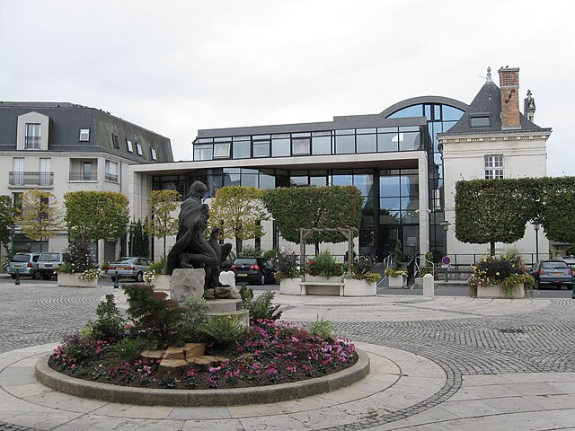
Orléans (Orléans)


- city in north-central France
- Country:

- Postal Code: 45100; 45000
- Coordinates: 47° 54' 8" N, 1° 54' 15" E


- GPS tracks (wikiloc): [Link]
- AboveSeaLevel: 116 м m
- Area: 27.48 sq km
- Population: 114644
- Web site: http://www.orleans.fr
- Wikipedia en: wiki(en)
- Wikipedia: wiki(fr)
- Wikidata storage: Wikidata: Q6548
- Wikipedia Commons Gallery: [Link]
- Wikipedia Commons Category: [Link]
- Wikipedia Commons Maps Category: [Link]
- Freebase ID: [/m/0k1p8]
- Freebase ID: [/m/0k1p8]
- Freebase ID: [/m/0k1p8]
- Freebase ID: [/m/0k1p8]
- Freebase ID: [/m/0k1p8]
- Freebase ID: [/m/0k1p8]
- Freebase ID: [/m/0k1p8]
- GeoNames ID: Alt: [2989317]
- GeoNames ID: Alt: [2989317]
- GeoNames ID: Alt: [2989317]
- GeoNames ID: Alt: [2989317]
- GeoNames ID: Alt: [2989317]
- GeoNames ID: Alt: [2989317]
- GeoNames ID: Alt: [2989317]
- SIREN number: [214502346]
- SIREN number: [214502346]
- SIREN number: [214502346]
- SIREN number: [214502346]
- SIREN number: [214502346]
- SIREN number: [214502346]
- SIREN number: [214502346]
- BnF ID: [15260626s]
- BnF ID: [15260626s]
- BnF ID: [15260626s]
- BnF ID: [15260626s]
- BnF ID: [15260626s]
- BnF ID: [15260626s]
- BnF ID: [15260626s]
- VIAF ID: Alt: [139548210]
- VIAF ID: Alt: [139548210]
- VIAF ID: Alt: [139548210]
- VIAF ID: Alt: [139548210]
- VIAF ID: Alt: [139548210]
- VIAF ID: Alt: [139548210]
- VIAF ID: Alt: [139548210]
- OSM relation ID: [147559]
- OSM relation ID: [147559]
- OSM relation ID: [147559]
- OSM relation ID: [147559]
- OSM relation ID: [147559]
- OSM relation ID: [147559]
- OSM relation ID: [147559]
- GND ID: Alt: [4116785-5]
- GND ID: Alt: [4116785-5]
- GND ID: Alt: [4116785-5]
- GND ID: Alt: [4116785-5]
- GND ID: Alt: [4116785-5]
- GND ID: Alt: [4116785-5]
- GND ID: Alt: [4116785-5]
- archINFORM location ID: [616]
- archINFORM location ID: [616]
- archINFORM location ID: [616]
- archINFORM location ID: [616]
- archINFORM location ID: [616]
- archINFORM location ID: [616]
- archINFORM location ID: [616]
- Library of Congress authority ID: Alt: [n80010348]
- Library of Congress authority ID: Alt: [n80010348]
- Library of Congress authority ID: Alt: [n80010348]
- Library of Congress authority ID: Alt: [n80010348]
- Library of Congress authority ID: Alt: [n80010348]
- Library of Congress authority ID: Alt: [n80010348]
- Library of Congress authority ID: Alt: [n80010348]
- MusicBrainz area ID: [5f5bcaab-497e-412a-b536-16baed9869d4]
- MusicBrainz area ID: [5f5bcaab-497e-412a-b536-16baed9869d4]
- MusicBrainz area ID: [5f5bcaab-497e-412a-b536-16baed9869d4]
- MusicBrainz area ID: [5f5bcaab-497e-412a-b536-16baed9869d4]
- MusicBrainz area ID: [5f5bcaab-497e-412a-b536-16baed9869d4]
- MusicBrainz area ID: [5f5bcaab-497e-412a-b536-16baed9869d4]
- MusicBrainz area ID: [5f5bcaab-497e-412a-b536-16baed9869d4]
- Quora topic ID: [Orléans]
- Quora topic ID: [Orléans]
- Quora topic ID: [Orléans]
- Quora topic ID: [Orléans]
- Quora topic ID: [Orléans]
- Quora topic ID: [Orléans]
- Quora topic ID: [Orléans]
- Encyclopædia Universalis ID: [orleans]
- Encyclopædia Universalis ID: [orleans]
- Encyclopædia Universalis ID: [orleans]
- Encyclopædia Universalis ID: [orleans]
- Encyclopædia Universalis ID: [orleans]
- Encyclopædia Universalis ID: [orleans]
- Encyclopædia Universalis ID: [orleans]
- EMLO location ID: [90e31530-9678-4ad3-9ff9-77329fcd4b9b]
- EMLO location ID: [90e31530-9678-4ad3-9ff9-77329fcd4b9b]
- EMLO location ID: [90e31530-9678-4ad3-9ff9-77329fcd4b9b]
- EMLO location ID: [90e31530-9678-4ad3-9ff9-77329fcd4b9b]
- EMLO location ID: [90e31530-9678-4ad3-9ff9-77329fcd4b9b]
- EMLO location ID: [90e31530-9678-4ad3-9ff9-77329fcd4b9b]
- EMLO location ID: [90e31530-9678-4ad3-9ff9-77329fcd4b9b]
- Facebook Places ID: [114697118542689]
- Facebook Places ID: [114697118542689]
- Facebook Places ID: [114697118542689]
- Facebook Places ID: [114697118542689]
- Facebook Places ID: [114697118542689]
- Facebook Places ID: [114697118542689]
- Facebook Places ID: [114697118542689]
- Great Russian Encyclopedia Online ID: [2693696]
- Great Russian Encyclopedia Online ID: [2693696]
- Great Russian Encyclopedia Online ID: [2693696]
- Great Russian Encyclopedia Online ID: [2693696]
- Great Russian Encyclopedia Online ID: [2693696]
- Great Russian Encyclopedia Online ID: [2693696]
- Great Russian Encyclopedia Online ID: [2693696]
- NKCR AUT ID: [ge423666]
- NKCR AUT ID: [ge423666]
- NKCR AUT ID: [ge423666]
- NKCR AUT ID: [ge423666]
- NKCR AUT ID: [ge423666]
- NKCR AUT ID: [ge423666]
- NKCR AUT ID: [ge423666]
- Structurae structure ID: [20023714]
- Structurae structure ID: [20023714]
- Structurae structure ID: [20023714]
- Structurae structure ID: [20023714]
- Structurae structure ID: [20023714]
- Structurae structure ID: [20023714]
- Structurae structure ID: [20023714]
- INSEE municipality code: 45234
- INSEE municipality code: 45234
- INSEE municipality code: 45234
- INSEE municipality code: 45234
- INSEE municipality code: 45234
- INSEE municipality code: 45234
- INSEE municipality code: 45234
- US National Archives Identifier: 10045072
- US National Archives Identifier: 10045072
- US National Archives Identifier: 10045072
- US National Archives Identifier: 10045072
- US National Archives Identifier: 10045072
- US National Archives Identifier: 10045072
- US National Archives Identifier: 10045072
Shares border with regions:


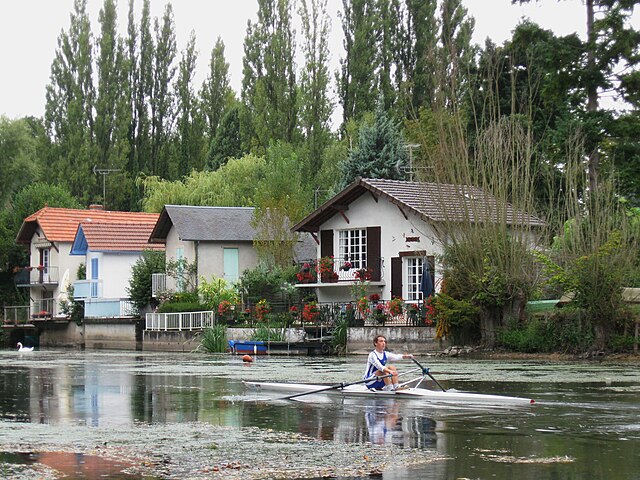
Semoy
- commune in Loiret, France
- Country:
- Postal Code: 45400
- Coordinates: 47° 55' 56" N, 1° 56' 55" E
- GPS tracks (wikiloc): [Link]
- Area: 7.78 sq km
- Population: 3199
- Web site: [Link]


Saint-Pryvé-Saint-Mesmin
- commune in Loiret, France
- Country:
- Postal Code: 45750
- Coordinates: 47° 52' 51" N, 1° 52' 4" E
- GPS tracks (wikiloc): [Link]
- Area: 8.87 sq km
- Population: 5483
- Web site: [Link]


Saint-Jean-de-la-Ruelle
- commune in Loiret, France
- Country:
- Postal Code: 45140
- Coordinates: 47° 54' 47" N, 1° 52' 24" E
- GPS tracks (wikiloc): [Link]
- Area: 6.1 sq km
- Population: 16365
- Web site: [Link]


Saint-Cyr-en-Val
- commune in Loiret, France
- Country:
- Postal Code: 45590
- Coordinates: 47° 49' 48" N, 1° 58' 10" E
- GPS tracks (wikiloc): [Link]
- Area: 44.23 sq km
- Population: 3273
- Web site: [Link]


Ardon
- commune in Loiret, France
- Country:
- Postal Code: 45160
- Coordinates: 47° 46' 42" N, 1° 52' 26" E
- GPS tracks (wikiloc): [Link]
- Area: 53.65 sq km
- Population: 1137
- Web site: [Link]

Saint-Jean-le-Blanc
- commune in Loiret, France
- Country:
- Postal Code: 45650
- Coordinates: 47° 53' 31" N, 1° 55' 2" E
- GPS tracks (wikiloc): [Link]
- Area: 7.66 sq km
- Population: 8459
- Web site: [Link]


La Ferté-Saint-Aubin
- commune in Loiret, France
- Country:
- Postal Code: 45240
- Coordinates: 47° 43' 2" N, 1° 56' 29" E
- GPS tracks (wikiloc): [Link]
- Area: 86.12 sq km
- Population: 7367
- Web site: [Link]

Olivet
- commune in Loiret, France
- Country:
- Postal Code: 45160
- Coordinates: 47° 51' 47" N, 1° 53' 59" E
- GPS tracks (wikiloc): [Link]
- Area: 23.39 sq km
- Population: 21639
- Web site: [Link]

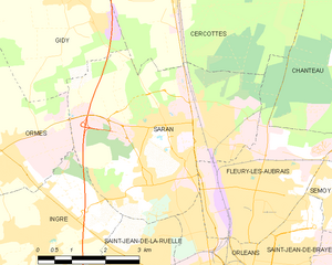
Saran
- commune in Loiret, France
- Country:
- Postal Code: 45770
- Coordinates: 47° 57' 5" N, 1° 52' 49" E
- GPS tracks (wikiloc): [Link]
- Area: 19.65 sq km
- Population: 16259
- Web site: [Link]


Saint-Jean-de-Braye
- commune in Loiret, France
- Country:
- Postal Code: 45800
- Coordinates: 47° 54' 43" N, 1° 58' 16" E
- GPS tracks (wikiloc): [Link]
- AboveSeaLevel: 100 м m
- Area: 13.7 sq km
- Population: 20123
- Web site: [Link]
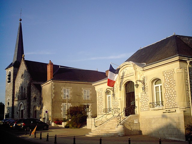

Fleury-les-Aubrais
- commune in Loiret, France
- Country:
- Postal Code: 45400
- Coordinates: 47° 55' 55" N, 1° 55' 16" E
- GPS tracks (wikiloc): [Link]
- Area: 10.12 sq km
- Population: 21089
- Web site: [Link]