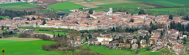
Arquata del Tronto (Arquata del Tronto)
.svg)
- Italian comune
 Hiking in Arquata del Tronto
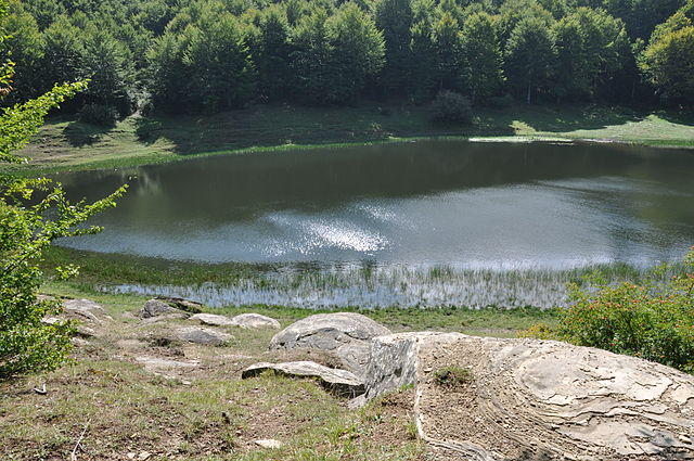
Arquata del Tronto, located in the Marche region of Italy, is a fantastic destination for hiking enthusiasts. Nestled in the picturesque Sibillini Mountains, the area offers a variety of trails that cater to different skill levels, showcasing stunning landscapes, rich biodiversity, and cultural heritage.
Trails and Routes
-
Gole dell'Infernaccio: This is one of the most popular hikes in the region. The trail takes you through a dramatic gorge with a beautiful river and offers opportunities to see waterfalls and diverse flora. The path is well-marked and accessible for most hikers.
-
Monte Vettore: For those seeking a challenge, the hike to Monte Vettore, the highest peak in the Sibillini Mountains, offers breathtaking panoramic views. The ascent can be steep and requires good endurance, but the views from the top are worth the effort.
-
Pizzo del Diavolo: This hike is notable for its spectacular views and rocky terrain. It’s ideal for experienced hikers looking for a more strenuous outing.
-
Sentiero del Lupo: This trail is family-friendly and takes you through beautiful landscapes rich in wildlife. It's a great opportunity for nature observation, including the chance to see wolves in their natural habitat.
Best Time to Hike
The best months for hiking in Arquata del Tronto are typically late spring (May to June) and early autumn (September to October) when the weather is mild, and the trails are less crowded. Summer months can be hot, while winter provides opportunities for snowshoeing and winter hikes.
Preparation Tips
- Footwear: Proper hiking boots are essential for rocky trails. Make sure they are broken in before your hike.
- Gear: Carry water, snacks, a map, and a first aid kit. A trekking pole can also be helpful, especially on steep terrain.
- Weather: Check the weather forecast before your hike, as conditions can change rapidly in the mountains.
- Wildlife Awareness: Be respectful of local wildlife and nature. Keep a safe distance from animals and follow Leave No Trace principles.
Cultural Aspects
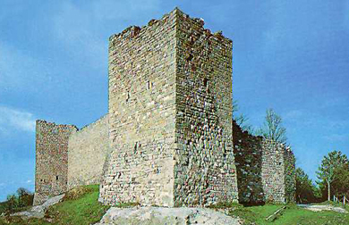
Arquata del Tronto is steeped in history, and hiking in this area also offers a chance to explore charming villages, ancient churches, and local cuisine. Don’t miss the opportunity to sample regional dishes, particularly those made with local produce.
Community and Regulations
Always inform someone of your hiking plans and adhere to local regulations and guidelines to ensure a safe and enjoyable experience. Some trails may require permits, especially in protected areas.
Whether you're a seasoned hiker or just looking to enjoy a day in nature, Arquata del Tronto provides a beautiful backdrop for an unforgettable outdoor adventure.
- Country:

- Postal Code: 63096
- Local Dialing Code: 0736
- Licence Plate Code: AP
- Coordinates: 42° 46' 21" N, 13° 17' 48" E


- GPS tracks (wikiloc): [Link]
- AboveSeaLevel: 777 м m
- Area: 92.23 sq km
- Population: 1115
- Web site: http://www.comune.arquatadeltronto.ap.it/
- Wikipedia en: wiki(en)
- Wikipedia: wiki(it)
- Wikidata storage: Wikidata: Q56031
- Wikipedia Commons Gallery: [Link]
- Wikipedia Commons Category: [Link]
- Freebase ID: [/m/0gl7kq]
- GeoNames ID: Alt: [6536796]
- VIAF ID: Alt: [150451359]
- OSM relation ID: [42140]
- Library of Congress authority ID: Alt: [no2004106227]
- TGN ID: [1043298]
- Digital Atlas of the Roman Empire ID: [42574]
- Pleiades ID: [416766]
- Google Maps Customer ID: [11631486948533925051]
- ISTAT ID: 044006
- Italian cadastre code: A437
Shares border with regions:

Norcia
- Italian comune
Hiking in Norcia
Norcia, located in the Umbria region of Italy, is a fantastic destination for hiking enthusiasts. Nestled in the heart of the Sibillini Mountains, Norcia offers breathtaking landscapes, diverse trails, and rich cultural heritage....
- Country:
- Postal Code: 06046
- Local Dialing Code: 0743
- Licence Plate Code: PG
- Coordinates: 42° 47' 36" N, 13° 5' 38" E
- GPS tracks (wikiloc): [Link]
- AboveSeaLevel: 604 м m
- Area: 275.58 sq km
- Population: 4888
- Web site: [Link]

Accumoli
- Italian comune
Hiking in Accumoli
Accumoli, located in the Apennine Mountains of central Italy, is a hidden gem for hiking enthusiasts. Nestled in the Lazio region, it offers stunning landscapes, rich history, and various trails suitable for different skill levels....
- Country:
- Postal Code: 02011
- Local Dialing Code: 0746
- Licence Plate Code: RI
- Coordinates: 42° 41' 40" N, 13° 14' 51" E
- GPS tracks (wikiloc): [Link]
- AboveSeaLevel: 855 м m
- Area: 87.37 sq km
- Population: 628
- Web site: [Link]

Valle Castellana
- Italian comune
Hiking in Valle Castellana
Valle Castellana, located in the Abruzzo region of Italy, is a beautiful area known for its stunning landscapes and diverse hiking trails. The region is characterized by its mountainous terrain, rolling hills, and picturesque villages, providing a rich experience for outdoor enthusiasts....
- Country:
- Postal Code: 64010
- Local Dialing Code: 0861
- Licence Plate Code: TE
- Coordinates: 42° 44' 0" N, 13° 30' 0" E
- GPS tracks (wikiloc): [Link]
- AboveSeaLevel: 625 м m
- Area: 131.76 sq km
- Population: 952
- Web site: [Link]


Acquasanta Terme
- Italian comune
Hiking in Acquasanta Terme
Acquasanta Terme, located in the Marche region of Italy, is known for its natural thermal springs and beautiful mountainous landscapes, making it an excellent destination for hiking enthusiasts. The area offers a variety of trails that cater to different skill levels, from easy walks to more challenging hikes....
- Country:
- Postal Code: 63095
- Local Dialing Code: 0736
- Licence Plate Code: AP
- Coordinates: 42° 46' 9" N, 13° 24' 34" E
- GPS tracks (wikiloc): [Link]
- AboveSeaLevel: 388 м m
- Area: 138.39 sq km
- Population: 2785
- Web site: [Link]
Montegallo
- Italian comune
Hiking in Montegallo
Montegallo is a beautiful destination located in the Apennine Mountains of central Italy, particularly within the province of Ascoli Piceno in the Marche region. It's known for its stunning landscapes, rolling hills, and rich biodiversity, making it a great spot for hiking enthusiasts....
- Country:
- Postal Code: 63094
- Local Dialing Code: 0736
- Licence Plate Code: AP
- Coordinates: 42° 50' 32" N, 13° 19' 58" E
- GPS tracks (wikiloc): [Link]
- AboveSeaLevel: 870 м m
- Area: 48.46 sq km
- Population: 504
- Web site: [Link]

Montemonaco
- Italian comune
Hiking in Montemonaco
Montemonaco is a picturesque village located in the Sibillini Mountains National Park in Italy's Marche region. This area is known for its stunning landscapes, diverse flora and fauna, and rich cultural history. Hiking in and around Montemonaco offers various trails suitable for different skill levels, making it an appealing destination for both novice and experienced hikers....
- Country:
- Postal Code: 63088
- Local Dialing Code: 0736
- Licence Plate Code: AP
- Coordinates: 42° 53' 57" N, 13° 20' 2" E
- GPS tracks (wikiloc): [Link]
- AboveSeaLevel: 980 м m
- Area: 67.81 sq km
- Population: 568
- Web site: [Link]