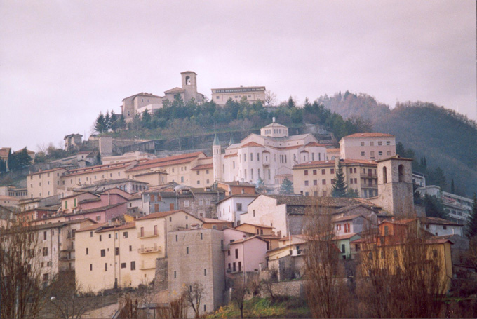
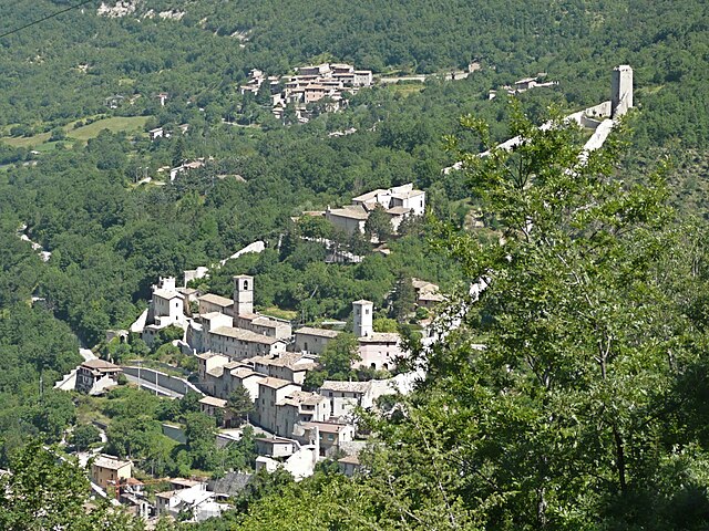
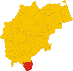
Norcia (Norcia)
.svg)
- Italian comune
 Hiking in Norcia
Norcia, located in the Umbria region of Italy, is a fantastic destination for hiking enthusiasts. Nestled in the heart of the Sibillini Mountains, Norcia offers breathtaking landscapes, diverse trails, and rich cultural heritage.
Highlights of Hiking in Norcia:
-
Sibillini National Park:
- The park surrounds Norcia and features a range of trails suitable for all skill levels. The terrain includes majestic mountains, rolling hills, and scenic valleys.
- Popular routes include the hike to Mount Sibilla, which offers stunning panoramic views, and trails around Piani di Castelluccio, known for its beautiful flowering meadows in spring.
-
Historical Significance:
- Norcia is not just about nature; it's also steeped in history. The region has ancient churches and fortified walls, and you can often find trails that lead to historical sites.
-
Wildlife and Flora:
- The Sibillini Mountains are home to diverse flora and fauna. While hiking, you might encounter various wildlife, including deer, wolves, and various bird species, as well as unique plant species, especially during blooming seasons.
-
Local Gastronomy:
- After a day of hiking, indulge in Norcia's renowned cuisine, particularly its cured meats (like prosciutto) and truffle products, which are celebrated throughout the region.
-
Hiking Organizations and Guides:
- There are local hiking groups and guides available if you prefer a guided experience. They can provide insights into the trails, nature, and local history.
Practical Tips:
- Best Time to Hike: Spring (especially late May to June) and early autumn are ideal, as the weather is typically mild, and the scenery is at its best.
- Trail Markings: Look for well-marked trails. You can often find trail maps at local tourist offices or online.
- Planning Ahead: Ensure to check the weather conditions before heading out, as mountain weather can change rapidly.
- Gear: Wear appropriate clothing and sturdy hiking boots. Carry sufficient water, snacks, and possibly trekking poles for hilly terrain.
Enjoy your hike in Norcia, where breathtaking nature meets cultural richness!
- Country:

- Postal Code: 06046
- Local Dialing Code: 0743
- Licence Plate Code: PG
- Coordinates: 42° 47' 36" N, 13° 5' 38" E


- GPS tracks (wikiloc): [Link]
- AboveSeaLevel: 604 м m
- Area: 275.58 sq km
- Population: 4888
- Web site: http://www.comune.norcia.pg.it
- Wikipedia en: wiki(en)
- Wikipedia: wiki(it)
- Wikidata storage: Wikidata: Q20494
- Wikipedia Commons Gallery: [Link]
- Wikipedia Commons Category: [Link]
- Freebase ID: [/m/02zfhk]
- GeoNames ID: Alt: [6540491]
- VIAF ID: Alt: [136117808]
- OSM relation ID: [42127]
- archINFORM location ID: [1009]
- Quora topic ID: [Norcia]
- TGN ID: [7005057]
- UN/LOCODE: [ITNRA]
- EMLO location ID: [bcd24219-47e7-4ee4-b1f8-b310d2358b08]
- Facebook Places ID: [107711432589734]
- Digital Atlas of the Roman Empire ID: [16794]
- Pleiades ID: [413229]
- ISTAT ID: 054035
- Italian cadastre code: F935
Shares border with regions:

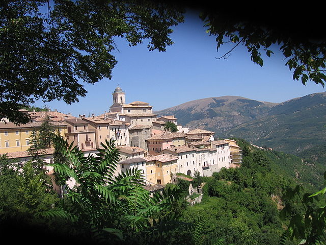
Cascia
- Italian comune
Hiking in Cascia
Cascia, located in the Umbria region of Italy, is a beautiful destination for hiking enthusiasts. Nestled in the scenic valley of the Monti Sibillini National Park, it offers a variety of trails that cater to different skill levels. Here’s what you should know about hiking in and around Cascia:...
- Country:
- Postal Code: 06043
- Local Dialing Code: 0743
- Licence Plate Code: PG
- Coordinates: 42° 43' 0" N, 13° 1' 0" E
- GPS tracks (wikiloc): [Link]
- AboveSeaLevel: 653 м m
- Area: 180.85 sq km
- Population: 3108
- Web site: [Link]


Cerreto di Spoleto
- Italian comune
Hiking in Cerreto di Spoleto
Cerreto di Spoleto is a charming village located in the Umbria region of Italy, nestled among the Apennine Mountains. This area is known for its stunning natural beauty, rich history, and well-maintained hiking trails, making it a great destination for outdoor enthusiasts....
- Country:
- Postal Code: 06040
- Local Dialing Code: 0743
- Licence Plate Code: PG
- Coordinates: 42° 49' 0" N, 12° 55' 0" E
- GPS tracks (wikiloc): [Link]
- AboveSeaLevel: 557 м m
- Area: 74.78 sq km
- Population: 1055
- Web site: [Link]


Poggiodomo
- Italian comune
Hiking in Poggiodomo
Poggiodomo is a small town located in the province of Perugia, in the Umbria region of Italy. Surrounded by stunning natural beauty, it offers a variety of hiking opportunities that cater to different skill levels and preferences....
- Country:
- Postal Code: 06040
- Local Dialing Code: 0743
- Licence Plate Code: PG
- Coordinates: 42° 43' 0" N, 12° 56' 0" E
- GPS tracks (wikiloc): [Link]
- AboveSeaLevel: 974 м m
- Area: 40.09 sq km
- Population: 102
- Web site: [Link]

Preci
- Italian comune
Hiking in Preci
Preci, located in the beautiful region of Umbria in Italy, is an excellent destination for hiking enthusiasts. The area is characterized by its stunning landscapes, including rolling hills, lush forests, and picturesque views of the surrounding valleys. Here are some highlights about hiking in Preci:...
- Country:
- Postal Code: 06047
- Local Dialing Code: 0743
- Licence Plate Code: PG
- Coordinates: 42° 53' 0" N, 13° 2' 0" E
- GPS tracks (wikiloc): [Link]
- AboveSeaLevel: 596 м m
- Area: 82.03 sq km
- Population: 704
- Web site: [Link]

Accumoli
- Italian comune
Hiking in Accumoli
Accumoli, located in the Apennine Mountains of central Italy, is a hidden gem for hiking enthusiasts. Nestled in the Lazio region, it offers stunning landscapes, rich history, and various trails suitable for different skill levels....
- Country:
- Postal Code: 02011
- Local Dialing Code: 0746
- Licence Plate Code: RI
- Coordinates: 42° 41' 40" N, 13° 14' 51" E
- GPS tracks (wikiloc): [Link]
- AboveSeaLevel: 855 м m
- Area: 87.37 sq km
- Population: 628
- Web site: [Link]
Cittareale
- Italian comune
Hiking in Cittareale
Cittareale, a charming village located in the province of Rieti in Italy's Lazio region, is surrounded by stunning natural landscapes, making it an excellent destination for hiking enthusiasts. The area is characterized by its mountainous terrain, dense forests, and picturesque views, which provide a variety of trails for all skill levels....
- Country:
- Postal Code: 02010
- Local Dialing Code: 0746
- Licence Plate Code: RI
- Coordinates: 42° 37' 0" N, 13° 10' 0" E
- GPS tracks (wikiloc): [Link]
- AboveSeaLevel: 952 м m
- Area: 59.67 sq km
- Population: 462
- Web site: [Link]


Arquata del Tronto
- Italian comune
Hiking in Arquata del Tronto
Arquata del Tronto, located in the Marche region of Italy, is a fantastic destination for hiking enthusiasts. Nestled in the picturesque Sibillini Mountains, the area offers a variety of trails that cater to different skill levels, showcasing stunning landscapes, rich biodiversity, and cultural heritage....
- Country:
- Postal Code: 63096
- Local Dialing Code: 0736
- Licence Plate Code: AP
- Coordinates: 42° 46' 21" N, 13° 17' 48" E
- GPS tracks (wikiloc): [Link]
- AboveSeaLevel: 777 м m
- Area: 92.23 sq km
- Population: 1115
- Web site: [Link]

Montemonaco
- Italian comune
Hiking in Montemonaco
Montemonaco is a picturesque village located in the Sibillini Mountains National Park in Italy's Marche region. This area is known for its stunning landscapes, diverse flora and fauna, and rich cultural history. Hiking in and around Montemonaco offers various trails suitable for different skill levels, making it an appealing destination for both novice and experienced hikers....
- Country:
- Postal Code: 63088
- Local Dialing Code: 0736
- Licence Plate Code: AP
- Coordinates: 42° 53' 57" N, 13° 20' 2" E
- GPS tracks (wikiloc): [Link]
- AboveSeaLevel: 980 м m
- Area: 67.81 sq km
- Population: 568
- Web site: [Link]
Castelsantangelo sul Nera
- Italian comune
Hiking in Castelsantangelo sul Nera
Castelsantangelo sul Nera is a beautiful commune located in the Marche region of Italy, surrounded by stunning natural landscapes that are perfect for hiking enthusiasts. Nestled within the Sibillini Mountains National Park, it offers a variety of trails with diverse levels of difficulty, catering to both beginners and experienced hikers....
- Country:
- Postal Code: 62030
- Local Dialing Code: 0737
- Licence Plate Code: MC
- Coordinates: 42° 53' 41" N, 13° 9' 12" E
- GPS tracks (wikiloc): [Link]
- AboveSeaLevel: 760 м m
- Area: 70.67 sq km
- Population: 260
- Web site: [Link]