Valle Castellana (Valle Castellana)
.svg)
- Italian comune
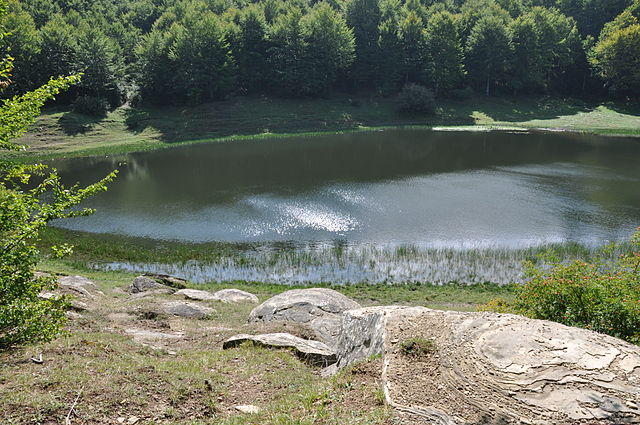
 Hiking in Valle Castellana
Valle Castellana, located in the Abruzzo region of Italy, is a beautiful area known for its stunning landscapes and diverse hiking trails. The region is characterized by its mountainous terrain, rolling hills, and picturesque villages, providing a rich experience for outdoor enthusiasts.
Hiking Trails
-
Sentiero dei Faggi: This trail takes you through lush beech forests and offers beautiful views of the surrounding mountains. It’s a moderate hike suitable for most skill levels.
-
Valle del Vino: This trail winds through vineyards and rolling hills, combining the beauty of nature with a taste of local agriculture. It's a relatively easy hike, perfect for families.
-
Monte Sirente: For those looking for a more challenging adventure, hikes to the summit of Monte Sirente provide breathtaking panoramic views of the surrounding Apennine Mountains. This trail is best suited for experienced hikers.
Flora and Fauna
Valle Castellana is home to a rich variety of flora and fauna. Depending on the season, you may encounter wildflowers, beech and oak trees, and possibly even wildlife such as deer or various bird species.
Tips for Hiking in Valle Castellana
- Check Weather Conditions: The weather can change quickly in mountainous areas, so be sure to check the forecast before heading out.
- Stay Hydrated: Always carry enough water, as some trails can be long and challenging.
- Wear Proper Footwear: Good hiking boots are essential for navigating rocky and uneven terrain.
- Respect Nature: Stay on marked trails and avoid leaving any litter behind to preserve the natural beauty of the area.
Conclusion
Hiking in Valle Castellana offers a unique opportunity to explore the natural beauty and tranquility of the Abruzzo region. Whether you're looking for a leisurely stroll through vineyards or a strenuous hike up a mountain, there’s something for everyone in this captivating landscape. Enjoy your adventure!
- Country:

- Postal Code: 64010
- Local Dialing Code: 0861
- Licence Plate Code: TE
- Coordinates: 42° 44' 0" N, 13° 30' 0" E


- GPS tracks (wikiloc): [Link]
- AboveSeaLevel: 625 м m
- Area: 131.76 sq km
- Population: 952
- Web site: http://www.comune.vallecastellana.te.it
- Wikipedia en: wiki(en)
- Wikipedia: wiki(it)
- Wikidata storage: Wikidata: Q51473
- Wikipedia Commons Category: [Link]
- Freebase ID: [/m/0fs4fn]
- GeoNames ID: Alt: [6540723]
- OSM relation ID: [42135]
- ISTAT ID: 067046
- Italian cadastre code: L597
Shares border with regions:

Accumoli
- Italian comune
Hiking in Accumoli
Accumoli, located in the Apennine Mountains of central Italy, is a hidden gem for hiking enthusiasts. Nestled in the Lazio region, it offers stunning landscapes, rich history, and various trails suitable for different skill levels....
- Country:
- Postal Code: 02011
- Local Dialing Code: 0746
- Licence Plate Code: RI
- Coordinates: 42° 41' 40" N, 13° 14' 51" E
- GPS tracks (wikiloc): [Link]
- AboveSeaLevel: 855 м m
- Area: 87.37 sq km
- Population: 628
- Web site: [Link]

Amatrice
- Italian comune
Hiking in Amatrice
Amatrice, located in the Apennine Mountains of Italy, is a beautiful destination for hiking enthusiasts. The region is known for its stunning landscapes, rich history, and picturesque villages. Here are some key points about hiking in Amatrice:...
- Country:
- Postal Code: 02012
- Local Dialing Code: 0746
- Licence Plate Code: RI
- Coordinates: 42° 37' 46" N, 13° 17' 18" E
- GPS tracks (wikiloc): [Link]
- AboveSeaLevel: 955 м m
- Area: 174.4 sq km
- Population: 2500
- Web site: [Link]

Campli
- Italian comune
Hiking in Campli
Campli, a charming town located in the Abruzzo region of Italy, offers some beautiful hiking opportunities amidst stunning landscapes, historical sites, and natural parks. Here are some key points to consider if you are planning a hiking trip in and around Campli:...
- Country:
- Postal Code: 64012
- Local Dialing Code: 0861
- Licence Plate Code: TE
- Coordinates: 42° 43' 34" N, 13° 41' 10" E
- GPS tracks (wikiloc): [Link]
- AboveSeaLevel: 393 м m
- Area: 73.43 sq km
- Population: 7110
- Web site: [Link]

Civitella del Tronto
- Italian comune
Hiking in Civitella del Tronto
Civitella del Tronto is a charming hilltop village located in the Abruzzo region of Italy, known for its historical architecture and stunning natural surroundings. Hiking in this area offers a mix of cultural heritage and beautiful landscapes....
- Country:
- Postal Code: 64010
- Local Dialing Code: 0861
- Licence Plate Code: TE
- Coordinates: 42° 46' 19" N, 13° 40' 0" E
- GPS tracks (wikiloc): [Link]
- AboveSeaLevel: 589 м m
- Area: 77.74 sq km
- Population: 4918
- Web site: [Link]

Rocca Santa Maria
- Italian comune
Hiking in Rocca Santa Maria
Rocca Santa Maria is a charming destination for hiking enthusiasts, located in the beautiful region of Abruzzo, Italy. Surrounded by the stunning landscapes of the Gran Sasso e Monti della Laga National Park, this area offers a variety of trails suitable for all levels of hikers....
- Country:
- Postal Code: 64010
- Local Dialing Code: 0861
- Licence Plate Code: TE
- Coordinates: 42° 41' 0" N, 13° 32' 0" E
- GPS tracks (wikiloc): [Link]
- AboveSeaLevel: 1073 м m
- Area: 61.8 sq km
- Population: 502
- Web site: [Link]

Torricella Sicura
- Italian comune
Hiking in Torricella Sicura
Torricella Sicura, located in the Abruzzo region of Italy, offers a beautiful landscape for hiking enthusiasts. Surrounded by the stunning views of the Gran Sasso and Monti della Laga National Park, which is not far from the village, the area features rugged mountains, rolling hills, and picturesque valleys....
- Country:
- Postal Code: 64010
- Local Dialing Code: 0861
- Licence Plate Code: TE
- Coordinates: 42° 39' 33" N, 13° 39' 26" E
- GPS tracks (wikiloc): [Link]
- AboveSeaLevel: 437 м m
- Area: 54.38 sq km
- Population: 2621
- Web site: [Link]


Acquasanta Terme
- Italian comune
Hiking in Acquasanta Terme
Acquasanta Terme, located in the Marche region of Italy, is known for its natural thermal springs and beautiful mountainous landscapes, making it an excellent destination for hiking enthusiasts. The area offers a variety of trails that cater to different skill levels, from easy walks to more challenging hikes....
- Country:
- Postal Code: 63095
- Local Dialing Code: 0736
- Licence Plate Code: AP
- Coordinates: 42° 46' 9" N, 13° 24' 34" E
- GPS tracks (wikiloc): [Link]
- AboveSeaLevel: 388 м m
- Area: 138.39 sq km
- Population: 2785
- Web site: [Link]


Arquata del Tronto
- Italian comune
Hiking in Arquata del Tronto
Arquata del Tronto, located in the Marche region of Italy, is a fantastic destination for hiking enthusiasts. Nestled in the picturesque Sibillini Mountains, the area offers a variety of trails that cater to different skill levels, showcasing stunning landscapes, rich biodiversity, and cultural heritage....
- Country:
- Postal Code: 63096
- Local Dialing Code: 0736
- Licence Plate Code: AP
- Coordinates: 42° 46' 21" N, 13° 17' 48" E
- GPS tracks (wikiloc): [Link]
- AboveSeaLevel: 777 м m
- Area: 92.23 sq km
- Population: 1115
- Web site: [Link]
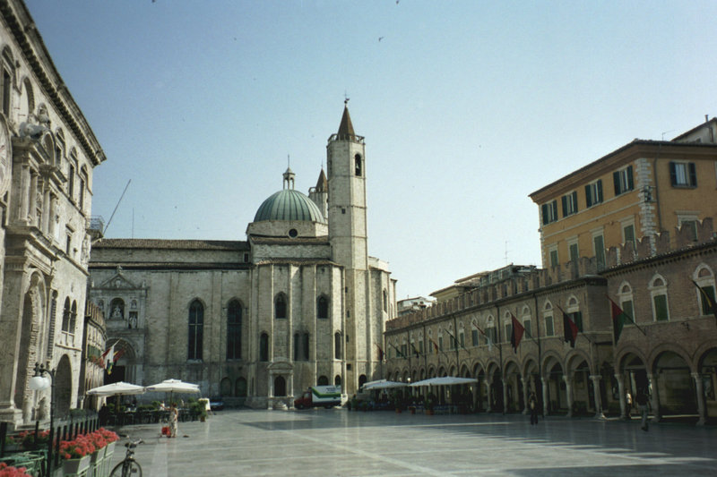

Ascoli Piceno
- Italian comune
Hiking in Ascoli Piceno
Ascoli Piceno, a charming town in the Marche region of Italy, offers a variety of hiking opportunities that allow you to explore its stunning landscapes, rich history, and charming villages. Here are some details about hiking in and around Ascoli Piceno:...
- Country:
- Postal Code: 63100
- Local Dialing Code: 0736
- Licence Plate Code: AP
- Coordinates: 42° 51' 17" N, 13° 34' 31" E
- GPS tracks (wikiloc): [Link]
- AboveSeaLevel: 154 м m
- Area: 158.02 sq km
- Population: 48773
- Web site: [Link]