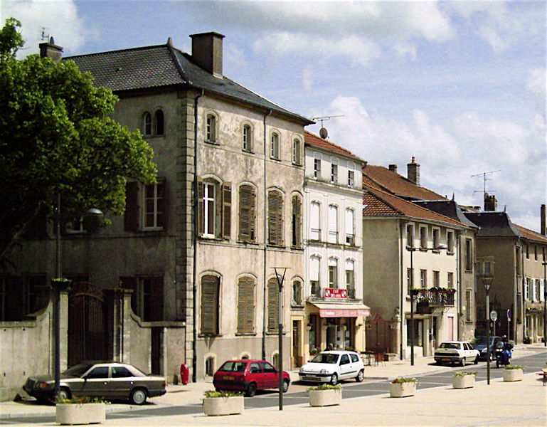
Arracourt (Arracourt)

- commune in Meurthe-et-Moselle, France
- Country:

- Postal Code: 54370
- Coordinates: 48° 43' 25" N, 6° 31' 59" E


- GPS tracks (wikiloc): [Link]
- Area: 17.41 sq km
- Population: 249
- Web site: http://arracourt.wifeo.com
- Wikipedia en: wiki(en)
- Wikipedia: wiki(fr)
- Wikidata storage: Wikidata: Q221252
- Wikipedia Commons Category: [Link]
- Freebase ID: [/m/03hlf9g]
- Freebase ID: [/m/03hlf9g]
- GeoNames ID: Alt: [6449693]
- GeoNames ID: Alt: [6449693]
- SIREN number: [215400235]
- SIREN number: [215400235]
- BnF ID: [15264092w]
- BnF ID: [15264092w]
- VIAF ID: Alt: [245869278]
- VIAF ID: Alt: [245869278]
- OSM relation ID: [2958751]
- OSM relation ID: [2958751]
- INSEE municipality code: 54023
- INSEE municipality code: 54023
Shares border with regions:


Bathelémont
- commune in Meurthe-et-Moselle, France
- Country:
- Postal Code: 54370
- Coordinates: 48° 41' 30" N, 6° 31' 30" E
- GPS tracks (wikiloc): [Link]
- Area: 6.6 sq km
- Population: 62


Réchicourt-la-Petite
- commune in Meurthe-et-Moselle, France
- Country:
- Postal Code: 54370
- Coordinates: 48° 43' 9" N, 6° 34' 58" E
- GPS tracks (wikiloc): [Link]
- Area: 5.5 sq km
- Population: 61

Vic-sur-Seille
- commune in Moselle, France
- Country:
- Postal Code: 57630
- Coordinates: 48° 46' 56" N, 6° 31' 53" E
- GPS tracks (wikiloc): [Link]
- Area: 19.5 sq km
- Population: 1305


Bezange-la-Grande
- commune in Meurthe-et-Moselle, France
- Country:
- Postal Code: 54370
- Coordinates: 48° 44' 46" N, 6° 28' 26" E
- GPS tracks (wikiloc): [Link]
- Area: 17.24 sq km
- Population: 163

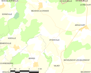
Athienville
- commune in Meurthe-et-Moselle, France
- Country:
- Postal Code: 54370
- Coordinates: 48° 42' 57" N, 6° 29' 26" E
- GPS tracks (wikiloc): [Link]
- Area: 12.96 sq km
- Population: 180


Bures
- commune in Meurthe-et-Moselle, France
- Country:
- Postal Code: 54370
- Coordinates: 48° 41' 39" N, 6° 34' 35" E
- GPS tracks (wikiloc): [Link]
- Area: 5.74 sq km
- Population: 66


Juvrecourt
- commune in Meurthe-et-Moselle, France
- Country:
- Postal Code: 54370
- Coordinates: 48° 44' 34" N, 6° 33' 57" E
- GPS tracks (wikiloc): [Link]
- Area: 6.11 sq km
- Population: 63