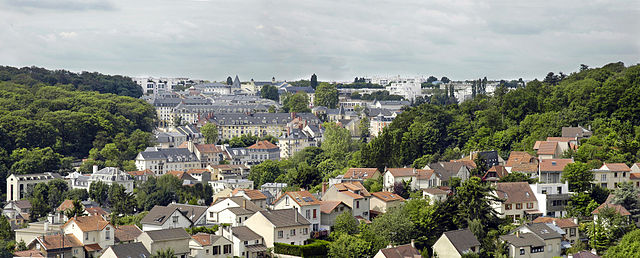
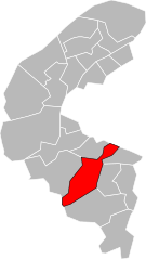
arrondissement of Antony (arrondissement d'Antony)

- arrondissement of France
- Country:

- Capital: Antony
- Coordinates: 48° 45' 42" N, 2° 18' 2" E


- GPS tracks (wikiloc): [Link]
- Area: 49 sq km
- Population: 395761
- Wikipedia en: wiki(en)
- Wikipedia: wiki(fr)
- Wikidata storage: Wikidata: Q700438
- Freebase ID: [/m/0953ch]
- GeoNames ID: Alt: [6457368]
- INSEE arrondissement code: [921]
Includes regions:
canton of Le Plessis-Robinson
- canton of France (until March 2015)
- Country:
- Capital: Le Plessis-Robinson
- Coordinates: 48° 47' 0" N, 2° 16' 0" E
- GPS tracks (wikiloc): [Link]

canton of Clamart
- canton of France
- Country:
- Capital: Clamart
- Coordinates: 48° 48' 0" N, 2° 16' 0" E
- GPS tracks (wikiloc): [Link]
- Population: 80451


canton of Montrouge
- canton of France
- Country:
- Capital: Montrouge
- Coordinates: 48° 49' 0" N, 2° 19' 0" E
- GPS tracks (wikiloc): [Link]
- Population: 78888


canton of Châtenay-Malabry
- canton of France
- Country:
- Capital: Châtenay-Malabry
- Coordinates: 48° 46' 0" N, 2° 16' 0" E
- GPS tracks (wikiloc): [Link]
- Population: 81659

canton of Châtillon
- canton of France
- Country:
- Capital: Châtillon
- Coordinates: 48° 48' 0" N, 2° 17' 0" E
- GPS tracks (wikiloc): [Link]
- Population: 61122

canton of Antony
- canton of France
- Country:
- Capital: Antony
- Coordinates: 48° 45' 0" N, 2° 18' 0" E
- GPS tracks (wikiloc): [Link]
- Population: 61711


canton of Bagneux
- canton of France
- Country:
- Capital: Bagneux
- Coordinates: 48° 48' 0" N, 2° 18' 0" E
- GPS tracks (wikiloc): [Link]
- Population: 59736

canton of Fontenay-aux-Roses
- canton of France (until March 2015)
- Country:
- Capital: Fontenay-aux-Roses
- Coordinates: 48° 47' 0" N, 2° 17' 0" E
- GPS tracks (wikiloc): [Link]

canton of Bourg-la-Reine
- canton of France (until March 2015)
- Country:
- Capital: Bourg-la-Reine
- Coordinates: 48° 47' 0" N, 2° 19' 0" E
- GPS tracks (wikiloc): [Link]