Belley (Belley)
- commune in Ain, France
 Hiking in Belley
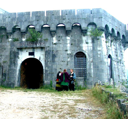
Belley, located in the Auvergne-Rhône-Alpes region of France, is surrounded by beautiful landscapes that offer a variety of hiking opportunities. The area is particularly known for its stunning natural scenery, including rolling hills, vineyards, and the nearby mountains of the Bauges and Chartreuse ranges.
Hiking Trails
-
Mont Revard: This mountain offers several trails with varying degrees of difficulty. The views from the summit are breathtaking, providing panoramas of the surrounding area, including Lake Bourget and the Alps.
-
The Pilgrimage Trail: One popular route is the chemin de Saint-Jacques, part of the Camino de Santiago. This trail offers both natural beauty and cultural heritage as it meanders through villages and historical sites.
-
Les Balcons du Rhône: This trail runs alongside the Rhône River, presenting hikers with lovely views while traversing picturesque landscapes. It’s suitable for different skill levels.
Tips for Hiking in Belley
- Weather Considerations: Check the forecast before heading out. Weather in the mountains can change rapidly.
- Trail Maps: It’s advisable to have a detailed map or a GPS device, as some trails may not be well-marked.
- Equipment: Wear sturdy hiking boots and bring enough water, snacks, and possibly trekking poles for uneven terrain.
- Respect Nature: Follow Leave No Trace principles, and enjoy the local flora and fauna without disturbing it.
Best Times to Hike
The best times for hiking in and around Belley are during the spring (April to June) and fall (September to October) when the weather is generally mild, and the flora is vibrant.
Whether you're looking for a leisurely stroll or a more strenuous hike, Belley provides excellent options for all hiking enthusiasts.
- Country:

- Postal Code: 01300
- Coordinates: 45° 45' 33" N, 5° 41' 17" E


- GPS tracks (wikiloc): [Link]
- Area: 22.42 sq km
- Population: 9058
- Web site: http://www.belley.fr
- Wikipedia en: wiki(en)
- Wikipedia: wiki(fr)
- Wikidata storage: Wikidata: Q188496
- Wikipedia Commons Category: [Link]
- Wikipedia Commons Maps Category: [Link]
- Freebase ID: [/m/07tp6p]
- Freebase ID: [/m/07tp6p]
- GeoNames ID: Alt: [3033625]
- GeoNames ID: Alt: [3033625]
- SIREN number: [210100343]
- SIREN number: [210100343]
- BnF ID: [11984785m]
- BnF ID: [11984785m]
- VIAF ID: Alt: [238372672]
- VIAF ID: Alt: [238372672]
- GND ID: Alt: [4087127-7]
- GND ID: Alt: [4087127-7]
- MusicBrainz area ID: [3b977693-3bc3-4548-93cd-619327c18014]
- MusicBrainz area ID: [3b977693-3bc3-4548-93cd-619327c18014]
- Quora topic ID: [Belley-1]
- Quora topic ID: [Belley-1]
- Digital Atlas of the Roman Empire ID: [194]
- Digital Atlas of the Roman Empire ID: [194]
- NKCR AUT ID: [ge896608]
- NKCR AUT ID: [ge896608]
- INSEE municipality code: 01034
- INSEE municipality code: 01034
Shares border with regions:


Arbignieu
- former commune in Ain, France
Hiking in Arbignieu
Arbignieu is a charming village in the Ain department of the Auvergne-Rhône-Alpes region in southeastern France. The area surrounding Arbignieu offers various hiking opportunities, showcasing beautiful landscapes, forests, and the peaceful ambiance of the French countryside....
- Country:
- Postal Code: 01300
- Coordinates: 45° 43' 42" N, 5° 39' 2" E
- GPS tracks (wikiloc): [Link]
- Area: 13.07 sq km
- Population: 491


Andert-et-Condon
- commune in Ain, France
Hiking in Andert-et-Condon
Andert-et-Condon is a charming commune located in the Auvergne-Rhône-Alpes region of France, nestled in the natural beauty of the French countryside. While this area may not be as widely recognized as some of the more famous hiking spots in the Alps or the Pyrenees, it offers a unique and tranquil hiking experience for those looking to explore rural France....
- Country:
- Postal Code: 01300
- Coordinates: 45° 47' 41" N, 5° 39' 19" E
- GPS tracks (wikiloc): [Link]
- Area: 6.94 sq km
- Population: 342

Brens
- commune in Ain, France
Hiking in Brens
Brens, located in the Ain department of the Auvergne-Rhône-Alpes region in France, offers a beautiful setting for hiking enthusiasts. The area is characterized by its picturesque landscapes, rolling hills, and lush greenery, making it a great destination for outdoor activities....
- Country:
- Postal Code: 01300
- Coordinates: 45° 43' 7" N, 5° 41' 41" E
- GPS tracks (wikiloc): [Link]
- Area: 6.9 sq km
- Population: 1171
- Web site: [Link]

Chazey-Bons
- former commune in Ain, France
Hiking in Chazey-Bons
Chazey-Bons is a small commune located in the Auvergne-Rhône-Alpes region of France, nestled in the scenic countryside. While it may not be as widely recognized as some major hiking destinations, it can offer a charming experience for hikers seeking tranquility and nature....
- Country:
- Postal Code: 01300
- Coordinates: 45° 48' 11" N, 5° 40' 54" E
- GPS tracks (wikiloc): [Link]
- Area: 10.59 sq km
- Population: 902
- Web site: [Link]
Arboys-en-Bugey
- commune in Ain, France
Hiking in Arboys-en-Bugey
Arboys-en-Bugey, located in the Ain department of the Auvergne-Rhône-Alpes region in southeastern France, offers a scenic and diverse landscape that is great for hiking enthusiasts. The area is characterized by its rolling hills, forests, and stunning views of the surrounding mountains, making it an excellent spot for both casual walkers and experienced hikers....
- Country:
- Postal Code: 01300
- Coordinates: 45° 43' 46" N, 5° 39' 4" E
- GPS tracks (wikiloc): [Link]
- Area: 22.49 sq km
- Web site: [Link]
Parves et Nattages
- commune in Ain, France
Hiking in Parves et Nattages
Parves-et-Nattages is a charming commune in the Auvergne-Rhône-Alpes region of France, known for its beautiful natural landscapes that appeal to hikers. Here’s what you need to know about hiking in this area:...
- Country:
- Postal Code: 01300
- Coordinates: 45° 44' 38" N, 5° 44' 32" E
- GPS tracks (wikiloc): [Link]
- Area: 15.86 sq km
- Web site: [Link]

Magnieu
- commune in Ain, France
Hiking in Magnieu
Magnieu is a small commune located in the Auvergne-Rhône-Alpes region of southeastern France. While not as widely known as some of the larger hiking destinations in the area, it offers opportunities for outdoor enthusiasts to explore the beautiful countryside and nearby natural landscapes....
- Country:
- Postal Code: 01300
- Coordinates: 45° 46' 32" N, 5° 43' 10" E
- GPS tracks (wikiloc): [Link]
- Area: 6.23 sq km
- Population: 473

Parves
- former commune in Ain, France
Hiking in Parves
Parves, located in the Auvergne-Rhône-Alpes region of France, is a beautiful destination for hiking enthusiasts. The area is characterized by its stunning landscapes, which include lush forests, mountainous terrain, and picturesque valleys. Here are some highlights and tips for hiking in Parves:...
- Country:
- Postal Code: 01300
- Coordinates: 45° 44' 39" N, 5° 44' 27" E
- GPS tracks (wikiloc): [Link]
- Area: 5.53 sq km
- Population: 371
Virignin
- commune in Ain, France
Hiking in Virignin
Virignin, located in the Auvergne-Rhône-Alpes region of France, is surrounded by beautiful landscapes that offer various hiking opportunities. The area is not as well-known as some other hiking destinations in France, making it a serene choice for outdoor enthusiasts....
- Country:
- Postal Code: 01300
- Coordinates: 45° 43' 2" N, 5° 42' 47" E
- GPS tracks (wikiloc): [Link]
- Area: 7.88 sq km
- Population: 1064
- Web site: [Link]