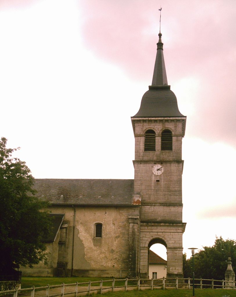
Hauteville-Lompnes (Hauteville-Lompnes)
- commune in Ain, France
Hauteville-Lompnes, located in the Ain department of the Auvergne-Rhône-Alpes region in France, is a stunning destination for hiking enthusiasts. Nestled in the foothills of the Alps, it offers a variety of trails ranging from easy walks to more challenging hikes, making it suitable for hikers of all experience levels.
Key Features of Hiking in Hauteville-Lompnes:
-
Scenic Landscapes: The area boasts picturesque landscapes, featuring rolling hills, forests, and alpine meadows. Hikers can enjoy breathtaking views of the surrounding mountains and valleys.
-
Diverse Trails: There are numerous hiking trails in and around Hauteville-Lompnes, including circuits that range from a few kilometers to longer day hikes. Trails are often marked and provide various levels of difficulty.
-
Natural Parks: The region is near the Regional Natural Park of the Haut-Jura, which offers access to a broader network of trails, rich biodiversity, and opportunities for wildlife watching.
-
Cultural Sites: Hiking in this area also allows you to explore local history and culture, with opportunities to visit quaint villages, historical sites, and enjoy regional cuisine in local restaurants.
-
Seasonal Activities: While hiking is a fantastic activity in warmer months, the region also offers snowshoeing and cross-country skiing in winter, making it a year-round destination for outdoor enthusiasts.
-
Local Guidance: For those unfamiliar with the area, engaging local guides or joining organized hikes can enhance your experience, providing insights into the terrain and the flora and fauna.
-
Travel Access: Hauteville-Lompnes is accessible by car and may have local transportation options. It's a great stop for those exploring the wider Auvergne-Rhône-Alpes region.
Tips for Hiking in Hauteville-Lompnes:
- Check Trail Maps: Make sure to bring a trail map or download relevant hiking apps to navigate easily.
- Prepare for Weather: Weather can change rapidly in mountainous areas; dress in layers and be prepared for sudden temperature shifts.
- Hydration and Snacks: Carry enough water and snacks to keep your energy up during longer hikes.
- Respect Nature: Follow Leave No Trace principles and stay on marked trails to protect the natural environment.
Whether you are a seasoned hiker or a beginner, Hauteville-Lompnes offers a wealth of outdoor adventures amid its charming landscapes. Enjoy your hiking experience!
- Country:

- Postal Code: 01110
- Coordinates: 45° 58' 44" N, 5° 35' 58" E


- GPS tracks (wikiloc): [Link]
- Area: 50.34 sq km
- Population: 3739
- Web site: http://www.hauteville-lompnes.com
- Wikipedia en: wiki(en)
- Wikipedia: wiki(fr)
- Wikidata storage: Wikidata: Q243114
- Wikipedia Commons Category: [Link]
- Wikipedia Commons Maps Category: [Link]
- Freebase ID: [/m/06n150]
- Freebase ID: [/m/06n150]
- GeoNames ID: Alt: [6424545]
- GeoNames ID: Alt: [6424545]
- SIREN number: [210101853]
- SIREN number: [210101853]
- BnF ID: [124238265]
- BnF ID: [124238265]
- VIAF ID: Alt: [241843753]
- VIAF ID: Alt: [241843753]
- GND ID: Alt: [4365010-7]
- GND ID: Alt: [4365010-7]
- TGN ID: [4006028]
- TGN ID: [4006028]
- INSEE municipality code: 01185
- INSEE municipality code: 01185
Shares border with regions:


Aranc
- commune in Ain, France
Aranc is a captivating destination for those who love the great outdoors, particularly hiking. Nestled in the stunning Jura Mountains in France, it offers a variety of trails that cater to different skill levels, from easy walks suitable for families to more challenging hikes for seasoned adventurers....
- Country:

- Postal Code: 01110
- Coordinates: 46° 0' 16" N, 5° 30' 33" E


- GPS tracks (wikiloc): [Link]
- Area: 21.65 sq km
- Population: 327
- Web site: [Link]

Champdor
- former commune in Ain, France
Champdor, located in the Auvergne-Rhône-Alpes region of France, is a picturesque destination for hikers, offering a range of trails that showcase the natural beauty of the area. Surrounded by mountains, forests, and rivers, the scenery is both diverse and breathtaking, making it an excellent spot for outdoor enthusiasts....
- Country:

- Postal Code: 01110
- Coordinates: 46° 1' 2" N, 5° 35' 50" E


- GPS tracks (wikiloc): [Link]
- Area: 17.37 sq km
- Population: 455

Cormaranche-en-Bugey
- commune in Ain, France
 Hiking in Cormaranche-en-Bugey
Cormaranche-en-Bugey is a charming village located in the Bugey region of the Auvergne-Rhône-Alpes in France. It's known for its beautiful landscapes, lush greenery, and a variety of outdoor activities, making it a great destination for hiking enthusiasts....
- Country:

- Postal Code: 01110
- Coordinates: 45° 57' 11" N, 5° 36' 40" E


- GPS tracks (wikiloc): [Link]
- Area: 18.92 sq km
- Population: 803
- Web site: [Link]

Champdor-Corcelles
- commune in Ain, France
Champdor-Corcelles is a small village located in the Ain department in the Auvergne-Rhône-Alpes region of France. It offers beautiful landscapes, making it an excellent destination for hiking enthusiasts. Here are some key points to consider when hiking in this area:...
- Country:

- Postal Code: 01080
- Coordinates: 46° 1' 5" N, 5° 35' 52" E


- GPS tracks (wikiloc): [Link]
- Area: 31.53 sq km
- Web site: [Link]

Évosges
- commune in Ain, France
The Vosges Mountains, located in northeastern France, offer a diverse array of hiking opportunities for outdoor enthusiasts. Here are some key points to consider when hiking in the Vosges:...
- Country:

- Postal Code: 01230
- Coordinates: 45° 57' 39" N, 5° 29' 53" E


- GPS tracks (wikiloc): [Link]
- Area: 12.08 sq km
- Population: 144

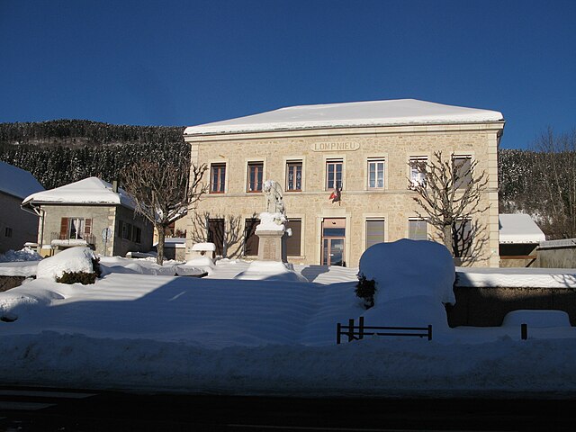
Lompnieu
- commune in Ain, France
Lompnieu is a charming village located in the Auvergne-Rhône-Alpes region of France, nestled in the beautiful Jura mountains. This area offers stunning landscapes, lush forests, and a variety of trails that cater to hikers of all levels. Here are some key points about hiking in Lompnieu:...
- Country:

- Postal Code: 01260
- Coordinates: 45° 57' 42" N, 5° 39' 39" E


- GPS tracks (wikiloc): [Link]
- Area: 11.35 sq km
- Population: 113
- Web site: [Link]

Ruffieu
- commune in Ain, France
Ruffieu is a charming village located in the Ain department of the Auvergne-Rhône-Alpes region in France. It’s nestled in the picturesque landscapes of the Jura mountains, offering a variety of hiking opportunities that cater to different levels of experience....
- Country:

- Postal Code: 01260
- Coordinates: 45° 59' 39" N, 5° 39' 48" E


- GPS tracks (wikiloc): [Link]
- Area: 14.03 sq km
- Population: 182
- Web site: [Link]

Hostiaz
- commune in Ain, France
Hostiaz is a charming village located in the Savoie region of France, known for its beautiful mountain landscapes and tranquil surroundings, making it a great destination for hiking enthusiasts. Here are some aspects of hiking in and around Hostiaz:...
- Country:

- Postal Code: 01110
- Coordinates: 45° 54' 6" N, 5° 32' 4" E


- GPS tracks (wikiloc): [Link]
- Area: 10.6 sq km
- Population: 87

Thézillieu
- commune in Ain, France
Thézillieu is a picturesque village located in the Ain department of France, nestled in the beautiful landscapes of the Rhône-Alpes region. Hiking in and around Thézillieu offers a wonderful opportunity to explore the natural beauty of the French countryside, with trails that cater to various skill levels. Here are some highlights and tips for hiking in this area:...
- Country:

- Postal Code: 01110
- Coordinates: 45° 53' 34" N, 5° 36' 3" E


- GPS tracks (wikiloc): [Link]
- Area: 26.25 sq km
- Population: 300
- Web site: [Link]

Chaley
- commune in Ain, France
Chaley, a picturesque area often known for its natural beauty, offers various hiking trails suitable for a range of skill levels. Whether you’re a beginner looking for gentle paths or an experienced hiker seeking challenging routes, Chaley has something to offer....
- Country:

- Postal Code: 01230
- Coordinates: 45° 57' 19" N, 5° 31' 54" E


- GPS tracks (wikiloc): [Link]
- Area: 4.6 sq km
- Population: 144

Tenay
- commune in Ain, France
Hiking in Tenaya, often associated with Tenaya Lake and the Tioga Pass area in Yosemite National Park, offers some spectacular opportunities for outdoor enthusiasts. Here are some highlights and tips for hiking in this beautiful region:...
- Country:

- Postal Code: 01230
- Coordinates: 45° 55' 12" N, 5° 30' 30" E


- GPS tracks (wikiloc): [Link]
- Area: 13.12 sq km
- Population: 1053
- Web site: [Link]