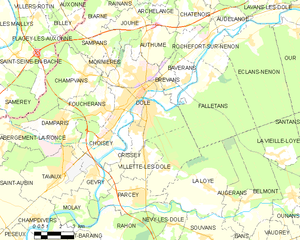
arrondissement of Dole (arrondissement de Dole)

- arrondissement of France
 Hiking in arrondissement of Dole
The Arrondissement of Dole, located in the Jura department in the Bourgogne-Franche-Comté region of eastern France, offers a variety of hiking opportunities that showcase the stunning natural landscape of the Jura Mountains. Here are some highlights for hiking in this area:
1.
- Historical Sites: The town of Dole itself is rich in history, featuring architecture and sights from the Renaissance to the present day. While exploring the town, you can find hiking trails that lead through its picturesque surroundings, including wooded areas and riversides.
2.
- Jura Mountains: The Jura Mountains provide numerous trails with varying levels of difficulty. Popular routes often include beautiful vistas, panoramic views, and opportunities for observing local wildlife.
- Forests: The region is home to extensive forests, particularly the Forêt des Vallières near Dole, which offers shaded paths suited for relaxing hikes.
3.
- Sentier des Grands Lacs: This hiking trail leads to some of the stunning lakes in the Jura region, such as Lake Chalain. You can enjoy the peaceful forest paths and spectacular views of the lakes.
- Circuit des Cuisines: A moderate hike that allows you to experience both natural landscapes and local agricultural scenery.
4.
- Local Gastronomy: As you hike, consider tasting local products like Jura cheese and wines available at small farms and markets. Some routes pass through vineyards and cheese-making areas where you can learn about the local heritage.
5.
- Trail Maps: Always carry a detailed hiking map or use a reliable GPS device, as some trails may not be well-marked.
- Footwear: Wear appropriate hiking boots and clothing, as the terrain can be uneven and weather conditions can change quickly.
- Hydration: Carry enough water and some snacks, especially on longer hikes.
6.
- Spring and Fall: These seasons offer mild temperatures and beautiful landscapes, making them ideal for hiking. However, summer hikes can also be enjoyable, provided you start early to avoid the heat.
Before heading out, check local guides or tourist offices for updated trail conditions and any specific regulations or recommendations related to hiking in the area. Enjoy your adventure in the Arrondissement of Dole!
- Country:

- Capital: Dole
- Coordinates: 47° 5' 0" N, 5° 30' 0" E


- GPS tracks (wikiloc): [Link]
- Area: 1180 sq km
- Population: 106051
- Wikipedia en: wiki(en)
- Wikipedia: wiki(fr)
- Wikidata storage: Wikidata: Q701143
- Freebase ID: [/m/095bt8]
- GeoNames ID: Alt: [3021262]
- Library of Congress authority ID: Alt: [n2018015729]
- INSEE arrondissement code: [391]
- GNS Unique Feature ID: -1424091
Includes regions:

canton of Gendrey
- canton of France (until March 2015)
Hiking in canton of Gendrey
Canton de Gendrey, located in the Doubs department in the Bourgogne-Franche-Comté region of France, offers a range of hiking opportunities that reflect the diverse landscapes of the area. Here’s what you should know about hiking in this beautiful canton:...

canton of Dampierre
- canton of France
Hiking in canton of Dampierre
Canton de Dampierre, located in Switzerland, offers a beautiful setting for hiking enthusiasts. It is surrounded by stunning natural landscapes, including rolling hills, forests, and, in some areas, picturesque alpine views. Here are some key points to consider when planning a hike in this area:...

canton of Montmirey-le-Château
- canton of France
- Country:
- Capital: Montmirey-le-Château
- Coordinates: 47° 13' 29" N, 5° 31' 44" E
- GPS tracks (wikiloc): [Link]

canton of Rochefort-sur-Nenon
- canton of France
- Country:
- Capital: Rochefort-sur-Nenon
- Coordinates: 47° 8' 27" N, 5° 33' 4" E
- GPS tracks (wikiloc): [Link]

Dole
- commune in Jura, France
- Country:
- Postal Code: 39100
- Coordinates: 47° 5' 32" N, 5° 29' 23" E
- GPS tracks (wikiloc): [Link]
- Area: 38.38 sq km
- Population: 23373
- Web site: [Link]

canton of Villers-Farlay
- canton of France (until March 2015)
Hiking in canton of Villers-Farlay
Canton de Villers-Farlay, located in the Jura region of France, offers beautiful landscapes, rich biodiversity, and a variety of hiking trails suitable for different skill levels. Here are some key highlights for hiking in this area:...
- Country:
- Capital: Villers-Farlay
- Coordinates: 46° 59' 48" N, 5° 46' 16" E
- GPS tracks (wikiloc): [Link]

canton of Chemin
- canton of France (until March 2015)
- Country:
- Capital: Chemin
- Coordinates: 46° 58' 36" N, 5° 18' 46" E
- GPS tracks (wikiloc): [Link]
- Area: 147.4 sq km

canton of Montbarrey
- canton of France (until March 2015)
Hiking in canton of Montbarrey
Canton de Montbarrey, located in the Jura department of France, is a beautiful area for hiking enthusiasts. This picturesque region is characterized by its rolling hills, dense forests, and stunning views of the Jura Mountains....
- Country:
- Capital: Montbarrey
- Coordinates: 47° 0' 44" N, 5° 37' 33" E
- GPS tracks (wikiloc): [Link]

canton of Chaussin
- canton of France (until March 2015)
Hiking in canton of Chaussin
Canton de Chaussin, located in the Jura region of France, is known for its picturesque landscapes, charming villages, and outdoor activities, including hiking. Here’s an overview of what you can expect when hiking in this lovely area:...