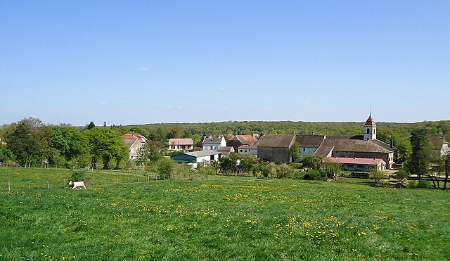
Gendrey (Gendrey)
- commune in Jura, France
- Country:

- Postal Code: 39350
- Coordinates: 47° 12' 18" N, 5° 41' 5" E


- GPS tracks (wikiloc): [Link]
- Area: 13.9 sq km
- Population: 423
- Wikipedia en: wiki(en)
- Wikipedia: wiki(fr)
- Wikidata storage: Wikidata: Q1421540
- Wikipedia Commons Category: [Link]
- Freebase ID: [/m/03npjcp]
- GeoNames ID: Alt: [6433568]
- SIREN number: [213902463]
- BnF ID: [152586104]
- INSEE municipality code: 39246
Shares border with regions:


Auxange
- commune in Jura, France
- Country:

- Postal Code: 39700
- Coordinates: 47° 10' 27" N, 5° 39' 0" E


- GPS tracks (wikiloc): [Link]
- Area: 5.2 sq km
- Population: 201


Sermange
- commune in Jura, France
- Country:

- Postal Code: 39700
- Coordinates: 47° 11' 35" N, 5° 39' 0" E


- GPS tracks (wikiloc): [Link]
- Area: 7.07 sq km
- Population: 264


Louvatange
- commune in Jura, France
Louvatange might not be widely recognized as a hiking destination, but if you're looking for scenic trails and outdoor adventure, you should consider some general tips for hiking in lesser-known areas. Here’s what you might want to keep in mind when exploring a new hiking location:...
- Country:

- Postal Code: 39350
- Coordinates: 47° 11' 47" N, 5° 43' 2" E


- GPS tracks (wikiloc): [Link]
- Area: 3.31 sq km
- Population: 100


Ougney
- commune in Jura, France
- Country:

- Postal Code: 39350
- Coordinates: 47° 14' 26" N, 5° 40' 5" E


- GPS tracks (wikiloc): [Link]
- Area: 7.08 sq km
- Population: 361


Orchamps
- commune in Jura, France
- Country:

- Postal Code: 39700
- Coordinates: 47° 8' 54" N, 5° 39' 27" E


- GPS tracks (wikiloc): [Link]
- Area: 9.92 sq km
- Population: 1086


Taxenne
- commune in Jura, France
- Country:

- Postal Code: 39350
- Coordinates: 47° 13' 27" N, 5° 40' 51" E


- GPS tracks (wikiloc): [Link]
- Area: 3.84 sq km
- Population: 100


Romain
- commune in Jura, France
Hiking in the Jura mountains of France, particularly in the region of Romain, offers breathtaking scenery, diverse landscapes, and a wealth of outdoor activities. Here are some highlights and tips for hiking in this area:...
- Country:

- Postal Code: 39350
- Coordinates: 47° 12' 48" N, 5° 43' 14" E


- GPS tracks (wikiloc): [Link]
- Area: 6.07 sq km
- Population: 207


Saligney
- commune in Jura, France
- Country:

- Postal Code: 39350
- Coordinates: 47° 13' 12" N, 5° 38' 24" E


- GPS tracks (wikiloc): [Link]
- Area: 7.98 sq km
- Population: 184


Ranchot
- commune in Jura, France
Ranchot, located in the Indian state of Madhya Pradesh, is not one of the most widely recognized hiking destinations, but it offers a unique experience for nature lovers and those looking to explore the rural landscape. Here are some highlights and tips for hiking in the Ranchot area:...
- Country:

- Postal Code: 39700
- Coordinates: 47° 9' 1" N, 5° 43' 21" E


- GPS tracks (wikiloc): [Link]
- Area: 6.91 sq km
- Population: 487


La Barre
- commune in Jura, France
La Barre, located in the Jura mountain range in eastern France, is a fantastic location for hiking enthusiasts. The Jura is known for its stunning landscapes, deep forests, rolling hills, and charming villages, making it a great destination for outdoor activities....
- Country:

- Postal Code: 39700
- Coordinates: 47° 8' 49" N, 5° 40' 59" E


- GPS tracks (wikiloc): [Link]
- Area: 3.31 sq km
- Population: 229


Lavans-lès-Dole
- commune in Jura, France
- Country:

- Postal Code: 39700
- Coordinates: 47° 9' 20" N, 5° 37' 37" E


- GPS tracks (wikiloc): [Link]
- Area: 10.27 sq km
- Population: 328

