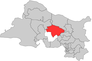
arrondissement of Istres (arrondissement d'Istres)
- arrondissement of France
- Country:

- Capital: Istres
- Coordinates: 43° 30' 15" N, 4° 59' 43" E


- GPS tracks (wikiloc): [Link]
- Area: 599 sq km
- Population: 313057
- Wikipedia en: wiki(en)
- Wikipedia: wiki(fr)
- Wikidata storage: Wikidata: Q701325
- Freebase ID: [/m/095klt]
- GeoNames ID: Alt: [6457359]
- INSEE arrondissement code: [134]
Includes regions:


canton of Berre-l'Étang
- canton of France
- Country:

- Capital: Berre-l'Étang
- Coordinates: 43° 28' 0" N, 5° 11' 0" E


- GPS tracks (wikiloc): [Link]
- Population: 69713

canton of Châteauneuf-Côte-Bleue
- canton of France
- Country:

- Capital: Châteauneuf-les-Martigues
- Coordinates: 43° 23' 0" N, 5° 10' 0" E


- GPS tracks (wikiloc): [Link]


canton of Marignane
- canton of France
- Country:

- Capital: Marignane
- Coordinates: 43° 25' 0" N, 5° 12' 51" E


- GPS tracks (wikiloc): [Link]
- Population: 81808


canton of Vitrolles
- canton of France
- Country:

- Capital: Vitrolles
- Coordinates: 43° 27' 36" N, 5° 14' 55" E


- GPS tracks (wikiloc): [Link]
- Population: 64617


