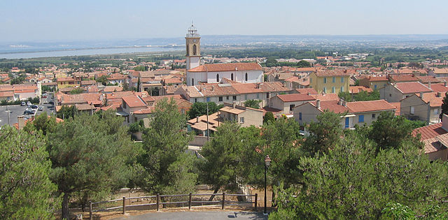
Marignane (Marignane)

- commune in Bouches-du-Rhône, France
- Country:

- Postal Code: 13700
- Coordinates: 43° 25' 1" N, 5° 12' 53" E


- GPS tracks (wikiloc): [Link]
- AboveSeaLevel: 15 м m
- Area: 23.16 sq km
- Population: 33929
- Web site: http://www.marignane.fr
- Wikipedia en: wiki(en)
- Wikipedia: wiki(fr)
- Wikidata storage: Wikidata: Q243317
- Wikipedia Commons Category: [Link]
- Freebase ID: [/m/07yg2v]
- GeoNames ID: Alt: [2995750]
- SIREN number: [211300546]
- BnF ID: [15247336j]
- VIAF ID: Alt: [167752137]
- GND ID: Alt: [4289662-9]
- Quora topic ID: [Marignane]
- Gran Enciclopèdia Catalana ID: [0040396]
- INSEE municipality code: 13054
Shares border with regions:


Vitrolles
- commune in Bouches-du-Rhône, France
- Country:
- Postal Code: 13127
- Coordinates: 43° 26' 53" N, 5° 14' 59" E
- GPS tracks (wikiloc): [Link]
- Area: 36.58 sq km
- Population: 34089
- Web site: [Link]


Berre-l'Étang
- commune in Bouches-du-Rhône, France
- Country:
- Postal Code: 13130
- Coordinates: 43° 28' 32" N, 5° 10' 5" E
- GPS tracks (wikiloc): [Link]
- Area: 43.64 sq km
- Population: 13477
- Web site: [Link]

Châteauneuf-les-Martigues
- commune in Bouches-du-Rhône, France
- Country:
- Postal Code: 13220
- Coordinates: 43° 22' 59" N, 5° 9' 51" E
- GPS tracks (wikiloc): [Link]
- Area: 31.65 sq km
- Population: 15057
- Web site: [Link]


Gignac-la-Nerthe
- commune in Bouches-du-Rhône, France
- Country:
- Postal Code: 13180
- Coordinates: 43° 23' 35" N, 5° 14' 8" E
- GPS tracks (wikiloc): [Link]
- Area: 8.64 sq km
- Population: 9063
- Web site: [Link]


Saint-Victoret
- commune in Bouches-du-Rhône, France
- Country:
- Postal Code: 13730
- Coordinates: 43° 25' 15" N, 5° 14' 0" E
- GPS tracks (wikiloc): [Link]
- Area: 4.73 sq km
- Population: 6550
- Web site: [Link]