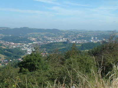
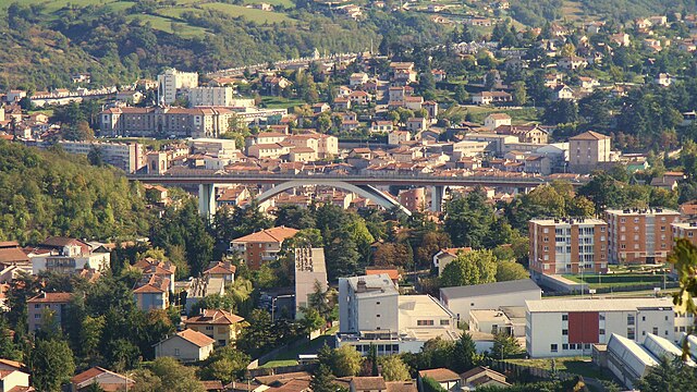
arrondissement of Saint-Étienne (arrondissement de Saint-Étienne)

- arrondissement of France
- Country:

- Capital: Saint-Étienne
- Coordinates: 45° 26' 2" N, 4° 23' 10" E


- GPS tracks (wikiloc): [Link]
- Area: 1041 sq km
- Population: 422208
- Wikipedia en: wiki(en)
- Wikipedia: wiki(fr)
- Wikidata storage: Wikidata: Q702441
- Freebase ID: [/m/095hz1]
- GeoNames ID: Alt: [2980288]
- INSEE arrondissement code: [423]
Includes regions:

canton of Saint-Étienne-Nord-Ouest-1
- canton of France
- Country:
- Capital: Saint-Étienne
- Coordinates: 45° 27' 8" N, 4° 22' 22" E
- GPS tracks (wikiloc): [Link]
canton of Saint-Étienne-Nord-Ouest-2
- canton of France (until March 2015)
- Country:
- Capital: Saint-Étienne
- Coordinates: 45° 26' 18" N, 4° 20' 57" E
- GPS tracks (wikiloc): [Link]
canton of Saint-Étienne-Sud-Est-3
- canton of France (until March 2015)
- Country:
- Capital: Saint-Étienne
canton of Saint-Étienne-Sud-Est-2
- canton of France (until March 2015)
- Country:
- Capital: Saint-Étienne
canton of Saint-Étienne-Sud-Est-1
- canton of France (until March 2015)
- Country:
- Capital: Saint-Étienne
canton of Saint-Étienne-Sud-Ouest-1
- canton of France (until March 2015)
- Country:
- Capital: Saint-Étienne
canton of Saint-Étienne-Sud-Ouest-2
- canton of France (until March 2015)
- Country:
- Capital: Saint-Étienne

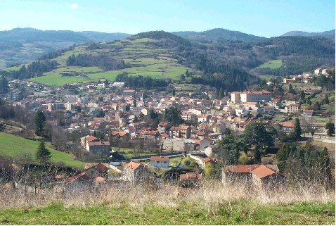
canton of Firminy
- canton of France
- Country:
- Capital: Firminy
- Coordinates: 45° 24' 3" N, 4° 15' 26" E
- GPS tracks (wikiloc): [Link]
- Population: 31259
canton of La Grand-Croix
- canton of France
- Country:
- Capital: La Grand-Croix
- Coordinates: 45° 29' 38" N, 4° 33' 44" E
- GPS tracks (wikiloc): [Link]


canton of Rive-de-Gier
- canton of France
- Country:
- Capital: Rive-de-Gier
- Coordinates: 45° 31' 48" N, 4° 37' 24" E
- GPS tracks (wikiloc): [Link]
- Population: 43537

canton of Saint-Chamond-Nord
- canton of France
- Country:
- Capital: Saint-Chamond
- Coordinates: 45° 28' 0" N, 4° 30' 0" E
- GPS tracks (wikiloc): [Link]
canton of Saint-Chamond-Sud
- canton of France
- Country:
- Capital: Saint-Chamond
- Coordinates: 45° 26' 48" N, 4° 30' 57" E
- GPS tracks (wikiloc): [Link]

canton of Saint-Genest-Malifaux
- canton of France
- Country:
- Capital: Saint-Genest-Malifaux
- Coordinates: 45° 20' 19" N, 4° 25' 46" E
- GPS tracks (wikiloc): [Link]

canton of Saint-Héand
- canton of France
- Country:
- Capital: Saint-Héand
- Coordinates: 45° 30' 52" N, 4° 24' 56" E
- GPS tracks (wikiloc): [Link]
canton of Saint-Étienne-Nord-Est-1
- canton of France (until March 2015)
- Country:
- Capital: Saint-Étienne

canton of Le Chambon-Feugerolles
- canton of France (until March 2015)
- Country:
- Capital: Le Chambon-Feugerolles
- Coordinates: 45° 24' 1" N, 4° 20' 46" E
- GPS tracks (wikiloc): [Link]
canton of Saint-Étienne-Nord-Est-2
- canton of France (until March 2015)
- Country:
- Capital: Saint-Étienne
- Coordinates: 45° 27' 12" N, 4° 24' 20" E
- GPS tracks (wikiloc): [Link]
canton of Bourg-Argental
- canton of France (until March 2015)
- Country:
- Capital: Bourg-Argental
- Coordinates: 45° 18' 42" N, 4° 33' 44" E
- GPS tracks (wikiloc): [Link]