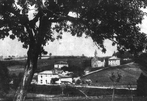
Saint-Jean-de-Bournay (Saint-Jean-de-Bournay)

- commune in Isère, France
 Hiking in Saint-Jean-de-Bournay
Saint-Jean-de-Bournay is a charming commune located in the Isère department of the Auvergne-Rhône-Alpes region in southeastern France. The surrounding area is characterized by diverse landscapes, including low valleys, rolling hills, and scenic views, making it a great destination for hiking enthusiasts.
Hiking Opportunities
-
Trails: The region boasts several hiking trails that vary in difficulty, catering to both beginners and experienced hikers. You can find marked paths that guide you through the beautiful countryside, offering opportunities to explore local flora and fauna.
-
Nature and Scenery: The landscape around Saint-Jean-de-Bournay includes agricultural lands, forests, and rivers, providing an excellent backdrop for nature walks. Make sure to take in the views of the Chartreuse Mountains in the distance.
-
Nearby Natural Attractions: Consider taking day hikes to nearby natural attractions, such as the Vercors Regional Natural Park or the Chartreuse Mountains. These areas offer more challenging trails and stunning landscapes.
-
Local Wildlife: While hiking, keep an eye out for local wildlife. The area is home to various bird species, deer, and other small animals, adding to the experience of being in nature.
Tips for Hiking in Saint-Jean-de-Bournay
-
Weather Preparedness: Check the weather forecast before heading out, as conditions can change rapidly in the region.
-
Hiking Gear: Wear comfortable hiking shoes, bring plenty of water, and consider using trekking poles for uneven terrain.
-
Maps and Navigation: It's advisable to carry a map or download hiking apps that offer offline maps to help navigate the trails.
-
Respect Nature: Be mindful of the environment by sticking to marked trails, taking your trash with you, and respecting local wildlife.
-
Local Resources: Stop by local tourist information centers for updated trail maps, guided hike options, and tips from locals.
By choosing the right trail and preparing appropriately, you can enjoy the natural beauty and tranquility that Saint-Jean-de-Bournay has to offer. Happy hiking!
- Country:

- Postal Code: 38440
- Coordinates: 45° 30' 8" N, 5° 8' 16" E


- GPS tracks (wikiloc): [Link]
- Area: 26.87 sq km
- Population: 4622
- Web site: http://www.saintjeandebournay.fr/main/index.php
- Wikipedia en: wiki(en)
- Wikipedia: wiki(fr)
- Wikidata storage: Wikidata: Q1002760
- Wikipedia Commons Category: [Link]
- Freebase ID: [/m/03nvgwk]
- GeoNames ID: Alt: [6433351]
- SIREN number: [213803992]
- BnF ID: [15258209t]
- VIAF ID: Alt: [128102671]
- archINFORM location ID: [45527]
- Library of Congress authority ID: Alt: [nb2008025162]
- PACTOLS thesaurus ID: [pcrt96vIYkknox]
- MusicBrainz area ID: [5e80349c-2583-4375-9fc4-38646c64e830]
- INSEE municipality code: 38399
Shares border with regions:


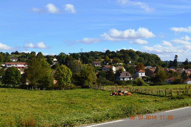
Villeneuve-de-Marc
- commune in Isère, France
Hiking in Villeneuve-de-Marc
Villeneuve-de-Marc is a charming village located in the Auvergne-Rhône-Alpes region of France. It's situated near the Rhône River and offers a picturesque landscape that is perfect for hiking enthusiasts. Here are some details to help you plan a hiking trip in and around Villeneuve-de-Marc:...
- Country:
- Postal Code: 38440
- Coordinates: 45° 28' 33" N, 5° 6' 8" E
- GPS tracks (wikiloc): [Link]
- Area: 26.18 sq km
- Population: 1140
- Web site: [Link]
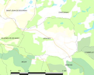
Lieudieu
- commune in Isère, France
Hiking in Lieudieu
Lieudieu is a scenic area located in the Auvergne-Rhône-Alpes region of France, nestled in the beautiful landscapes of the Alps. Hiking in this region can offer breathtaking views, diverse terrain, and opportunities to explore both nature and local culture....
- Country:
- Postal Code: 38440
- Coordinates: 45° 27' 30" N, 5° 10' 53" E
- GPS tracks (wikiloc): [Link]
- Area: 5.94 sq km
- Population: 341


Charantonnay
- commune in Isère, France
Hiking in Charantonnay
Charantonnay is a charming municipality located in the Auvergne-Rhône-Alpes region of France, which is known for its beautiful landscapes and outdoor activities. Although it's a smaller village, it offers access to some lovely hiking opportunities in the surrounding areas. Here are some key points to consider for hiking in and around Charantonnay:...
- Country:
- Postal Code: 38790
- Coordinates: 45° 32' 13" N, 5° 6' 29" E
- GPS tracks (wikiloc): [Link]
- Area: 11 sq km
- Population: 1853
- Web site: [Link]

Artas
- commune in Isère, France
Hiking in Artas
Artas, located in the Isère department of the Auvergne-Rhône-Alpes region in southeastern France, is known for its beautiful landscapes and diverse hiking opportunities. Though small, the area surrounding Artas features a variety of trails that cater to different levels of hikers, from beginners to more experienced mountain trekkers....
- Country:
- Postal Code: 38440
- Coordinates: 45° 32' 7" N, 5° 9' 52" E
- GPS tracks (wikiloc): [Link]
- Area: 14.15 sq km
- Population: 1817
- Web site: [Link]


Châtonnay
- commune in Isère, France
Hiking in Châtonnay
Châtonnay is a charming village located in the Isère department of the Auvergne-Rhône-Alpes region in France, offering beautiful landscapes and a variety of hiking opportunities. While it may not be as well-known as some of the larger national parks or hiking destinations in France, the surrounding areas feature picturesque scenery, including rolling hills, forests, and valleys....
- Country:
- Postal Code: 38440
- Coordinates: 45° 29' 9" N, 5° 12' 25" E
- GPS tracks (wikiloc): [Link]
- Area: 31.84 sq km
- Population: 2070
- Web site: [Link]

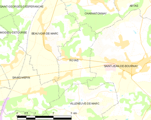
Royas
- commune in Isère, France
Hiking in Royas
Royas is a beautiful yet lesser-known hiking destination, perfect for those looking to explore nature away from the more crowded trails. Although it might not be as famous as other hiking spots, it offers stunning landscapes, diverse wildlife, and a peaceful atmosphere....
- Country:
- Postal Code: 38440
- Coordinates: 45° 30' 21" N, 5° 6' 16" E
- GPS tracks (wikiloc): [Link]
- Area: 5.48 sq km
- Population: 389
- Web site: [Link]

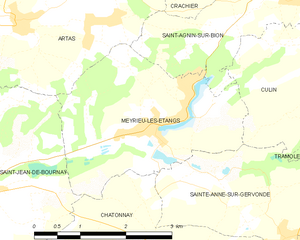
Meyrieu-les-Étangs
- commune in Isère, France
Hiking in Meyrieu-les-Étangs
Meyrieu-les-Étangs is a charming commune located in the Auvergne-Rhône-Alpes region of France. Nestled in a rural setting, it offers several opportunities for hiking enthusiasts to enjoy nature and exploration....
- Country:
- Postal Code: 38440
- Coordinates: 45° 30' 49" N, 5° 12' 0" E
- GPS tracks (wikiloc): [Link]
- AboveSeaLevel: 390 м m
- Area: 8.54 sq km
- Population: 969
- Web site: [Link]