
Augsburg (Augsburg)

.svg)
- city in Bavaria, Germany
 Hiking in Augsburg
Augsburg, located in Bavaria, Germany, is a charming city that offers various outdoor activities, including hiking. While the city itself is urban, it provides easy access to beautiful natural landscapes in the surrounding areas, making it a great base for hiking enthusiasts.
1.
- Augsburg Stadtwald: The Augsburg City Forest is a popular spot for local hikers. It features several well-marked trails where you can enjoy a leisurely walk among trees and enjoy nature without leaving the city.
- Lech River Trails: The banks of the Lech River offer scenic trails perfect for hiking or biking. The paths along the river provide beautiful views and opportunities to spot local wildlife.
- The Augsburg Western Woods (Augsburger Westliche Wälder): A larger area just outside of Augsburg with extensive hiking trails through forests, meadows, and past serene lakes.
2.
- Südliche Frankenhochland: A little further out, this region offers more challenging hikes with stunning views of the Bavarian countryside.
- Ammergebirge Nature Park: About an hour from Augsburg, this area features more rugged terrain, including beautiful mountain trails. It’s perfect for day hikes or a longer excursion.
3.
- Trail Conditions: Check local resources for trail conditions before you head out, especially in wetter months.
- Map & GPS: While many trails are marked, having a map and GPS can help you navigate more remote areas.
- Gear: Wear appropriate clothing and sturdy hiking boots, and pack essentials such as water, snacks, and a first-aid kit.
4.
In addition to hiking, Augsburg offers many cultural activities, including museums, historical sites like the Augsburg Cathedral, and the Fuggerei, a historical social housing complex.
Augsburg's blend of urban and rural settings allows for a diverse experience, making it a lovely destination for both city exploration and nature hikes.
- Country:

- Postal Code: 86179; 86169; 86167; 86165; 86163; 86161; 86159; 86157; 86156; 86154; 86153; 86152; 86199; 86150
- Local Dialing Code: 0821
- Licence Plate Code: A
- Coordinates: 48° 22' 18" N, 10° 53' 54" E


- GPS tracks (wikiloc): [Link]
- AboveSeaLevel: 482 м m
- Area: 146.87 sq km
- Population: 289584
- Web site: https://www.augsburg.de/
- Wikipedia en: wiki(en)
- Wikipedia: wiki(de)
- Wikidata storage: Wikidata: Q2749
- Wikipedia Commons Gallery: [Link]
- Wikipedia Commons Category: [Link]
- Wikipedia Commons Maps Category: [Link]
- Freebase ID: [/m/09f8q]
- GeoNames ID: Alt: [3220868]
- BnF ID: [11862310j]
- VIAF ID: Alt: [153139306]
- OSM relation ID: [62407]
- GND ID: Alt: [4003614-5]
- archINFORM location ID: [214]
- Library of Congress authority ID: Alt: [n50073906]
- PACTOLS thesaurus ID: [pcrtmiMA4Nus9S]
- MusicBrainz area ID: [72cb4849-5677-47c2-8c5f-415c9074f5f3]
- Quora topic ID: [Augsburg-Germany-2]
- TGN ID: [7004324]
- UN/LOCODE: [DEAGB]
- SUDOC authorities ID: [026359804]
- Gran Enciclopèdia Catalana ID: [0006092]
- Encyclopædia Universalis ID: [augsbourg]
- HDS ID: [6581]
- EMLO location ID: [4c10c090-b2c1-4122-8d94-e5125e7c3c41]
- Facebook Places ID: [110526485641433]
- Great Russian Encyclopedia Online ID: [1839887]
- Bavarikon ID: [ODB_A00000897]
- NKCR AUT ID: [ge134035]
- DMOZ ID: Alt: [Regional/Europe/Germany/States/Bavaria/Localities/Augsburg/]
- National Library of Israel ID: [000187620]
- NUTS code: [DE271]
- YSO ID: [504574]
- Nomisma ID: [augsburg]
- Klexikon article ID: [Augsburg]
- Global Anabaptist Mennonite Encyclopedia Online ID: [Augsburg (Freistaat Bayern, Germany)]
- German municipality key: 09761000
- US National Archives Identifier: 10044874
- German district key: 09761
Includes regions:
Augsburg-Antonsviertel
Hiking in Augsburg-Antonsviertel
Augsburg-Antonsviertel, while primarily an urban district, offers several spots where nature enthusiasts can enjoy light hiking and walking experiences. The area is characterized by its historical architecture and parks, making it a charming setting for a stroll rather than a rigorous hiking expedition. Here are some key points about hiking and outdoor activities in and around Augsburg-Antonsviertel:...
- Country:
- Coordinates: 48° 21' 25" N, 10° 53' 9" E
- GPS tracks (wikiloc): [Link]
Augsburg-Bergheim
- human settlement in Germany
Hiking in Augsburg-Bergheim
Augsburg-Bergheim, located near the historic city of Augsburg in Bavaria, Germany, offers a variety of scenic hiking opportunities. The region is characterized by its lush landscapes, quaint villages, and proximity to the Lech River, making it a great destination for outdoor enthusiasts. Here are some highlights and tips for hiking in Augsburg-Bergheim:...
- Country:
- Coordinates: 48° 19' 2" N, 10° 49' 16" E
- GPS tracks (wikiloc): [Link]
Augsburg-Bärenkeller
- human settlement in Germany
Hiking in Augsburg-Bärenkeller
Augsburg-Bärenkeller is a charming district located in Augsburg, Bavaria, Germany. This area, while primarily urban, offers access to some outdoor activities, including hiking. Here are some details about hiking in and around Augsburg-Bärenkeller:...
- Country:
- Coordinates: 48° 23' 50" N, 10° 51' 0" E
- GPS tracks (wikiloc): [Link]
Augsburg-Firnhaberau
Hiking in Augsburg-Firnhaberau
Augsburg-Firnhaberau, located in the southwest region of Augsburg, Germany, offers several opportunities for hiking enthusiasts to explore the natural beauty of the area. Here are some key points to consider when hiking in Firnhaberau:...
- Country:
- Coordinates: 48° 24' 20" N, 10° 53' 40" E
- GPS tracks (wikiloc): [Link]
Augsburg-Hammerschmiede
Hiking in Augsburg-Hammerschmiede
Augsburg-Hammerschmiede, located in the city of Augsburg in Bavaria, Germany, offers a great opportunity for hiking enthusiasts. This area is characterized by beautiful landscapes, historical sites, and well-marked trails....
- Country:
- Coordinates: 48° 24' 0" N, 10° 54' 40" E
- GPS tracks (wikiloc): [Link]


Augsburg-Göggingen
- human settlement
Hiking in Augsburg-Göggingen
Augsburg-Göggingen is a beautiful area located on the outskirts of Augsburg, Germany. It is known for its scenic landscapes, historical sites, and access to various hiking trails that cater to different experience levels. Here are some highlights of hiking in this region:...
- Country:
- Coordinates: 48° 20' 20" N, 10° 52' 19" E
- GPS tracks (wikiloc): [Link]
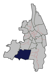
Augsburg-Haunstetten
- human settlement in Germany
Hiking in Augsburg-Haunstetten
Augsburg-Haunstetten is a district in Augsburg, Germany, that offers a variety of hiking opportunities for both casual walkers and avid hikers. While it may not be as mountainous as other regions in Bavaria, it features beautiful landscapes, parks, and well-maintained trails that provide scenic views and a chance to connect with nature....
- Country:
- Coordinates: 48° 18' 30" N, 10° 54' 15" E
- GPS tracks (wikiloc): [Link]
Augsburg-Hochfeld
- human settlement in Germany
Hiking in Augsburg-Hochfeld
Augsburg-Hochfeld, located in the city of Augsburg, Bavaria, Germany, is a great place for hiking and enjoying nature. This area combines urban environments with access to natural spaces, making it suitable for various outdoor activities....
- Country:
- Coordinates: 48° 20' 50" N, 10° 54' 0" E
- GPS tracks (wikiloc): [Link]
Augsburg-Hochzoll
Hiking in Augsburg-Hochzoll
Augsburg-Hochzoll is a lovely area for hiking, situated in the outskirts of the city of Augsburg, Germany. It combines natural beauty with cultural and historical sites, making it an ideal destination for outdoor enthusiasts....
- Country:
- Coordinates: 48° 21' 10" N, 10° 56' 50" E
- GPS tracks (wikiloc): [Link]


Augsburg-Innenstadt
- administrative district of Augsburg, literally
Hiking in Augsburg-Innenstadt
Augsburg-Innenstadt, the historic city center of Augsburg, Germany, is not traditionally known for extensive hiking trails like those found in mountainous or rural areas. However, it offers unique opportunities for walking and exploring the city's rich history, architecture, and natural beauty. Here are some highlights and tips for hiking or long walks in the area:...
- Country:
- Coordinates: 48° 22' 0" N, 10° 54' 0" E
- GPS tracks (wikiloc): [Link]

Augsburg-Inningen
Hiking in Augsburg-Inningen
Augsburg-Inningen, located in the southwestern part of Germany, is a charming area for hiking enthusiasts. This district is not only rich in history but also offers beautiful landscapes and nature trails, making it a great spot for outdoor activities....
- Country:
- Postal Code: 86199
- Coordinates: 48° 18' 10" N, 10° 51' 30" E
- GPS tracks (wikiloc): [Link]
- Area: 12.7833 sq km
- Population: 4748
Augsburg-Kriegshaber
- human settlement in Germany
Hiking in Augsburg-Kriegshaber
Augsburg-Kriegshaber is a district located in the city of Augsburg, Germany, and while it's primarily known as a residential area, it offers some opportunities for outdoor activities, including hiking. While the immediate area may not have extensive hiking trails, you can find paths and green spaces ideal for walking and connecting with nature....
- Country:
- Coordinates: 48° 22' 36" N, 10° 51' 30" E
- GPS tracks (wikiloc): [Link]
Augsburg-Lechhausen
- district of Augsburg
Hiking in Augsburg-Lechhausen
Augsburg-Lechhausen is an interesting area for hiking, located within the city of Augsburg, Germany. While it might not be as picturesque as some of the surrounding Bavarian countryside, it still offers several opportunities for walking and enjoying the outdoors....
- Country:
- Coordinates: 48° 22' 52" N, 10° 54' 58" E
- GPS tracks (wikiloc): [Link]
Oberhausen
- quarter of Augsburg, Bavaria, Germany
Hiking in Oberhausen
Augsburg-Oberhausen, situated in the state of Bavaria, Germany, offers some appealing hiking opportunities that blend urban and natural landscapes. While the area is primarily known for its rich history and cultural attractions, there are also appealing trails for outdoor enthusiasts....
- Country:
- Coordinates: 48° 23' 31" N, 10° 52' 41" E
- GPS tracks (wikiloc): [Link]
Pfersee
- human settlement in Germany
Hiking in Pfersee
Pfersee is a district in the city of Augsburg, Germany, and while it may not be a large hiking destination in itself, it offers access to several parks and green spaces ideal for walking and light hiking. If you're looking to explore the outdoors in and around Pfersee, here are some options:...
- Country:
- Coordinates: 48° 22' 0" N, 10° 52' 5" E
- GPS tracks (wikiloc): [Link]
Augsburg-Spickel-Herrenbach
- location in Germany
Hiking in Augsburg-Spickel-Herrenbach
Augsburg-Spickel-Herrenbach is a lovely area in Germany that offers various hiking opportunities for both casual walkers and more experienced hikers. Nestled in the region of Bavaria, you can expect beautiful landscapes, picturesque streets, and a mix of urban green areas and natural surroundings....
- Country:
- Coordinates: 48° 21' 21" N, 10° 55' 23" E
- GPS tracks (wikiloc): [Link]
Augsburg-Universitätsviertel
Hiking in Augsburg-Universitätsviertel
Augsburg-Universitätsviertel is a vibrant area known for its university and student life, offering a mix of urban and natural environments. While the area itself may not be a traditional hiking destination, there are several outdoor opportunities for walks and light hiking nearby....
- Country:
- Postal Code: 86159
- Coordinates: 48° 18' 30" N, 10° 54' 15" E
- GPS tracks (wikiloc): [Link]
- Area: 4.0019 sq km
- Population: 10983
Shares border with regions:
Augsburg
- district in Bavaria, Germany
Hiking in Augsburg
Augsburg is a city in Bavaria, Germany, known for its rich history and beautiful surroundings, making it a great base for hiking enthusiasts. While the city itself offers various parks and local trails, the surrounding district provides a variety of hiking options for different skill levels. Here are some highlights:...
- Country:
- Capital: Augsburg
- Licence Plate Code: A
- Coordinates: 48° 25' 12" N, 10° 49' 48" E
- GPS tracks (wikiloc): [Link]
- AboveSeaLevel: 521 м m
- Area: 1071.00 sq km
- Population: 191469
- Web site: [Link]
Aichach-Friedberg
- district in Bavaria, Germany
Hiking in Aichach-Friedberg
Aichach-Friedberg is a beautiful region located in Bavaria, Germany, known for its diverse landscapes, charming villages, and historical sites. Hiking in this area offers a variety of trails that cater to different skill levels, making it an excellent destination for both novice hikers and experienced outdoor enthusiasts....
- Country:
- Capital: Aichach
- Licence Plate Code: FDB; AIC
- Coordinates: 48° 25' 12" N, 11° 4' 48" E
- GPS tracks (wikiloc): [Link]
- AboveSeaLevel: 483 м m
- Area: 781.00 sq km
- Population: 101792
- Web site: [Link]


Stadtbergen
- municipality of Germany
Hiking in Stadtbergen
Stadtbergen, a charming town located near Augsburg in Bavaria, Germany, offers several opportunities for outdoor enthusiasts and hikers. While it may not be as well-known as some of Bavaria's larger national parks or hiking regions, it has its own unique trails and scenic landscapes. Here are some highlights for hiking in and around Stadtbergen:...
- Country:
- Postal Code: 86391
- Local Dialing Code: 0821
- Licence Plate Code: A
- Coordinates: 48° 22' 0" N, 10° 51' 0" E
- GPS tracks (wikiloc): [Link]
- AboveSeaLevel: 486 м m
- Area: 11.50 sq km
- Population: 11713
- Web site: [Link]