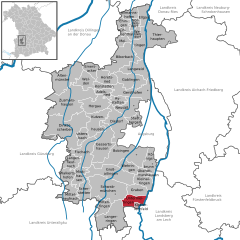
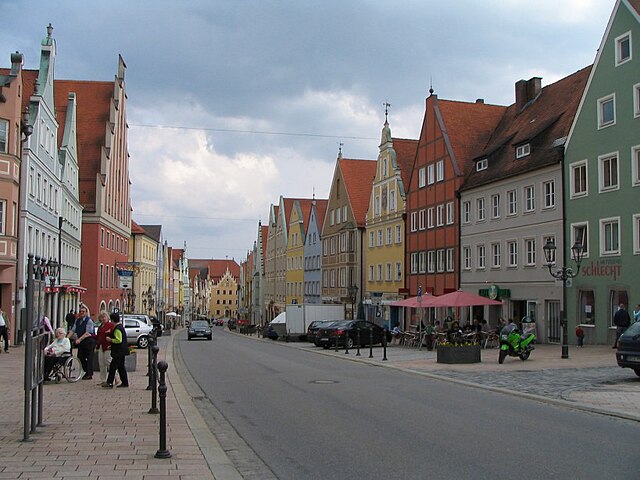
Augsburg (Landkreis Augsburg)
.svg)
- district in Bavaria, Germany
 Hiking in Augsburg
Augsburg is a city in Bavaria, Germany, known for its rich history and beautiful surroundings, making it a great base for hiking enthusiasts. While the city itself offers various parks and local trails, the surrounding district provides a variety of hiking options for different skill levels. Here are some highlights:
1.
- Augsburg Western Woods (Augsburger Westernwald): This area features lush forests, meadows, and streams. It offers a network of trails suitable for hiking, running, and cycling. The landscapes are perfect for enjoying the tranquility of nature.
- Lechfeld: The Lech river valley is a notable area for scenic hikes, with trails that often partner the river, providing picturesque views of the water and surrounding fields.
2.
- Augsburg has historical trails that connect various cultural sites such as the famous Fuggerei, the historic town center, and the Augsburg Cathedral. You can explore the city's rich heritage while enjoying a leisurely hike.
3.
- There are well-marked hiking trails in the region, varying in difficulty. The Augsburg-Herrenbach loop is a popular choice for those looking for a moderate hike, integrating both nature and beautiful views.
- Via Claudia Augusta: This ancient Roman road offers an extended hiking route that can be accessed from Augsburg, leading through picturesque landscapes and small towns.
4.
- Bavarian Alps: Just a short trip from Augsburg, you can access trails in the Bavarian Alps, which offer more challenging hikes with stunning mountain views.
- Swabian Jura: The nearby Swabian Jura is known for its dramatic landscapes, caves, and unique rock formations, providing great hiking opportunities for both beginners and experienced hikers.
5.
- Best Hiking Seasons: Spring and fall are ideal for hiking to enjoy mild temperatures and beautiful scenery.
- Gear: Wear appropriate hiking shoes and bring water and snacks. Some trails may have limited facilities, so be prepared.
- Local Guides: Consider joining guided hikes offered by local organizations for a more immersive experience and knowledge about the area's ecology and history.
Overall, Augsburg's combination of urban charm and natural beauty makes it a fantastic destination for hiking enthusiasts. Whether you're looking for a casual stroll or a more challenging hike, you'll find great options in and around the district!
- Country:

- Capital: Augsburg
- Licence Plate Code: A
- Coordinates: 48° 25' 12" N, 10° 49' 48" E


- GPS tracks (wikiloc): [Link]
- AboveSeaLevel: 521 м m
- Area: 1071.00 sq km
- Population: 191469
- Web site: http://www.landkreis-augsburg.de/
- Wikipedia en: wiki(en)
- Wikipedia: wiki(de)
- Wikidata storage: Wikidata: Q10414
- Wikipedia Commons Category: [Link]
- Freebase ID: [/m/01c0zx]
- GeoNames ID: Alt: [3220871]
- VIAF ID: Alt: [243373942]
- OSM relation ID: [62622]
- GND ID: Alt: [4003617-0]
- archINFORM location ID: [2322]
- Library of Congress authority ID: Alt: [n82263681]
- TGN ID: [7077090]
- Historical Gazetteer (GOV) ID: [adm_139772]
- Bavarikon ID: [ODB_A00000575]
- NUTS code: [DE276]
- BabelNet ID: [01241380n]
- German district key: 09772
Includes regions:
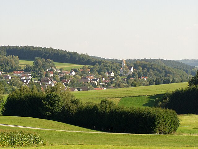

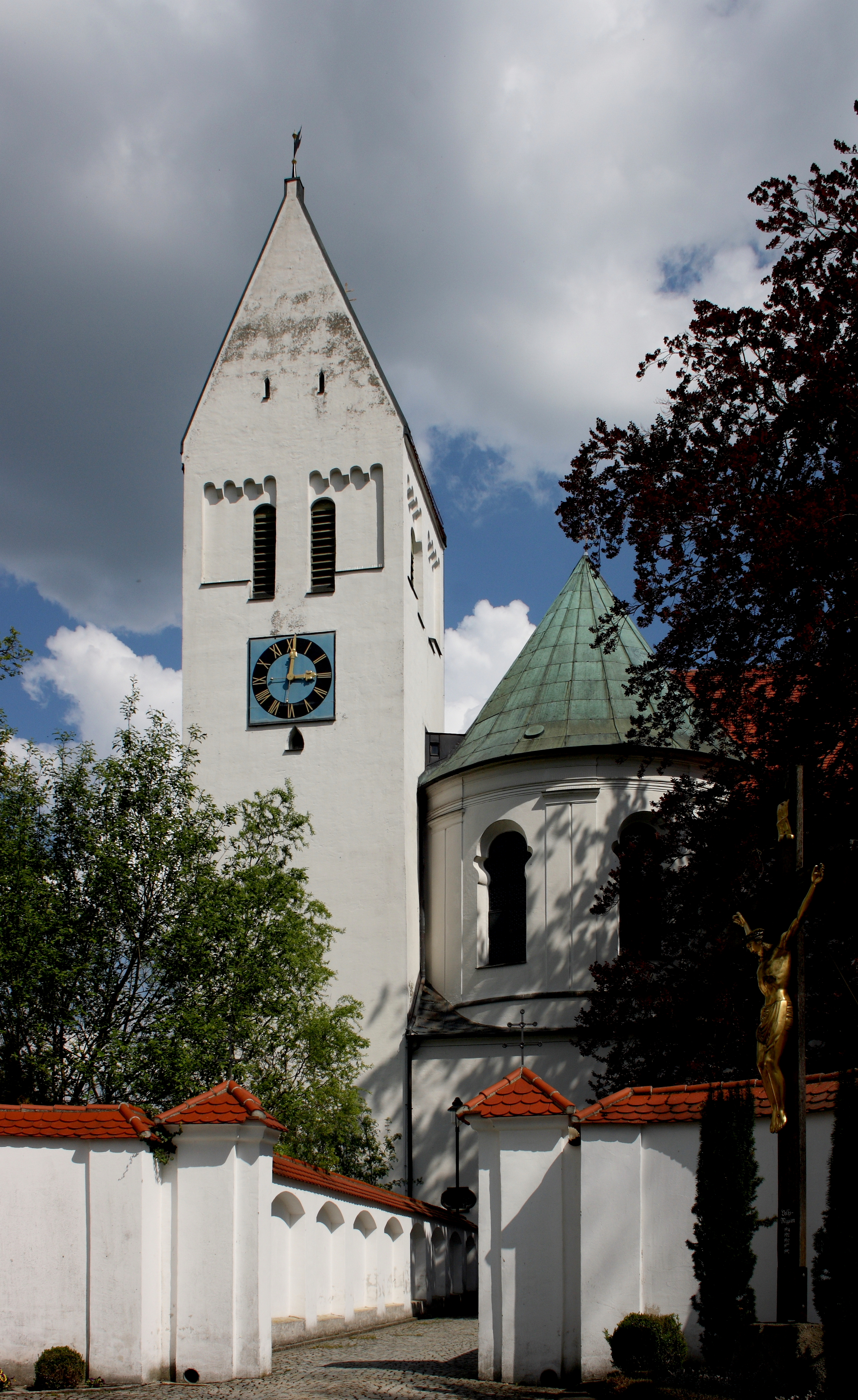
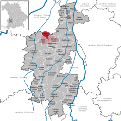
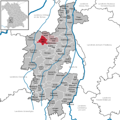
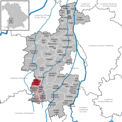
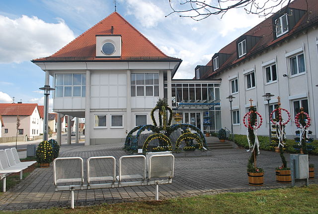
Mickhausen
- municipality of Germany
Hiking in Mickhausen
Mickhausen, located in Bavaria, Germany, is a wonderful area for hiking enthusiasts. The region is characterized by picturesque landscapes, rolling hills, and lush greenery, making it an attractive destination for both casual walkers and seasoned hikers. Here are some highlights about hiking in Mickhausen:...
- Country:
- Postal Code: 86866
- Local Dialing Code: 08204
- Licence Plate Code: A
- Coordinates: 48° 15' 0" N, 10° 37' 0" E
- GPS tracks (wikiloc): [Link]
- AboveSeaLevel: 540 м m
- Area: 15.48 sq km
- Population: 1102
- Web site: [Link]
Schmellerforst
- unincorporated area in Germany
Hiking in Schmellerforst
Schmellerforst, located in Germany, is known for its picturesque landscapes, dense forests, and diverse wildlife. Hiking in this region can be a rewarding experience as it offers a variety of trails suitable for different skill levels. Here are some highlights and tips for hiking in Schmellerforst:...
- Country:
- Coordinates: 48° 19' 0" N, 10° 31' 0" E
- GPS tracks (wikiloc): [Link]


Walkertshofen
- municipality of Germany
Hiking in Walkertshofen
Walkertshofen is a small village in Bavaria, Germany, known for its scenic landscapes and rural charm. While it may not be as famous as some other hiking destinations in the Bavarian Alps, Wild and peaceful nature awaits those who venture into its surroundings....
- Country:
- Postal Code: 86877
- Local Dialing Code: 08239
- Licence Plate Code: A
- Coordinates: 48° 14' 0" N, 10° 35' 0" E
- GPS tracks (wikiloc): [Link]
- AboveSeaLevel: 537 м m
- Area: 12.75 sq km
- Population: 846
- Web site: [Link]


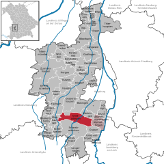
Zusmarshausen
- municipality of Germany
Hiking in Zusmarshausen
Zusmarshausen, located in Bavaria, Germany, offers a variety of hiking opportunities suited for different fitness levels and preferences. The region is known for its picturesque landscapes, dense forests, and charming rural scenery. Here are some highlights and tips for hiking in and around Zusmarshausen:...
- Country:
- Postal Code: 86441
- Local Dialing Code: 08291
- Licence Plate Code: A
- Coordinates: 48° 23' 0" N, 10° 35' 0" E
- GPS tracks (wikiloc): [Link]
- AboveSeaLevel: 463 м m
- Area: 68.72 sq km
- Population: 4803
- Web site: [Link]


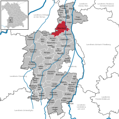
Meitingen
- municipality of Germany
Hiking in Meitingen
Meitingen is a quaint town located in Bavaria, Germany, and while it may not be widely known as a hiking destination, it offers some beautiful trails and scenic spots for outdoor enthusiasts. Here are some aspects to consider when hiking in and around Meitingen:...
- Country:
- Postal Code: 86405
- Local Dialing Code: 08271
- Licence Plate Code: A
- Coordinates: 48° 32' 0" N, 10° 50' 0" E
- GPS tracks (wikiloc): [Link]
- AboveSeaLevel: 433 м m
- Area: 29.87 sq km
- Population: 8999
- Web site: [Link]


Bobingen
- municipality of Germany
Hiking in Bobingen
Bobingen is a charming town located in Bavaria, Germany, not far from the city of Augsburg. While it may not be as well-known as some of the larger hiking destinations in the region, it does offer some pleasant hiking opportunities for those looking to enjoy the natural beauty of the surrounding area....
- Country:
- Postal Code: 86399
- Local Dialing Code: 08234
- Licence Plate Code: A
- Coordinates: 48° 16' 0" N, 10° 49' 0" E
- GPS tracks (wikiloc): [Link]
- AboveSeaLevel: 521 м m
- Area: 50.25 sq km
- Population: 13553
- Web site: [Link]
Ustersbach
- municipality of Germany
Hiking in Ustersbach
Ustersbach is a picturesque village located in the Bavarian region of Germany, known for its beautiful landscapes and outdoor activities. If you're considering hiking in Ustersbach, here are some key details that may help you enjoy your experience:...
- Country:
- Postal Code: 86514
- Local Dialing Code: 08236
- Licence Plate Code: A
- Coordinates: 48° 19' 0" N, 10° 39' 0" E
- GPS tracks (wikiloc): [Link]
- AboveSeaLevel: 490 м m
- Area: 11.14 sq km
- Population: 1005
- Web site: [Link]

Thierhaupten
- municipality of Germany
Hiking in Thierhaupten
Thierhaupten, located in Bavaria, Germany, offers a beautiful setting for hiking enthusiasts. This charming town is surrounded by picturesque landscapes, including forests, fields, and the nearby Lech River, making it an attractive destination for outdoor activities....
- Country:
- Postal Code: 86672
- Local Dialing Code: 08271
- Licence Plate Code: A
- Coordinates: 48° 34' 0" N, 10° 55' 0" E
- GPS tracks (wikiloc): [Link]
- AboveSeaLevel: 432 м m
- Area: 39.19 sq km
- Population: 3786
- Web site: [Link]


Adelsried
- municipality in Germany
Hiking in Adelsried
Adelsried, located in Bavaria, Germany, offers a great opportunity for hiking enthusiasts to explore its beautiful landscapes. Nestled near the Wettenhausen Forest and with proximity to the Ausgburg area, it's an excellent spot for both beginners and experienced hikers....
- Country:
- Postal Code: 86477
- Local Dialing Code: 08294
- Licence Plate Code: A
- Coordinates: 48° 25' 0" N, 10° 43' 0" E
- GPS tracks (wikiloc): [Link]
- AboveSeaLevel: 490 м m
- Area: 9.7 sq km
- Population: 1816
- Web site: [Link]

Mittelneufnach
- municipality of Germany
Hiking in Mittelneufnach
Mittelneufnach is a quaint village located in the Swabian region of Bavaria, Germany. While it may not be a widely recognized hiking destination, the surrounding area offers beautiful landscapes and trails that are perfect for outdoor enthusiasts....
- Country:
- Postal Code: 86868
- Local Dialing Code: 08262
- Licence Plate Code: A
- Coordinates: 48° 11' 0" N, 10° 36' 0" E
- GPS tracks (wikiloc): [Link]
- AboveSeaLevel: 560 м m
- Area: 16.96 sq km
- Population: 901
- Web site: [Link]


Wehringen
- municipality of Germany
Hiking in Wehringen
Wehringen, a small town located in Bavaria, Germany, offers beautiful hiking opportunities for outdoor enthusiasts. Nestled near the foothills of the Alps, the region features picturesque landscapes with forests, meadows, and views of distant mountains, making it a perfect spot for hiking....
- Country:
- Postal Code: 86517
- Local Dialing Code: 08234
- Licence Plate Code: A
- Coordinates: 48° 15' 0" N, 10° 48' 0" E
- GPS tracks (wikiloc): [Link]
- AboveSeaLevel: 527 м m
- Area: 13.96 sq km
- Population: 2070
- Web site: [Link]


Altenmünster
- municipality of Germany
Hiking in Altenmünster
Altenmünster, located in Bavaria, Germany, is a picturesque village that offers a range of hiking opportunities for outdoor enthusiasts. Here are some highlights about hiking in the area:...
- Country:
- Postal Code: 86450
- Local Dialing Code: 08295
- Licence Plate Code: A
- Coordinates: 48° 28' 0" N, 10° 36' 0" E
- GPS tracks (wikiloc): [Link]
- AboveSeaLevel: 436 м m
- Area: 41.30 sq km
- Population: 3385
- Web site: [Link]


Gersthofen
- municipality of Germany
Hiking in Gersthofen
Gersthofen is a small town located near Augsburg in Bavaria, Germany. While it may not be a traditional hiking destination like some of the larger national parks or mountain ranges, there are still opportunities for enjoyable walks and hikes in and around the area. Here are some points to consider when hiking in Gersthofen:...
- Country:
- Postal Code: 86368
- Local Dialing Code: 0821
- Licence Plate Code: A
- Coordinates: 48° 25' 0" N, 10° 52' 0" E
- GPS tracks (wikiloc): [Link]
- AboveSeaLevel: 469 м m
- Area: 33.95 sq km
- Population: 17051
- Web site: [Link]


Ellgau
- municipality of Germany
Hiking in Ellgau
Ellgau, located in Bavaria, Germany, is a charming destination for hikers seeking beautiful landscapes and a mix of cultural experiences. The area is characterized by its picturesque countryside, rolling hills, and well-marked trails. Here are some tips and highlights for hiking in Ellgau:...
- Country:
- Postal Code: 86679
- Local Dialing Code: 08273
- Licence Plate Code: A
- Coordinates: 48° 36' 0" N, 10° 52' 0" E
- GPS tracks (wikiloc): [Link]
- AboveSeaLevel: 421 м m
- Area: 13.89 sq km
- Population: 843
- Web site: [Link]

Aystetten
- municipality of Germany
Hiking in Aystetten
Aystetten is a small municipality located in Bavaria, Germany, near Augsburg. While it may not be a widely known hiking destination, it offers a variety of trails and beautiful natural surroundings that can provide a great outdoor experience....
- Country:
- Postal Code: 86482
- Local Dialing Code: 0821
- Licence Plate Code: A
- Coordinates: 48° 24' 17" N, 10° 46' 27" E
- GPS tracks (wikiloc): [Link]
- AboveSeaLevel: 478 м m
- Area: 9.35 sq km
- Population: 2383
- Web site: [Link]


Neusäß
- city in Bavaria
Hiking in Neusäß
Neusäß is a charming town located in Bavaria, Germany, near Augsburg. It may not be as famous for hiking as some of the larger national parks or mountainous regions in Germany, but it offers several opportunities for those who enjoy outdoor activities....
- Country:
- Postal Code: 86356
- Local Dialing Code: 0821
- Coordinates: 48° 24' 0" N, 10° 50' 0" E
- GPS tracks (wikiloc): [Link]
- AboveSeaLevel: 485 м m
- Area: 25.14 sq km
- Population: 22038
- Web site: [Link]

Untermeitingen
- municipality of Germany
Hiking in Untermeitingen
Untermeitingen, located in Bavaria, Germany, offers some lovely hiking opportunities for both beginners and more experienced hikers. The surrounding region is characterized by gentle hills, lush greenery, and picturesque landscapes, making it a great place for outdoor activities....
- Country:
- Postal Code: 86836
- Local Dialing Code: 08232
- Licence Plate Code: A
- Coordinates: 48° 10' 0" N, 10° 48' 0" E
- GPS tracks (wikiloc): [Link]
- AboveSeaLevel: 560 м m
- Area: 15.58 sq km
- Population: 3853
- Web site: [Link]


Stadtbergen
- municipality of Germany
Hiking in Stadtbergen
Stadtbergen, a charming town located near Augsburg in Bavaria, Germany, offers several opportunities for outdoor enthusiasts and hikers. While it may not be as well-known as some of Bavaria's larger national parks or hiking regions, it has its own unique trails and scenic landscapes. Here are some highlights for hiking in and around Stadtbergen:...
- Country:
- Postal Code: 86391
- Local Dialing Code: 0821
- Licence Plate Code: A
- Coordinates: 48° 22' 0" N, 10° 51' 0" E
- GPS tracks (wikiloc): [Link]
- AboveSeaLevel: 486 м m
- Area: 11.50 sq km
- Population: 11713
- Web site: [Link]

Emersacker
- municipality of Germany
Hiking in Emersacker
Emersacker is a picturesque village located in Bavaria, Germany, which provides a wonderful backdrop for hiking enthusiasts. The region features a variety of trails that cater to different levels of hiking experience, allowing visitors to explore the natural beauty of the landscape, including forests, fields, and the nearby Lech River....
- Country:
- Postal Code: 86494
- Local Dialing Code: 08293
- Licence Plate Code: A
- Coordinates: 48° 30' 0" N, 10° 40' 0" E
- GPS tracks (wikiloc): [Link]
- AboveSeaLevel: 450 м m
- Area: 11.64 sq km
- Population: 1012
- Web site: [Link]

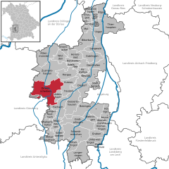
Dinkelscherben
- municipality of Germany
Hiking in Dinkelscherben
Dinkelscherben is a charming town located in Bavaria, Germany, and it serves as a great base for hiking enthusiasts looking to explore the surrounding countryside. The area is characterized by beautiful landscapes, rich vegetation, and a network of trails suitable for varying skill levels. Here are some highlights for hiking in and around Dinkelscherben:...
- Country:
- Postal Code: 86424
- Local Dialing Code: 08292
- Licence Plate Code: A
- Coordinates: 48° 21' 0" N, 10° 35' 0" E
- GPS tracks (wikiloc): [Link]
- AboveSeaLevel: 460 м m
- Area: 67.65 sq km
- Population: 6154
- Web site: [Link]


Fischach
- municipality of Germany
Hiking in Fischach
Fischach, a small town located in Bavaria, Germany, is surrounded by lush landscapes and offers a variety of hiking opportunities for outdoor enthusiasts. The region is characterized by rolling hills, forests, and picturesque meadows, making it an ideal spot for those looking to explore nature....
- Country:
- Postal Code: 86850
- Local Dialing Code: 08236
- Licence Plate Code: A
- Coordinates: 48° 17' 27" N, 10° 39' 13" E
- GPS tracks (wikiloc): [Link]
- AboveSeaLevel: 495 м m
- Area: 30.10 sq km
- Population: 3863
- Web site: [Link]


Nordendorf
- municipality of Germany
Hiking in Nordendorf
Nordendorf, located in Bavaria, Germany, offers scenic hiking opportunities characterized by its picturesque landscapes, lush green fields, and charming villages. Here are some key points to consider for hiking in the Nordendorf area:...
- Country:
- Postal Code: 86695
- Local Dialing Code: 08273
- Licence Plate Code: A
- Coordinates: 48° 36' 0" N, 10° 50' 0" E
- GPS tracks (wikiloc): [Link]
- AboveSeaLevel: 422 м m
- Area: 7.51 sq km
- Population: 1982
- Web site: [Link]


Oberottmarshausen
- municipality of Germany
Hiking in Oberottmarshausen
Oberottmarshausen is a small village in Bavaria, Germany, surrounded by picturesque landscapes that offer a variety of hiking opportunities. While not as widely known as some larger destinations, you can enjoy the serene Bavarian countryside with its lush fields, forests, and charming farms....
- Country:
- Postal Code: 86507
- Local Dialing Code: 08231
- Licence Plate Code: A
- Coordinates: 48° 14' 0" N, 10° 51' 0" E
- GPS tracks (wikiloc): [Link]
- AboveSeaLevel: 534 м m
- Area: 8.60 sq km
- Population: 1033
- Web site: [Link]


Allmannshofen
- municipality of Germany
Hiking in Allmannshofen
Allmannshofen is a small municipality located in Bavaria, Germany, not far from the larger city of Augsburg. While it may not be widely known for hiking specifically, the region surrounding Allmannshofen offers some lovely opportunities for outdoor activities, including hiking....
- Country:
- Postal Code: 86695
- Local Dialing Code: 08273
- Licence Plate Code: A
- Coordinates: 48° 36' 43" N, 10° 48' 33" E
- GPS tracks (wikiloc): [Link]
- AboveSeaLevel: 450 м m
- Area: 10.31 sq km
- Population: 715
- Web site: [Link]


Klosterlechfeld
- municipality of Germany
Hiking in Klosterlechfeld
Klosterlechfeld, located in Bavaria, Germany, is a charming area that offers a variety of outdoor activities, including hiking. Surrounded by picturesque landscapes, it is a great location for both beginners and experienced hikers. Here are a few points to consider when planning a hiking trip to Klosterlechfeld:...
- Country:
- Postal Code: 86836
- Local Dialing Code: 08232
- Licence Plate Code: A
- Coordinates: 48° 9' 32" N, 10° 49' 50" E
- GPS tracks (wikiloc): [Link]
- AboveSeaLevel: 584 м m
- Area: 2.82 sq km
- Population: 1838
- Web site: [Link]


Diedorf
- municipality of Germany
Hiking in Diedorf
Diedorf is a small town in Bavaria, Germany, located near Augsburg. While it may not be as well-known for hiking as some larger destinations, there are still opportunities to explore the natural beauty of the surrounding area....
- Country:
- Postal Code: 86420
- Local Dialing Code: 08238; 0821
- Licence Plate Code: A
- Coordinates: 48° 21' 0" N, 10° 46' 0" E
- GPS tracks (wikiloc): [Link]
- AboveSeaLevel: 478 м m
- Area: 33.21 sq km
- Population: 9995
- Web site: [Link]


Westendorf
- municipality of Germany
Hiking in Westendorf
Westendorf, located in the Tyrol region of Austria, is a beautiful destination for hikers. The Schmutter area, in particular, offers a range of trails that showcase the stunning alpine scenery, including rolling hills, lush valleys, and breathtaking mountain vistas....
- Country:
- Postal Code: 86707
- Local Dialing Code: 08273
- Licence Plate Code: A
- Coordinates: 48° 34' 0" N, 10° 50' 0" E
- GPS tracks (wikiloc): [Link]
- AboveSeaLevel: 421 м m
- Area: 6.32 sq km
- Population: 1122
- Web site: [Link]


Königsbrunn
- municipality of Germany
Hiking in Königsbrunn
Königsbrunn, located in Bavaria, Germany, is a charming town that offers various options for hiking enthusiasts. While the town itself is primarily urban, it is surrounded by beautiful natural landscapes that provide excellent hiking opportunities. Here are some highlights for hiking in and around Königsbrunn:...
- Country:
- Postal Code: 86343
- Local Dialing Code: 08231
- Licence Plate Code: A
- Coordinates: 48° 16' 8" N, 10° 53' 27" E
- GPS tracks (wikiloc): [Link]
- AboveSeaLevel: 516 м m
- Area: 18.40 sq km
- Population: 19231
- Web site: [Link]


Schwabmünchen
- municipality of Germany
Hiking in Schwabmünchen
Schwabmünchen, located in Bavaria, Germany, offers beautiful landscapes and numerous hiking opportunities, making it a great destination for outdoor enthusiasts. Here are some highlights about hiking in and around Schwabmünchen:...
- Country:
- Postal Code: 86830
- Local Dialing Code: 08232; 08204
- Coordinates: 48° 10' 44" N, 10° 45' 18" E
- GPS tracks (wikiloc): [Link]
- AboveSeaLevel: 554 м m
- Area: 55.51 sq km
- Population: 10433
- Web site: [Link]

Welden
- municipality of Germany
Hiking in Welden
Welden, while not as widely known as some larger hiking destinations, offers a range of outdoor experiences that appeal to various skill levels. Here’s a general guide on what you can expect when hiking in Welden:...
- Country:
- Postal Code: 86465
- Local Dialing Code: 08293
- Licence Plate Code: A
- Coordinates: 48° 27' 0" N, 10° 40' 0" E
- GPS tracks (wikiloc): [Link]
- AboveSeaLevel: 464 м m
- Area: 17.96 sq km
- Population: 2961
- Web site: [Link]

Gessertshausen
- municipality of Germany
Hiking in Gessertshausen
Gessertshausen, located in Bavaria, Germany, offers various opportunities for hiking, particularly in the surrounding landscapes that showcase the natural beauty of the region. Here are some highlights and tips for hiking around Gessertshausen:...
- Country:
- Postal Code: 86459
- Local Dialing Code: 08238
- Licence Plate Code: A
- Coordinates: 48° 20' 0" N, 10° 44' 0" E
- GPS tracks (wikiloc): [Link]
- AboveSeaLevel: 478 м m
- Area: 41.34 sq km
- Population: 3862
- Web site: [Link]


Kleinaitingen
- municipality of Germany
Hiking in Kleinaitingen
Kleinaitingen is a small village in Bavaria, Germany, offering a serene environment and access to beautiful natural landscapes. While it may not be as well-known as larger hiking destinations, it has its own charm and opportunities for outdoor enthusiasts....
- Country:
- Postal Code: 86507
- Local Dialing Code: 08203
- Licence Plate Code: A
- Coordinates: 48° 13' 0" N, 10° 50' 0" E
- GPS tracks (wikiloc): [Link]
- AboveSeaLevel: 540 м m
- Area: 15.67 sq km
- Population: 880
- Web site: [Link]


Heretsried
- municipality of Germany
Hiking in Heretsried
Heretsried is a small village located in the region of Bavaria, Germany. While it may not be as well-known as larger hiking destinations, it can serve as a wonderful base for exploring the natural beauty of the surrounding area....
- Country:
- Postal Code: 86465
- Local Dialing Code: 08293
- Licence Plate Code: A
- Coordinates: 48° 28' 0" N, 10° 44' 0" E
- GPS tracks (wikiloc): [Link]
- AboveSeaLevel: 515 м m
- Area: 17.31 sq km
- Population: 943
- Web site: [Link]


Scherstetten
- municipality of Germany
Hiking in Scherstetten
Scherstetten is a picturesque village in Bavaria, Germany, that offers beautiful outdoor opportunities, particularly for hiking enthusiasts. Nestled in a serene landscape, it provides a great escape for those looking to explore nature....
- Country:
- Postal Code: 86872
- Local Dialing Code: 08262
- Licence Plate Code: A
- Coordinates: 48° 11' 0" N, 10° 38' 0" E
- GPS tracks (wikiloc): [Link]
- AboveSeaLevel: 561 м m
- Area: 15.69 sq km
- Population: 918
- Web site: [Link]

Langenneufnach
- municipality of Germany
Hiking in Langenneufnach
Langenneufnach is a picturesque village located in Bavaria, Germany, surrounded by beautiful natural landscapes that make it an excellent destination for hiking enthusiasts. Here’s what you can expect when hiking in and around Langenneufnach:...
- Country:
- Postal Code: 86863
- Local Dialing Code: 08239
- Licence Plate Code: A
- Coordinates: 48° 16' 0" N, 10° 35' 0" E
- GPS tracks (wikiloc): [Link]
- AboveSeaLevel: 520 м m
- Area: 12.87 sq km
- Population: 1424
- Web site: [Link]


Hiltenfingen
- municipality of Germany
Hiking in Hiltenfingen
Hiltenfingen is a picturesque village located in Bavaria, Germany, offering beautiful landscapes and a variety of hiking opportunities. The surrounding area features scenic trails that traverse through forests, meadows, and along rivers, providing hikers with stunning views of the natural surroundings and the Bavarian countryside....
- Country:
- Postal Code: 86856
- Local Dialing Code: 08232
- Licence Plate Code: A
- Coordinates: 48° 10' 0" N, 10° 43' 0" E
- GPS tracks (wikiloc): [Link]
- AboveSeaLevel: 556 м m
- Area: 14.55 sq km
- Population: 1235
- Web site: [Link]

Großaitingen
- municipality of Germany
Hiking in Großaitingen
Großaitingen, located in Bavaria, Germany, offers a range of hiking opportunities for outdoor enthusiasts. The region is characterized by picturesque landscapes, lush forests, and scenic fields, making it ideal for hikers of all skill levels. Here are some key points about hiking in Großaitingen:...
- Country:
- Postal Code: 86845
- Local Dialing Code: 08203
- Licence Plate Code: A
- Coordinates: 48° 13' 39" N, 10° 46' 46" E
- GPS tracks (wikiloc): [Link]
- AboveSeaLevel: 539 м m
- Area: 39.05 sq km
- Population: 3620
- Web site: [Link]


Graben
- municipality in the Swabian district of Augsburg, Germany
Hiking in Graben
Graben, located in Bavaria, Germany, is a picturesque area that offers various opportunities for hiking enthusiasts. Though it's a small village, the surrounding region is rich in natural beauty, with rolling hills, forests, and scenic landscapes that characterize the Bavarian countryside....
- Country:
- Postal Code: 86836
- Local Dialing Code: 08232
- Licence Plate Code: A
- Coordinates: 48° 12' 0" N, 10° 49' 0" E
- GPS tracks (wikiloc): [Link]
- AboveSeaLevel: 556 м m
- Area: 14.56 sq km
- Population: 3748
- Web site: [Link]


Langerringen
- Municipality in Bavaria, Germany
Hiking in Langerringen
Langerringen is a small village located in Bavaria, Germany, and while it may not be as famous as some hiking destinations, it offers a charming environment for outdoor enthusiasts. The surrounding region features picturesque landscapes typical of Bavaria, including rolling hills, forests, and meadows. Here are some aspects of hiking in and around Langerringen:...
- Country:
- Postal Code: 86853
- Local Dialing Code: 08232
- Licence Plate Code: A
- Coordinates: 48° 9' 0" N, 10° 46' 0" E
- GPS tracks (wikiloc): [Link]
- AboveSeaLevel: 567 м m
- Area: 42.10 sq km
- Population: 2765
- Web site: [Link]


Kutzenhausen
- municipality of Germany
Hiking in Kutzenhausen
Kutzenhausen, located in Bavaria, Germany, is a charming village that offers a variety of hiking opportunities in the beautiful surrounding landscape. The region features a mix of rolling hills, forests, and picturesque rural scenes, making it ideal for outdoor enthusiasts. Here are some highlights and recommendations for hiking in Kutzenhausen:...
- Country:
- Postal Code: 86500
- Local Dialing Code: 08238
- Licence Plate Code: A
- Coordinates: 48° 20' 0" N, 10° 42' 0" E
- GPS tracks (wikiloc): [Link]
- AboveSeaLevel: 478 м m
- Area: 27.93 sq km
- Population: 2034
- Web site: [Link]

Biberbach
- municipality of Germany
Hiking in Biberbach
Biberbach is a charming village located in the Bavarian region of Germany, and it offers beautiful hiking opportunities surrounded by picturesque landscapes. While the village itself might not be as well-known as some major hiking destinations in Bavaria, it serves as a great starting point for exploring the nearby trails and natural wonders....
- Country:
- Postal Code: 86485
- Local Dialing Code: 08271
- Licence Plate Code: A
- Coordinates: 48° 31' 0" N, 10° 49' 0" E
- GPS tracks (wikiloc): [Link]
- AboveSeaLevel: 464 м m
- Area: 35.90 sq km
- Population: 2758
- Web site: [Link]


Kühlenthal
- municipality of Germany
Hiking in Kühlenthal
Kühlenthal is a picturesque area that often attracts hikers due to its stunning natural beauty and diverse landscapes. While specific trails may vary, here’s what you can typically expect when hiking in Kühlenthal or a similar region:...
- Country:
- Postal Code: 86707
- Local Dialing Code: 08273
- Licence Plate Code: A
- Coordinates: 48° 34' 0" N, 10° 49' 0" E
- GPS tracks (wikiloc): [Link]
- AboveSeaLevel: 430 м m
- Area: 7.13 sq km
- Population: 613
- Web site: [Link]


Gablingen
- municipality of Germany
Hiking in Gablingen
Gablingen is a small town located in Bavaria, Germany, close to the city of Augsburg. While it may not be as widely known as some other hiking destinations, it does offer some charming walking and hiking opportunities, especially for those looking to escape into nature without venturing too far from urban areas....
- Country:
- Postal Code: 86456
- Local Dialing Code: 08230
- Licence Plate Code: A
- Coordinates: 48° 27' 0" N, 10° 49' 0" E
- GPS tracks (wikiloc): [Link]
- AboveSeaLevel: 455 м m
- Area: 26.71 sq km
- Population: 3940
- Web site: [Link]


Horgau
- municipality of Germany
Hiking in Horgau
Horgau, located in Bavaria, Germany, is a charming area known for its scenic landscapes and proximity to nature, making it a nice spot for hiking enthusiasts. While Horgau itself may not be a major hiking destination, it is surrounded by beautiful countryside and is close to larger natural areas, such as the Augsburg region and various nearby hills....
- Country:
- Postal Code: 86497
- Local Dialing Code: 08294
- Licence Plate Code: A
- Coordinates: 48° 24' 0" N, 10° 41' 0" E
- GPS tracks (wikiloc): [Link]
- AboveSeaLevel: 465 м m
- Area: 26.52 sq km
- Population: 2012
- Web site: [Link]


Bonstetten
- municipality of Germany
Hiking in Bonstetten
Bonstetten is a charming village located in Bavaria, Germany, and while it may not be as widely known as some larger hiking destinations, it offers access to beautiful landscapes and scenic trails. Here are some highlights about hiking in and around Bonstetten:...
- Country:
- Postal Code: 86486
- Local Dialing Code: 08293
- Licence Plate Code: A
- Coordinates: 48° 26' 0" N, 10° 42' 0" E
- GPS tracks (wikiloc): [Link]
- AboveSeaLevel: 495 м m
- Area: 6.71 sq km
- Population: 939
- Web site: [Link]

Langweid am Lech
- municipality of Germany
Hiking in Langweid am Lech
Langweid am Lech is a charming town in Bavaria, Germany, located near the picturesque Lech River. It offers a serene environment for hiking enthusiasts, with a variety of trails that range from easy walks to more challenging hikes. Here are some key highlights about hiking in this region:...
- Country:
- Postal Code: 86462
- Local Dialing Code: 08230
- Licence Plate Code: A
- Coordinates: 48° 29' 24" N, 10° 51' 12" E
- GPS tracks (wikiloc): [Link]
- AboveSeaLevel: 450 м m
- Area: 23.54 sq km
- Population: 6084
- Web site: [Link]


Ehingen
- municipality in the district of Augsburg, Swabia, Bavaria,Germany
Hiking in Ehingen
Ehingen, located in the Swabian region of Germany, offers a variety of beautiful hiking opportunities that showcase the area's stunning natural landscapes, rich history, and charming local culture. Here are some highlights and tips for hiking in Ehingen:...
- Country:
- Postal Code: 86678
- Local Dialing Code: 08273
- Licence Plate Code: A
- Coordinates: 48° 36' 0" N, 10° 48' 0" E
- GPS tracks (wikiloc): [Link]
- AboveSeaLevel: 434 м m
- Area: 9.64 sq km
- Population: 805
- Web site: [Link]
Shares border with regions:

Ostallgäu
- district in Bavaria, Germany
Hiking in Ostallgäu
Ostallgäu is a picturesque region in Bavaria, Germany, known for its stunning landscapes dominated by the Alps, rolling hills, and charming villages. It's an excellent destination for hiking, offering a variety of trails suitable for different skill levels, from beginner to advanced. Here are some key highlights of hiking in Ostallgäu:...
- Country:
- Capital: Marktoberdorf
- Licence Plate Code: OAL; MOD; FÜS
- Coordinates: 47° 45' 0" N, 10° 34' 48" E
- GPS tracks (wikiloc): [Link]
- AboveSeaLevel: 724 м m
- Area: 1395.00 sq km
- Population: 114547
- Web site: [Link]

Unterallgäu
- district in Bavaria, Germany
Hiking in Unterallgäu
Unterallgäu is a beautiful region in Bavaria, Germany, known for its picturesque landscapes, charming villages, and extensive hiking trails. Located in the Allgäu, it's characterized by rolling hills, lush meadows, and stunning views of the Alpine foothills. Here are some highlights if you're considering hiking in Unterallgäu:...
- Country:
- Capital: Mindelheim
- Licence Plate Code: MN
- Coordinates: 48° 0' 0" N, 10° 30' 0" E
- GPS tracks (wikiloc): [Link]
- Area: 1230.24 sq km
- Population: 115770
- Web site: [Link]

Günzburg
- district in Bavaria, Germany
Hiking in Günzburg
Günzburg district, located in Bavaria, Germany, offers various hiking opportunities that showcase the beautiful landscapes of southern Germany. Here are some highlights about hiking in the area:...
- Country:
- Capital: Günzburg
- Licence Plate Code: KRU; GZ
- Coordinates: 48° 19' 48" N, 10° 19' 48" E
- GPS tracks (wikiloc): [Link]
- AboveSeaLevel: 537 м m
- Area: 763.00 sq km
- Population: 107120
- Web site: [Link]
Aichach-Friedberg
- district in Bavaria, Germany
Hiking in Aichach-Friedberg
Aichach-Friedberg is a beautiful region located in Bavaria, Germany, known for its diverse landscapes, charming villages, and historical sites. Hiking in this area offers a variety of trails that cater to different skill levels, making it an excellent destination for both novice hikers and experienced outdoor enthusiasts....
- Country:
- Capital: Aichach
- Licence Plate Code: FDB; AIC
- Coordinates: 48° 25' 12" N, 11° 4' 48" E
- GPS tracks (wikiloc): [Link]
- AboveSeaLevel: 483 м m
- Area: 781.00 sq km
- Population: 101792
- Web site: [Link]

Dillingen
- district in Bavaria, Germany
Hiking in Dillingen
Dillingen, located in Bavaria, Germany, offers a variety of hiking opportunities amidst beautiful landscapes. The district is characterized by rolling hills, lush forests, and scenic views, making it an excellent destination for both casual walkers and serious hikers....
- Country:
- Capital: Dillingen an der Donau
- Licence Plate Code: WER; DLG
- Coordinates: 48° 34' 48" N, 10° 25' 12" E
- GPS tracks (wikiloc): [Link]
- AboveSeaLevel: 425 м m
- Area: 792.00 sq km
- Population: 80209
- Web site: [Link]
Donau-Ries
- district in Bavaria, Germany
Hiking in Donau-Ries
Donau-Ries is a beautiful region in Bavaria, Germany, known for its stunning landscapes, rich history, and cultural significance. Spanning both the Danube River and the Ries crater, this area offers diverse hiking opportunities for both beginners and more experienced trekkers....
- Country:
- Capital: Donauwörth
- Licence Plate Code: NÖ; DON
- Coordinates: 48° 49' 48" N, 10° 40' 12" E
- GPS tracks (wikiloc): [Link]
- AboveSeaLevel: 508 м m
- Area: 1275.00 sq km
- Population: 117483
- Web site: [Link]

Landsberg
- district of Bavaria, Germany
Hiking in Landsberg
Landsberg district, located in Bavaria, Germany, is a beautiful area that offers a variety of hiking opportunities amidst stunning natural landscapes. The region is characterized by its rolling hills, lush forests, and picturesque lakes, making it an ideal destination for outdoor enthusiasts. Here are some key points about hiking in Landsberg district:...
- Country:
- Capital: Landsberg am Lech
- Licence Plate Code: LL
- Coordinates: 48° 1' 12" N, 10° 57' 0" E
- GPS tracks (wikiloc): [Link]
- AboveSeaLevel: 636 м m
- Area: 804.00 sq km
- Population: 83612
- Web site: [Link]
Augsburg
- city in Bavaria, Germany
Hiking in Augsburg
Augsburg, located in Bavaria, Germany, is a charming city that offers various outdoor activities, including hiking. While the city itself is urban, it provides easy access to beautiful natural landscapes in the surrounding areas, making it a great base for hiking enthusiasts....
- Country:
- Postal Code: 86179; 86169; 86167; 86165; 86163; 86161; 86159; 86157; 86156; 86154; 86153; 86152; 86199; 86150
- Local Dialing Code: 0821
- Licence Plate Code: A
- Coordinates: 48° 22' 18" N, 10° 53' 54" E
- GPS tracks (wikiloc): [Link]
- AboveSeaLevel: 482 м m
- Area: 146.87 sq km
- Population: 289584
- Web site: [Link]