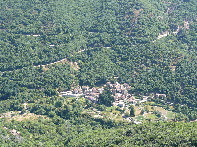
Aulas (Aulas)

- commune in Gard, France
- Country:

- Postal Code: 30120
- Coordinates: 44° 0' 1" N, 3° 35' 11" E


- GPS tracks (wikiloc): [Link]
- Area: 2.91 sq km
- Population: 480
- Wikipedia en: wiki(en)
- Wikipedia: wiki(fr)
- Wikidata storage: Wikidata: Q1060263
- Wikipedia Commons Category: [Link]
- Freebase ID: [/m/02w222m]
- GeoNames ID: Alt: [3036159]
- SIREN number: [213000243]
- BnF ID: [15254665f]
- INSEE municipality code: 30024
Shares border with regions:
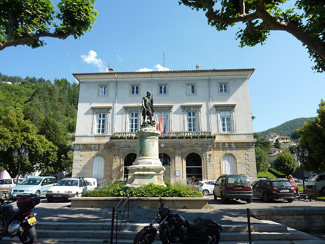

Le Vigan
- commune in Gard, France
- Country:
- Postal Code: 30120
- Coordinates: 43° 59' 32" N, 3° 36' 20" E
- GPS tracks (wikiloc): [Link]
- AboveSeaLevel: 231 м m
- Area: 17.24 sq km
- Population: 3896
- Web site: [Link]

Arphy
- commune in Gard, France
- Country:
- Postal Code: 30120
- Coordinates: 44° 1' 7" N, 3° 35' 49" E
- GPS tracks (wikiloc): [Link]
- Area: 20.92 sq km
- Population: 174


Avèze
- commune in Gard, France
- Country:
- Postal Code: 30120
- Coordinates: 43° 58' 17" N, 3° 36' 1" E
- GPS tracks (wikiloc): [Link]
- Area: 4.14 sq km
- Population: 1079


Mandagout
- commune in Gard, France
- Country:
- Postal Code: 30120
- Coordinates: 44° 1' 15" N, 3° 37' 31" E
- GPS tracks (wikiloc): [Link]
- Area: 15.12 sq km
- Population: 399
Bréau-et-Salagosse
- commune in Gard, France
- Country:
- Postal Code: 30120
- Coordinates: 43° 59' 23" N, 3° 34' 15" E
- GPS tracks (wikiloc): [Link]
- Area: 24.69 sq km
- Population: 417