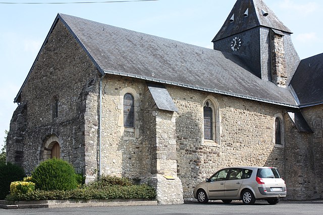
Auvers-sous-Montfaucon (Auvers-sous-Montfaucon)

- commune in Sarthe, France
- Country:

- Postal Code: 72540
- Coordinates: 48° 0' 22" N, 0° 4' 14" E


- GPS tracks (wikiloc): [Link]
- Area: 7.49 sq km
- Population: 247
- Web site: https://lapagelocale.com/72540-auvers-sous-montfaucon
- Wikipedia en: wiki(en)
- Wikipedia: wiki(fr)
- Wikidata storage: Wikidata: Q641410
- Wikipedia Commons Category: [Link]
- Freebase ID: [/m/03qh_t0]
- GeoNames ID: Alt: [6450907]
- SIREN number: [217200179]
- BnF ID: [152735760]
- INSEE municipality code: 72017
Shares border with regions:
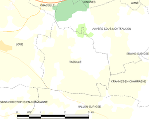
Tassillé
- commune in Sarthe, France
- Country:
- Postal Code: 72540
- Coordinates: 47° 59' 34" N, 0° 5' 36" E
- GPS tracks (wikiloc): [Link]
- Area: 6.46 sq km
- Population: 143
- Web site: [Link]


Amné
- commune in Sarthe, France
- Country:
- Postal Code: 72540
- Coordinates: 48° 2' 24" N, 0° 3' 33" E
- GPS tracks (wikiloc): [Link]
- Area: 15.95 sq km
- Population: 552
- Web site: [Link]


Longnes
- commune in Sarthe, France
- Country:
- Postal Code: 72540
- Coordinates: 48° 1' 13" N, 0° 4' 47" E
- GPS tracks (wikiloc): [Link]
- Area: 6.4 sq km
- Population: 336


Loué
- commune in Sarthe, France
- Country:
- Postal Code: 72540
- Coordinates: 47° 59' 44" N, 0° 9' 12" E
- GPS tracks (wikiloc): [Link]
- Area: 15.85 sq km
- Population: 2231
- Web site: [Link]


Brains-sur-Gée
- commune in Sarthe, France
- Country:
- Postal Code: 72550
- Coordinates: 48° 0' 58" N, 0° 1' 34" E
- GPS tracks (wikiloc): [Link]
- Area: 15.9 sq km
- Population: 805


Chassillé
- commune in Sarthe, France
- Country:
- Postal Code: 72540
- Coordinates: 48° 1' 14" N, 0° 6' 58" E
- GPS tracks (wikiloc): [Link]
- Area: 7.27 sq km
- Population: 246


Crannes-en-Champagne
- commune in Sarthe, France
- Country:
- Postal Code: 72540
- Coordinates: 47° 58' 51" N, 0° 3' 7" E
- GPS tracks (wikiloc): [Link]
- Area: 11.97 sq km
- Population: 352