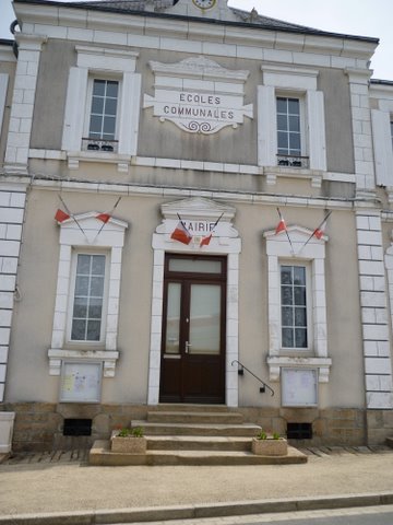
Azerables (Azerables)

- commune in Creuse, France
- Country:

- Postal Code: 23160
- Coordinates: 46° 21' 14" N, 1° 28' 37" E


- GPS tracks (wikiloc): [Link]
- Area: 39.44 sq km
- Population: 826
- Web site: http://www.azerables-mairie.fr
- Wikipedia en: wiki(en)
- Wikipedia: wiki(fr)
- Wikidata storage: Wikidata: Q1080843
- Wikipedia Commons Category: [Link]
- Freebase ID: [/m/03mfhjm]
- Freebase ID: [/m/03mfhjm]
- GeoNames ID: Alt: [6447687]
- GeoNames ID: Alt: [6447687]
- SIREN number: [212301501]
- SIREN number: [212301501]
- BnF ID: [15251403m]
- BnF ID: [15251403m]
- VIAF ID: Alt: [247847293]
- VIAF ID: Alt: [247847293]
- PACTOLS thesaurus ID: [pcrtpf3fDaft1l]
- PACTOLS thesaurus ID: [pcrtpf3fDaft1l]
- INSEE municipality code: 23015
- INSEE municipality code: 23015
Shares border with regions:

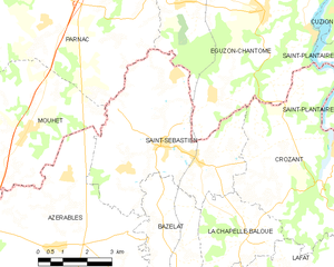
Saint-Sébastien
- commune in Creuse, France
- Country:
- Postal Code: 23160
- Coordinates: 46° 23' 28" N, 1° 31' 53" E
- GPS tracks (wikiloc): [Link]
- Area: 24.98 sq km
- Population: 657

Saint-Sulpice-les-Feuilles
- commune in Haute-Vienne, France
- Country:
- Postal Code: 87160
- Coordinates: 46° 19' 9" N, 1° 22' 5" E
- GPS tracks (wikiloc): [Link]
- Area: 35.63 sq km
- Population: 1252

Mouhet
- commune in Indre, France
- Country:
- Postal Code: 36170
- Coordinates: 46° 22' 59" N, 1° 26' 0" E
- GPS tracks (wikiloc): [Link]
- Area: 32.26 sq km
- Population: 479


Les Grands-Chézeaux
- commune in Haute-Vienne, France
- Country:
- Postal Code: 87160
- Coordinates: 46° 21' 8" N, 1° 23' 36" E
- GPS tracks (wikiloc): [Link]
- Area: 13.51 sq km
- Population: 246

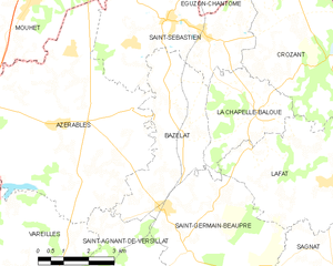
Bazelat
- commune in Creuse, France
- Country:
- Postal Code: 23160
- Coordinates: 46° 21' 8" N, 1° 32' 18" E
- GPS tracks (wikiloc): [Link]
- Area: 13.43 sq km
- Population: 274


Vareilles
- commune in Creuse, France
- Country:
- Postal Code: 23300
- Coordinates: 46° 18' 1" N, 1° 28' 38" E
- GPS tracks (wikiloc): [Link]
- Area: 17.68 sq km
- Population: 312


Saint-Agnant-de-Versillat
- commune in Creuse, France
- Country:
- Postal Code: 23300
- Coordinates: 46° 16' 44" N, 1° 30' 40" E
- GPS tracks (wikiloc): [Link]
- Area: 50.46 sq km
- Population: 1104