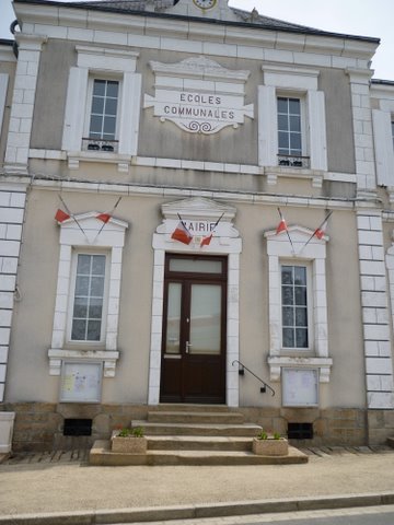
Saint-Sébastien (Saint-Sébastien)

- commune in Creuse, France
- Country:

- Postal Code: 23160
- Coordinates: 46° 23' 28" N, 1° 31' 53" E


- GPS tracks (wikiloc): [Link]
- Area: 24.98 sq km
- Population: 657
- Wikipedia en: wiki(en)
- Wikipedia: wiki(fr)
- Wikidata storage: Wikidata: Q1011170
- Wikipedia Commons Category: [Link]
- Freebase ID: [/m/03mfl11]
- Freebase ID: [/m/03mfl11]
- GeoNames ID: Alt: [6612357]
- GeoNames ID: Alt: [6612357]
- SIREN number: [212323901]
- SIREN number: [212323901]
- BnF ID: [15251626t]
- BnF ID: [15251626t]
- INSEE municipality code: 23239
- INSEE municipality code: 23239
Shares border with regions:


La Chapelle-Baloue
- commune in Creuse, France
- Country:
- Postal Code: 23160
- Coordinates: 46° 21' 35" N, 1° 34' 36" E
- GPS tracks (wikiloc): [Link]
- Area: 8.68 sq km
- Population: 135


Azerables
- commune in Creuse, France
- Country:
- Postal Code: 23160
- Coordinates: 46° 21' 14" N, 1° 28' 37" E
- GPS tracks (wikiloc): [Link]
- Area: 39.44 sq km
- Population: 826
- Web site: [Link]


Parnac
- commune in Indre, France
- Country:
- Postal Code: 36170
- Coordinates: 46° 27' 12" N, 1° 26' 32" E
- GPS tracks (wikiloc): [Link]
- Area: 46.75 sq km
- Population: 508
- Web site: [Link]

Mouhet
- commune in Indre, France
- Country:
- Postal Code: 36170
- Coordinates: 46° 22' 59" N, 1° 26' 0" E
- GPS tracks (wikiloc): [Link]
- Area: 32.26 sq km
- Population: 479

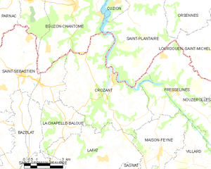
Crozant
- commune in Creuse, France
- Country:
- Postal Code: 23160
- Coordinates: 46° 23' 30" N, 1° 37' 16" E
- GPS tracks (wikiloc): [Link]
- Area: 30.52 sq km
- Population: 459

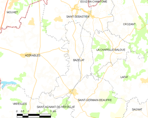
Bazelat
- commune in Creuse, France
- Country:
- Postal Code: 23160
- Coordinates: 46° 21' 8" N, 1° 32' 18" E
- GPS tracks (wikiloc): [Link]
- Area: 13.43 sq km
- Population: 274


Éguzon-Chantôme
- commune in Indre, France
- Country:
- Postal Code: 36270
- Coordinates: 46° 26' 32" N, 1° 34' 57" E
- GPS tracks (wikiloc): [Link]
- Area: 36.44 sq km
- Population: 1375