Bazelat (Bazelat)

- commune in Creuse, France
- Country:

- Postal Code: 23160
- Coordinates: 46° 21' 8" N, 1° 32' 18" E


- GPS tracks (wikiloc): [Link]
- Area: 13.43 sq km
- Population: 274
- Wikipedia en: wiki(en)
- Wikipedia: wiki(fr)
- Wikidata storage: Wikidata: Q200336
- Wikipedia Commons Category: [Link]
- Freebase ID: [/m/03mfhkn]
- Freebase ID: [/m/03mfhkn]
- GeoNames ID: Alt: [6447689]
- GeoNames ID: Alt: [6447689]
- SIREN number: [212301808]
- SIREN number: [212301808]
- BnF ID: [15251406n]
- BnF ID: [15251406n]
- PACTOLS thesaurus ID: [pcrtIj6p68uGhH]
- PACTOLS thesaurus ID: [pcrtIj6p68uGhH]
- INSEE municipality code: 23018
- INSEE municipality code: 23018
Shares border with regions:

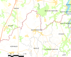
Saint-Sébastien
- commune in Creuse, France
- Country:
- Postal Code: 23160
- Coordinates: 46° 23' 28" N, 1° 31' 53" E
- GPS tracks (wikiloc): [Link]
- Area: 24.98 sq km
- Population: 657


La Chapelle-Baloue
- commune in Creuse, France
- Country:
- Postal Code: 23160
- Coordinates: 46° 21' 35" N, 1° 34' 36" E
- GPS tracks (wikiloc): [Link]
- Area: 8.68 sq km
- Population: 135


Azerables
- commune in Creuse, France
- Country:
- Postal Code: 23160
- Coordinates: 46° 21' 14" N, 1° 28' 37" E
- GPS tracks (wikiloc): [Link]
- Area: 39.44 sq km
- Population: 826
- Web site: [Link]


Saint-Germain-Beaupré
- commune in Creuse, France
- Country:
- Postal Code: 23160
- Coordinates: 46° 18' 28" N, 1° 32' 42" E
- GPS tracks (wikiloc): [Link]
- Area: 17.06 sq km
- Population: 440
Lafat
- commune in Creuse, France
- Country:
- Postal Code: 23800
- Coordinates: 46° 20' 5" N, 1° 36' 50" E
- GPS tracks (wikiloc): [Link]
- Area: 21.28 sq km
- Population: 362


Saint-Agnant-de-Versillat
- commune in Creuse, France
- Country:
- Postal Code: 23300
- Coordinates: 46° 16' 44" N, 1° 30' 40" E
- GPS tracks (wikiloc): [Link]
- Area: 50.46 sq km
- Population: 1104