Windhaag bei Perg (Windhaag bei Perg)
- municipality in Austria
Windhaag bei Perg is a beautiful area in Austria that offers various hiking opportunities, ideal for outdoor enthusiasts. Nestled in the region of Upper Austria, this scenic locality is characterized by its rolling hills, forests, and charming landscapes.
Hiking Features:
-
Scenic Trails: The region offers a network of well-marked trails ranging in difficulty from easy to moderate, catering to both novice and experienced hikers. You'll find paths that wind through lush forests, along rivers, and over gentle hills.
-
Natural Beauty: Expect to see stunning views of the surrounding countryside, especially in spring and autumn when the foliage is vibrant. Wildlife is also abundant here, making it a great spot for nature lovers.
-
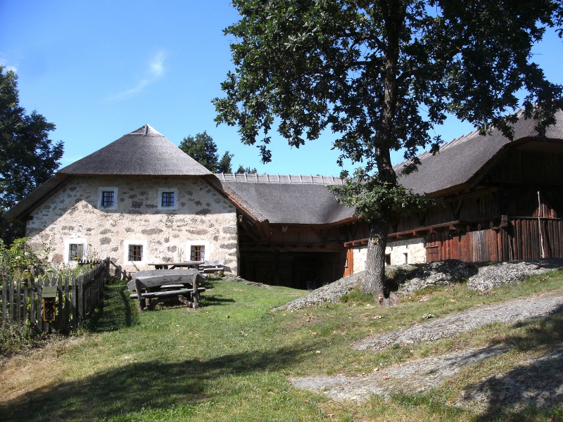
Cultural Experiences: Along the trails, you can find historical sites, traditional farmhouses, and local fauna and flora, contributing to a rich hiking experience that combines nature and culture.
-
Accessibility: Windhaag bei Perg is relatively accessible from larger towns and cities in Upper Austria, making it an attractive option for a day hike or a weekend getaway.
-
Local Tips: It's always a good idea to check local weather conditions before heading out, as they can change rapidly. Make sure to wear appropriate hiking gear, bring enough water and snacks, and consider using hiking maps or apps for navigation.
Whether you’re looking for a peaceful day in nature or an invigorating hike, Windhaag bei Perg provides various options to explore the stunning natural landscapes of Upper Austria. Enjoy your hike!
- Country:

- Postal Code: 4322
- Local Dialing Code: 07264
- Licence Plate Code: PE
- Coordinates: 48° 17' 0" N, 14° 40' 49" E


- GPS tracks (wikiloc): [Link]
- AboveSeaLevel: 514 м m
- Area: 19.18 sq km
- Population: 1508
- Web site: http://www.windhaag-perg.at/
- Wikipedia en: wiki(en)
- Wikipedia: wiki(de)
- Wikidata storage: Wikidata: Q679371
- Wikipedia Commons Category: [Link]
- Freebase ID: [/m/03gv7s_]
- GeoNames ID: Alt: [7873177]
- Austrian municipality key: [41126]
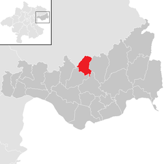
Shares border with regions:

Perg
- municipality in Austria
Hiking in Perg, Austria, is a delightful experience, offering a variety of trails that cater to different skill levels and interests. The region is characterized by its beautiful landscapes, including rolling hills, forests, and scenic vistas overlooking the Danube River....
- Country:

- Postal Code: 4320
- Local Dialing Code: 07262
- Licence Plate Code: PE
- Coordinates: 48° 15' 1" N, 14° 38' 1" E


- GPS tracks (wikiloc): [Link]
- AboveSeaLevel: 250 м m
- Area: 26.44 sq km
- Population: 8388
- Web site: [Link]


Rechberg
- municipality in Austria
Rechberg is a beautiful hiking destination located in the Styria region of Austria. Known for its stunning landscapes, scenic views, and tranquil atmosphere, it offers various hiking trails suitable for different skill levels....
- Country:

- Postal Code: 4324
- Local Dialing Code: 07264
- Licence Plate Code: PE
- Coordinates: 48° 19' 19" N, 14° 42' 44" E


- GPS tracks (wikiloc): [Link]
- AboveSeaLevel: 576 м m
- Area: 13.8 sq km
- Population: 996
- Web site: [Link]

Allerheiligen im Mühlkreis
- municipality in Austria
 Hiking in Allerheiligen im Mühlkreis
Allerheiligen im Mühlkreis is a charming village located in Upper Austria, surrounded by lush landscapes and offering a range of hiking opportunities. Here are some aspects to consider if you're planning to hike in this area:...
- Country:

- Postal Code: 4320
- Local Dialing Code: 07262
- Licence Plate Code: PE
- Coordinates: 48° 18' 1" N, 14° 38' 1" E


- GPS tracks (wikiloc): [Link]
- AboveSeaLevel: 568 м m
- Area: 20.2 sq km
- Population: 1261
- Web site: [Link]

Münzbach
- municipality in Austria
Münzbach, a picturesque village in Austria, offers a wonderful environment for hiking enthusiasts. Nestled in the foothills of the Alps, the region presents a range of trails that cater to various skill levels, from leisurely strolls to more challenging hikes....
- Country:

- Postal Code: 4323
- Local Dialing Code: 07264
- Licence Plate Code: PE
- Coordinates: 48° 16' 1" N, 14° 42' 56" E


- GPS tracks (wikiloc): [Link]
- AboveSeaLevel: 421 м m
- Area: 24.89 sq km
- Population: 1814
- Web site: [Link]

Bad Zell
- municipality in Austria
Bad Zell, located in the beautiful region of Upper Austria, offers a range of hiking opportunities for nature enthusiasts and adventure seekers. The area is characterized by its picturesque landscapes, lush forests, and rolling hills, making it a great destination for hikers of all skill levels....
- Country:

- Postal Code: 4283
- Local Dialing Code: 07263
- Licence Plate Code: FR
- Coordinates: 48° 21' 0" N, 14° 40' 0" E


- GPS tracks (wikiloc): [Link]
- AboveSeaLevel: 515 м m
- Area: 45.5 sq km
- Population: 2868
- Web site: [Link]