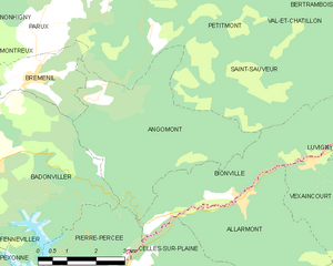
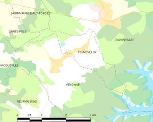
Badonviller (Badonviller)
- commune in Meurthe-et-Moselle, France
- Country:

- Postal Code: 54540
- Coordinates: 48° 30' 0" N, 6° 53' 35" E


- GPS tracks (wikiloc): [Link]
- Area: 21.95 sq km
- Population: 1557
- Web site: http://www.ville-badonviller.fr/
- Wikipedia en: wiki(en)
- Wikipedia: wiki(fr)
- Wikidata storage: Wikidata: Q501953
- Wikipedia Commons Category: [Link]
- Freebase ID: [/m/0b9kt0]
- Freebase ID: [/m/0b9kt0]
- GeoNames ID: Alt: [3035449]
- GeoNames ID: Alt: [3035449]
- SIREN number: [215400409]
- SIREN number: [215400409]
- BnF ID: [15264109s]
- BnF ID: [15264109s]
- VIAF ID: Alt: [243218432]
- VIAF ID: Alt: [243218432]
- INSEE municipality code: 54040
- INSEE municipality code: 54040
Shares border with regions:


Pexonne
- commune in Meurthe-et-Moselle, France
- Country:

- Postal Code: 54540
- Coordinates: 48° 29' 0" N, 6° 51' 57" E


- GPS tracks (wikiloc): [Link]
- Area: 13.43 sq km
- Population: 373


Pierre-Percée
- commune in Meurthe-et-Moselle, France
- Country:

- Postal Code: 54540
- Coordinates: 48° 28' 7" N, 6° 55' 57" E


- GPS tracks (wikiloc): [Link]
- Area: 9.93 sq km
- Population: 92


Montreux
- commune in Meurthe-et-Moselle, France
- Country:

- Postal Code: 54450
- Coordinates: 48° 32' 9" N, 6° 52' 56" E


- GPS tracks (wikiloc): [Link]
- Area: 3.69 sq km
- Population: 63


Angomont
- commune in Meurthe-et-Moselle, France
- Country:

- Postal Code: 54540
- Coordinates: 48° 30' 58" N, 6° 56' 48" E


- GPS tracks (wikiloc): [Link]
- Area: 17.28 sq km
- Population: 81


Neuviller-lès-Badonviller
- commune in Meurthe-et-Moselle, France
- Country:

- Postal Code: 54540
- Coordinates: 48° 31' 3" N, 6° 52' 26" E


- GPS tracks (wikiloc): [Link]
- Area: 5.75 sq km
- Population: 91


Saint-Maurice-aux-Forges
- commune in Meurthe-et-Moselle, France
- Country:

- Postal Code: 54540
- Coordinates: 48° 30' 37" N, 6° 50' 51" E


- GPS tracks (wikiloc): [Link]
- Area: 3.3 sq km
- Population: 106


Fenneviller
- commune in Meurthe-et-Moselle, France
- Country:

- Postal Code: 54540
- Coordinates: 48° 29' 14" N, 6° 52' 53" E


- GPS tracks (wikiloc): [Link]
- Area: 2.99 sq km
- Population: 92


Ancerviller
- commune in Meurthe-et-Moselle, France
- Country:

- Postal Code: 54450
- Coordinates: 48° 31' 56" N, 6° 50' 6" E


- GPS tracks (wikiloc): [Link]
- Area: 12.34 sq km
- Population: 273


Bréménil
- commune in Meurthe-et-Moselle, France
- Country:

- Postal Code: 54540
- Coordinates: 48° 31' 24" N, 6° 55' 7" E


- GPS tracks (wikiloc): [Link]
- Area: 5.6 sq km
- Population: 110
