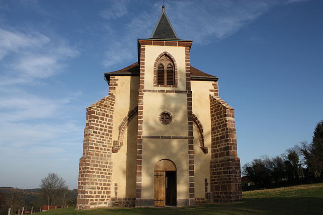
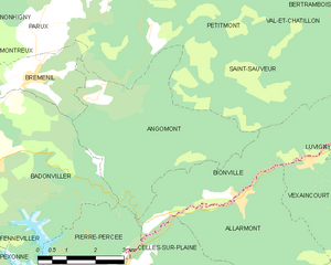
Angomont (Angomont)
- commune in Meurthe-et-Moselle, France
- Country:

- Postal Code: 54540
- Coordinates: 48° 30' 58" N, 6° 56' 48" E


- GPS tracks (wikiloc): [Link]
- Area: 17.28 sq km
- Population: 81
- Wikipedia en: wiki(en)
- Wikipedia: wiki(fr)
- Wikidata storage: Wikidata: Q193720
- Wikipedia Commons Category: [Link]
- Freebase ID: [/m/03hlfcw]
- Freebase ID: [/m/03hlfcw]
- GeoNames ID: Alt: [6449687]
- GeoNames ID: Alt: [6449687]
- SIREN number: [215400177]
- SIREN number: [215400177]
- BnF ID: [15264086z]
- BnF ID: [15264086z]
- VIAF ID: Alt: [238166596]
- VIAF ID: Alt: [238166596]
- INSEE municipality code: 54017
- INSEE municipality code: 54017
Shares border with regions:


Pierre-Percée
- commune in Meurthe-et-Moselle, France
- Country:

- Postal Code: 54540
- Coordinates: 48° 28' 7" N, 6° 55' 57" E


- GPS tracks (wikiloc): [Link]
- Area: 9.93 sq km
- Population: 92


Saint-Sauveur
- commune in Meurthe-et-Moselle, France
- Country:

- Postal Code: 54480
- Coordinates: 48° 32' 2" N, 6° 58' 25" E


- GPS tracks (wikiloc): [Link]
- Area: 19.16 sq km
- Population: 52


Badonviller
- commune in Meurthe-et-Moselle, France
- Country:

- Postal Code: 54540
- Coordinates: 48° 30' 0" N, 6° 53' 35" E


- GPS tracks (wikiloc): [Link]
- Area: 21.95 sq km
- Population: 1557
- Web site: [Link]


Bionville
- commune in Meurthe-et-Moselle, France
- Country:

- Postal Code: 54540
- Coordinates: 48° 29' 2" N, 7° 0' 39" E


- GPS tracks (wikiloc): [Link]
- Area: 12.14 sq km
- Population: 119


Bréménil
- commune in Meurthe-et-Moselle, France
- Country:

- Postal Code: 54540
- Coordinates: 48° 31' 24" N, 6° 55' 7" E


- GPS tracks (wikiloc): [Link]
- Area: 5.6 sq km
- Population: 110
