Bagnaria Arsa (Bagnaria Arsa)
- Italian comune
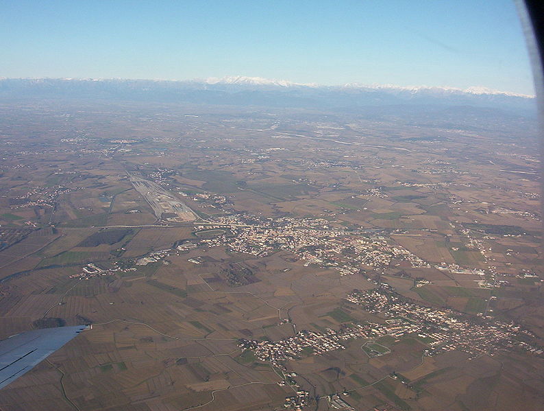
Bagnaria Arsa, located in the Friuli Venezia Giulia region of northeastern Italy, offers a variety of hiking opportunities that showcase the natural beauty of the surrounding landscapes. This area is characterized by its rolling hills, scenic views, and rich cultural heritage.
Highlights of Hiking in Bagnaria Arsa:
-
Scenic Trails: The trails in and around Bagnaria Arsa vary in difficulty, making them suitable for both novice and experienced hikers. You can find routes that take you through vineyards, wooded areas, and along the rivers.
-
Natural Features: The region is home to diverse flora and fauna. As you hike, you may encounter local wildlife, picturesque hillsides, and the peaceful ambiance of nature.
-
Cultural Heritage: The area boasts historical sites and quaint villages, which can make for interesting stops along your hike. Look for local architecture, traditional farming practices, and perhaps even agricultural festivals if you visit during the right season.
-
Proximity to Other Hiking Areas: Bagnaria Arsa is conveniently located near more extensive hiking areas such as the Colli Orientali del Friuli and the Julian Alps. If you're looking to expand your hiking experience, you can easily venture into these neighboring regions.
-
Seasonal Considerations: Spring and fall are particularly beautiful times to hike in the area, with mild weather and vibrant scenery. Summers can be warm, and winters may bring snow to higher elevations, so dress appropriately for the season.
Recommendations:
-
Maps and Guidance: Be sure to carry a reliable map or GPS device, as not all trails may be well-marked. It’s also helpful to check local resources or visitor centers for the latest trail conditions and recommendations.
-
Local Expertise: Consider hiring a local guide or joining a hiking group, especially if you're unfamiliar with the area. This can enhance your experience by providing insights about the trails and local culture.
-
Essential Gear: Proper hiking gear, including sturdy footwear, water, snacks, and weather-appropriate clothing, is essential for a safe and enjoyable hike.
Exploring the trails around Bagnaria Arsa can be a rewarding experience, allowing you to immerse yourself in the natural beauty and rich culture of this charming Italian region.
- Country:

- Postal Code: 33050
- Local Dialing Code: 0432
- Licence Plate Code: UD
- Coordinates: 45° 53' 0" N, 13° 17' 0" E


- GPS tracks (wikiloc): [Link]
- AboveSeaLevel: 20 м m
- Area: 19.23 sq km
- Population: 3483
- Web site: http://www.comune.bagnariaarsa.ud.it
- Wikipedia en: wiki(en)
- Wikipedia: wiki(it)
- Wikidata storage: Wikidata: Q53223
- Wikipedia Commons Category: [Link]
- Freebase ID: [/m/0gk880]
- GeoNames ID: Alt: [6542179]
- VIAF ID: Alt: [235257003]
- OSM relation ID: [79260]
- UN/LOCODE: [ITBAA]
- ISTAT ID: 030008
- Italian cadastre code: A553
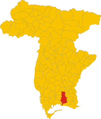
Shares border with regions:


Aiello del Friuli
- Italian comune
Aiello del Friuli, located in the Friuli Venezia Giulia region of northeastern Italy, offers a unique combination of natural beauty and cultural heritage. While it may not be as widely known for hiking as some other areas in the region, there are still opportunities for outdoor enthusiasts to enjoy the scenic landscapes and charm of the surrounding countryside....
- Country:

- Postal Code: 33041
- Local Dialing Code: 0431
- Licence Plate Code: UD
- Coordinates: 45° 52' 0" N, 13° 22' 0" E


- GPS tracks (wikiloc): [Link]
- AboveSeaLevel: 18 м m
- Area: 13.35 sq km
- Population: 2243
- Web site: [Link]


Cervignano del Friuli
- Italian comune
 Hiking in Cervignano del Friuli
Cervignano del Friuli, located in the Friuli Venezia Giulia region of northeastern Italy, offers a range of hiking opportunities characterized by its picturesque landscapes, rich history, and proximity to both natural and cultural attractions....
- Country:

- Postal Code: 33050; 33052
- Local Dialing Code: 0431
- Licence Plate Code: UD
- Coordinates: 45° 49' 23" N, 13° 20' 6" E


- GPS tracks (wikiloc): [Link]
- AboveSeaLevel: 2 м m
- Area: 29.17 sq km
- Population: 13881
- Web site: [Link]
Gonars
- Italian comune
Gonars, a small town in northeastern Italy, is located in the region of Friuli Venezia Giulia. While it may not be a primary destination for hikers compared to more prominent national parks or mountainous areas in Italy, it offers beautiful landscapes and trails for outdoor enthusiasts, particularly for those interested in exploring the countryside and enjoying scenic walks....
- Country:

- Postal Code: 33050
- Local Dialing Code: 0432
- Licence Plate Code: UD
- Coordinates: 45° 54' 0" N, 13° 14' 0" E


- GPS tracks (wikiloc): [Link]
- AboveSeaLevel: 21 м m
- Area: 19.82 sq km
- Population: 4718
- Web site: [Link]


Palmanova
- Italian town and comune in northeastern Italy, in the Province Udine
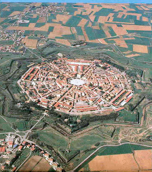
Palmanova, located in the Friuli Venezia Giulia region of Italy, is a unique destination known for its star-shaped fortress design dating back to the 16th century. While it is primarily recognized for its historical significance and architecture, the surrounding area offers several opportunities for hiking and exploring nature....
- Country:

- Postal Code: 33057
- Local Dialing Code: 0432
- Licence Plate Code: UD
- Coordinates: 45° 54' 0" N, 13° 19' 0" E


- GPS tracks (wikiloc): [Link]
- AboveSeaLevel: 27 м m
- Area: 13.3 sq km
- Population: 5419
- Web site: [Link]


Torviscosa
- Italian comune
Torviscosa is a small town located in the Friuli Venezia Giulia region of Italy. While it is not a major hiking destination compared to some other Italian regions, there are still opportunities for outdoor enthusiasts to explore the natural beauty of the area and nearby landscapes....
- Country:

- Postal Code: 33050
- Local Dialing Code: 0431
- Licence Plate Code: UD
- Coordinates: 45° 49' 0" N, 13° 17' 0" E


- GPS tracks (wikiloc): [Link]
- AboveSeaLevel: 3 м m
- Area: 48.62 sq km
- Population: 2829
- Web site: [Link]


Visco, Friuli
- Italian comune
Visco, located in the Friuli-Venezia Giulia region of Italy, is a quaint village offering a beautiful backdrop for hiking enthusiasts. The area is rich in both natural beauty and cultural heritage, making it an excellent destination for hikers of all skill levels....
- Country:

- Postal Code: 33040
- Local Dialing Code: 0432
- Licence Plate Code: UD
- Coordinates: 45° 54' 0" N, 13° 21' 0" E


- GPS tracks (wikiloc): [Link]
- AboveSeaLevel: 27 м m
- Area: 3.52 sq km
- Population: 786
- Web site: [Link]
