Balaiseaux (Balaiseaux)

- commune in Jura, France
- Country:

- Postal Code: 39120
- Coordinates: 46° 58' 34" N, 5° 27' 38" E


- GPS tracks (wikiloc): [Link]
- Area: 6.01 sq km
- Population: 296
- Wikipedia en: wiki(en)
- Wikipedia: wiki(fr)
- Wikidata storage: Wikidata: Q1161660
- Wikipedia Commons Category: [Link]
- Freebase ID: [/m/03mhs62]
- GeoNames ID: Alt: [6448776]
- SIREN number: [213900343]
- BnF ID: [15258399w]
- INSEE municipality code: 39034
Shares border with regions:

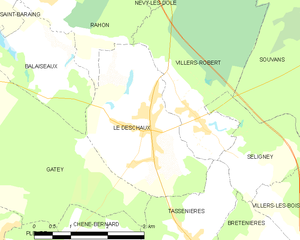
Le Deschaux
- commune in Jura, France
- Country:
- Postal Code: 39120
- Coordinates: 46° 57' 10" N, 5° 30' 7" E
- GPS tracks (wikiloc): [Link]
- Area: 8.56 sq km
- Population: 1023
- Web site: [Link]


Rahon
- commune in Jura, France
- Country:
- Postal Code: 39120
- Coordinates: 46° 59' 13" N, 5° 27' 41" E
- GPS tracks (wikiloc): [Link]
- AboveSeaLevel: 240 м m
- Area: 19.6 sq km
- Population: 508


Gatey
- commune in Jura, France
- Country:
- Postal Code: 39120
- Coordinates: 46° 56' 45" N, 5° 26' 6" E
- GPS tracks (wikiloc): [Link]
- Area: 14.84 sq km
- Population: 380


Saint-Baraing
- commune in Jura, France
- Country:
- Postal Code: 39120
- Coordinates: 46° 58' 53" N, 5° 25' 51" E
- GPS tracks (wikiloc): [Link]
- Area: 6.28 sq km
- Population: 267