Barlieu (Barlieu)

- commune in Cher, France
- Country:

- Postal Code: 18260
- Coordinates: 47° 29' 18" N, 2° 37' 43" E


- GPS tracks (wikiloc): [Link]
- Area: 27.87 sq km
- Population: 382
- Wikipedia en: wiki(en)
- Wikipedia: wiki(fr)
- Wikidata storage: Wikidata: Q1140100
- Wikipedia Commons Category: [Link]
- Freebase ID: [/m/03mfc3r]
- GeoNames ID: Alt: [6447430]
- SIREN number: [211800222]
- BnF ID: [15249368n]
- INSEE municipality code: 18022
Shares border with regions:


Concressault
- commune in Cher, France
- Country:
- Postal Code: 18260
- Coordinates: 47° 29' 22" N, 2° 34' 34" E
- GPS tracks (wikiloc): [Link]
- Area: 7.45 sq km
- Population: 206
Cernoy-en-Berry
- commune in Loiret, France
- Country:
- Postal Code: 45360
- Coordinates: 47° 32' 24" N, 2° 39' 40" E
- GPS tracks (wikiloc): [Link]
- Area: 28.23 sq km
- Population: 459


Pierrefitte-ès-Bois
- commune in Loiret, France
- Country:
- Postal Code: 45360
- Coordinates: 47° 30' 29" N, 2° 43' 1" E
- GPS tracks (wikiloc): [Link]
- Area: 27.18 sq km
- Population: 301
- Web site: [Link]
Vailly-sur-Sauldre
- commune in Cher, France
- Country:
- Postal Code: 18260
- Coordinates: 47° 27' 28" N, 2° 39' 1" E
- GPS tracks (wikiloc): [Link]
- Area: 18.25 sq km
- Population: 673
- Web site: [Link]

Blancafort
- commune in Cher, France
- Country:
- Postal Code: 18410
- Coordinates: 47° 31' 57" N, 2° 31' 50" E
- GPS tracks (wikiloc): [Link]
- Area: 64.35 sq km
- Population: 1064

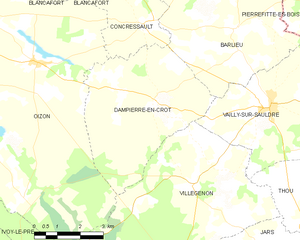
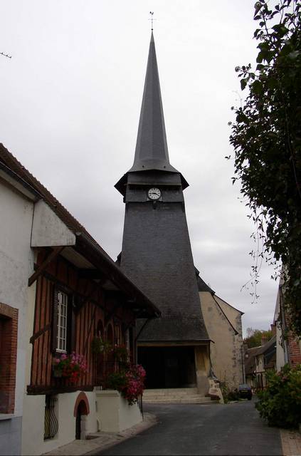
Dampierre-en-Crot
- commune in Cher, France
- Country:
- Postal Code: 18260
- Coordinates: 47° 27' 38" N, 2° 34' 58" E
- GPS tracks (wikiloc): [Link]
- Area: 22.05 sq km
- Population: 205