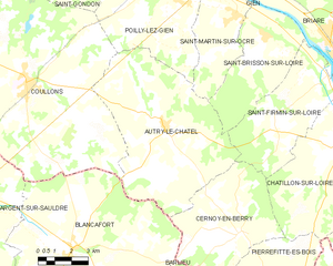
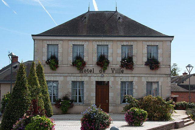
Blancafort (Blancafort)

- commune in Cher, France
- Country:

- Postal Code: 18410
- Coordinates: 47° 31' 57" N, 2° 31' 50" E


- GPS tracks (wikiloc): [Link]
- Area: 64.35 sq km
- Population: 1064
- Wikipedia en: wiki(en)
- Wikipedia: wiki(fr)
- Wikidata storage: Wikidata: Q665786
- Wikipedia Commons Category: [Link]
- Freebase ID: [/m/03mfc7n]
- GeoNames ID: Alt: [6447436]
- SIREN number: [211800305]
- BnF ID: [152493768]
- VIAF ID: Alt: [238430206]
- INSEE municipality code: 18030
Shares border with regions:
Barlieu
- commune in Cher, France
- Country:
- Postal Code: 18260
- Coordinates: 47° 29' 18" N, 2° 37' 43" E
- GPS tracks (wikiloc): [Link]
- Area: 27.87 sq km
- Population: 382


Concressault
- commune in Cher, France
- Country:
- Postal Code: 18260
- Coordinates: 47° 29' 22" N, 2° 34' 34" E
- GPS tracks (wikiloc): [Link]
- Area: 7.45 sq km
- Population: 206
Cernoy-en-Berry
- commune in Loiret, France
- Country:
- Postal Code: 45360
- Coordinates: 47° 32' 24" N, 2° 39' 40" E
- GPS tracks (wikiloc): [Link]
- Area: 28.23 sq km
- Population: 459

Autry-le-Châtel
- commune in Loiret, France
- Country:
- Postal Code: 45500
- Coordinates: 47° 35' 51" N, 2° 36' 8" E
- GPS tracks (wikiloc): [Link]
- AboveSeaLevel: 185 м m
- Area: 50.56 sq km
- Population: 973


Oizon
- commune in Cher, France
- Country:
- Postal Code: 18700
- Coordinates: 47° 28' 27" N, 2° 30' 55" E
- GPS tracks (wikiloc): [Link]
- Area: 62.03 sq km
- Population: 687

Coullons
- commune in Loiret, France
- Country:
- Postal Code: 45720
- Coordinates: 47° 37' 14" N, 2° 29' 33" E
- GPS tracks (wikiloc): [Link]
- Area: 78.97 sq km
- Population: 2489
- Web site: [Link]


Aubigny-sur-Nère
- commune in Cher, France
- Country:
- Postal Code: 18700
- Coordinates: 47° 29' 19" N, 2° 26' 21" E
- GPS tracks (wikiloc): [Link]
- Area: 61.53 sq km
- Population: 5539
- Web site: [Link]


Argent-sur-Sauldre
- commune in Cher, France
- Country:
- Postal Code: 18410
- Coordinates: 47° 33' 24" N, 2° 26' 35" E
- GPS tracks (wikiloc): [Link]
- Area: 67.35 sq km
- Population: 2142
- Web site: [Link]