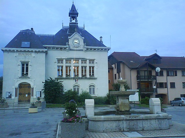
Barraux (Barraux)

- commune in Isère, France
 Hiking in Barraux
Barraux, a charming village located near Grenoble in the Isère department of France, offers several hiking opportunities that are suitable for different skill levels. The area is characterized by its beautiful natural scenery, including the nearby Chartreuse Mountains, which provide a stunning backdrop for outdoor activities.
Hiking Trails in Barraux
-
Sentier des Lavandes: This is a moderate trail that showcases the local lavender fields and offers panoramic views of the surrounding mountains. It’s a great option for a leisurely hike, especially in late spring or summer when the lavender is in bloom.
-
Les crêtes de la Chartreuse: A more challenging hike that takes you along the ridge of the Chartreuse Mountains. This trail offers breathtaking views and can be rewarding for experienced hikers looking for a longer trek.
-
Sentier de la Combe à la Chèvre: This is a shorter, family-friendly trail that’s perfect for beginners. It leads through forests and open meadows, making it a lovely option for a relaxing hike.
Preparation and Tips
- Footwear: Wear sturdy hiking boots to handle varying terrain.
- Water and Snacks: Carry enough water and some snacks to keep your energy up during your hikes.
- Maps and Guides: Make sure to have a detailed map or a hiking app downloaded for navigation, as some trails may not be well-marked.
- Weather: Check the weather forecast before heading out, as conditions can change rapidly in the mountains.
- Local Regulations: Be respectful of the natural environment. Stay on designated trails and follow any local guidelines.
Nearby Attractions
When you’re not hiking, you might want to explore the village of Barraux itself, with its historical architecture and small cafes, or venture into nearby towns like Grenoble or Chambery to experience more local culture.
Overall, hiking in Barraux offers a mix of beautiful landscapes, well-maintained trails, and opportunities to experience the unique flora and fauna of the region. Whether you’re a seasoned hiker or a beginner, there’s something for everyone in this picturesque part of France.
- Country:

- Postal Code: 38530
- Coordinates: 45° 26' 4" N, 5° 58' 40" E


- GPS tracks (wikiloc): [Link]
- Area: 11.13 sq km
- Population: 1876
- Web site: http://www.mairie-barraux.fr
- Wikipedia en: wiki(en)
- Wikipedia: wiki(fr)
- Wikidata storage: Wikidata: Q385282
- Wikipedia Commons Category: [Link]
- Freebase ID: [/m/0dyxfb]
- GeoNames ID: Alt: [6448722]
- SIREN number: [213800279]
- BnF ID: [15257856r]
- VIAF ID: Alt: [248741462]
- INSEE municipality code: 38027
Shares border with regions:

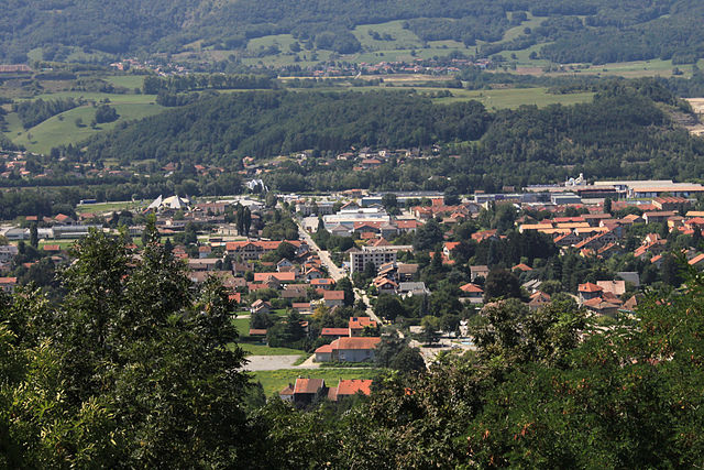
Chapareillan
- commune in Isère, France
Hiking in Chapareillan
Chapareillan is a charming commune located in the Auvergne-Rhône-Alpes region of France, known for its stunning natural landscapes and outdoor activities, including hiking. The area offers a variety of hiking trails suitable for different skill levels, making it a great destination for both beginners and experienced hikers....
- Country:
- Postal Code: 38530
- Coordinates: 45° 27' 46" N, 5° 59' 28" E
- GPS tracks (wikiloc): [Link]
- Area: 30.28 sq km
- Population: 2950
- Web site: [Link]


La Flachère
- commune in Isère, France
Hiking in La Flachère
La Flachère is a beautiful area located in the French Alps, specifically within the Savoie region. This region is renowned for its stunning landscapes, mountainous terrain, and diverse trails suitable for hikers of all skill levels....
- Country:
- Postal Code: 38530
- Coordinates: 45° 23' 55" N, 5° 57' 47" E
- GPS tracks (wikiloc): [Link]
- Area: 2.85 sq km
- Population: 479
- Web site: [Link]

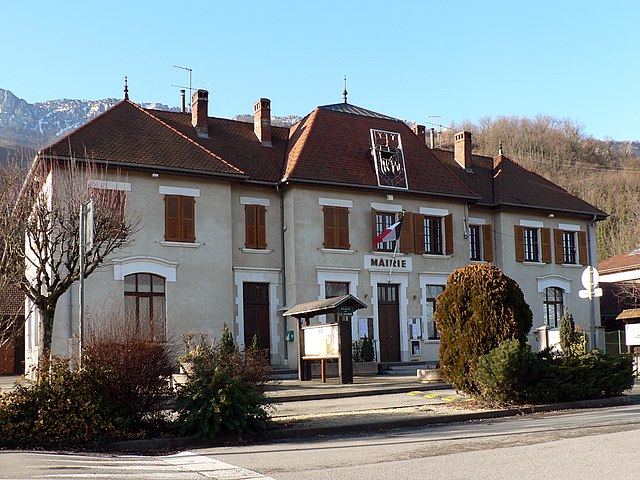
Pontcharra
- commune in Isère, France
Hiking in Pontcharra
Pontcharra is a charming town located in the Auvergne-Rhône-Alpes region of France, nestled in the Isère department. It offers great opportunities for hiking, surrounded by beautiful natural landscapes, including the Chartreuse and Belledonne mountain ranges. Here’s an overview of what you can expect when hiking in and around Pontcharra:...
- Country:
- Postal Code: 38530
- Coordinates: 45° 25' 59" N, 6° 0' 55" E
- GPS tracks (wikiloc): [Link]
- Area: 15.58 sq km
- Population: 7258
- Web site: [Link]

La Buissière
- commune in Isère, France
Hiking in La Buissière
La Buissière is a charming village located in France, often characterized by its scenic landscapes and proximity to nature, making it an excellent location for hiking enthusiasts. While the specific trails in La Buissière may not be widely documented, the surrounding regions typically offer various outdoor activities, including hiking paths that range from easy strolls to more challenging treks....
- Country:
- Postal Code: 38530
- Coordinates: 45° 24' 9" N, 5° 58' 42" E
- GPS tracks (wikiloc): [Link]
- Area: 7.71 sq km
- Population: 672
- Web site: [Link]


Sainte-Marie-du-Mont
- commune in Isère, France
Hiking in Sainte-Marie-du-Mont
Sainte-Marie-du-Mont is a charming village located in the Isère department of the Auvergne-Rhône-Alpes region in southeastern France. This area is known for its stunning natural landscapes and variety of outdoor activities, making it a great destination for hiking enthusiasts....
- Country:
- Postal Code: 38660
- Coordinates: 45° 24' 22" N, 5° 56' 44" E
- GPS tracks (wikiloc): [Link]
- Area: 23.87 sq km
- Population: 237
- Web site: [Link]