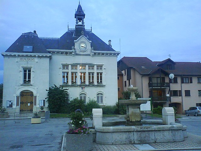
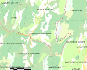
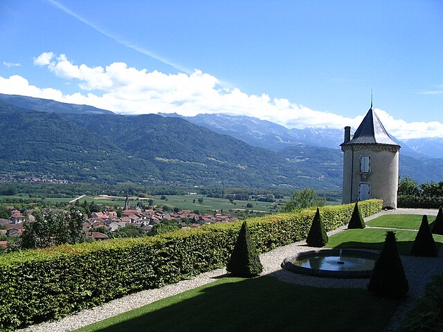
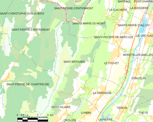
Sainte-Marie-du-Mont (Sainte-Marie-du-Mont)
- commune in Isère, France
 Hiking in Sainte-Marie-du-Mont
Sainte-Marie-du-Mont is a charming village located in the Isère department of the Auvergne-Rhône-Alpes region in southeastern France. This area is known for its stunning natural landscapes and variety of outdoor activities, making it a great destination for hiking enthusiasts.
Hiking Opportunities:
-
Scenic Trails: The region around Sainte-Marie-du-Mont features numerous well-marked hiking trails that range in difficulty, catering to both novice and experienced hikers. You can explore lush forests, meadows, and enjoy panoramic views of the surrounding mountains.
-
Mont Aiguille: One of the notable peaks in the area is Mont Aiguille, often referred to as the "Aiguille of the Vercors." There are trails leading up to viewpoints where you can admire the mountain’s distinctive shape.
-
Vercors Regional Natural Park: Just a short distance away is the Vercors Regional Natural Park, which offers an expansive network of trails, including more challenging hikes that lead to remarkable geological formations, caves, and breathtaking views.
-
Wildlife Watching: The diverse ecosystems in and around Sainte-Marie-du-Mont provide opportunities for wildlife spotting. Keep an eye out for local fauna, including deer, chamois, and a variety of bird species.
-
Guided Tours: If you prefer guided hikes, there are local organizations that offer guided tours, which can enhance your experience by providing insights into the flora, fauna, and history of the region.
Tips for Hiking in the Area:
- Check the Weather: Mountain weather can be unpredictable, so always check the forecast before heading out and be prepared for changes.
- Pack Proper Gear: Make sure to wear comfortable hiking boots, carry plenty of water, snacks, a map or GPS, and a first-aid kit.
- Know Your Limits: Be conscious of your fitness level and choose trails that match your abilities, especially if hiking with a group.
- Leave No Trace: Practice Leave No Trace principles to minimize your impact on the natural environment.
Best Time to Hike:
The best hiking seasons in this region are typically spring (April to June) and early autumn (September to October), when the weather is generally mild, and the scenery is at its most beautiful with wildflowers and fall foliage.
Overall, Sainte-Marie-du-Mont offers a perfect blend of natural beauty and outdoor adventure for hiking lovers!
- Country:

- Postal Code: 38660
- Coordinates: 45° 24' 22" N, 5° 56' 44" E


- GPS tracks (wikiloc): [Link]
- Area: 23.87 sq km
- Population: 237
- Web site: http://village-sainte-marie-du-mont.fr
- Wikipedia en: wiki(en)
- Wikipedia: wiki(fr)
- Wikidata storage: Wikidata: Q782943
- Wikipedia Commons Category: [Link]
- Freebase ID: [/m/03nvh9_]
- GeoNames ID: Alt: [6433365]
- SIREN number: [213804180]
- BnF ID: [15258227r]
- VIAF ID: Alt: [130020267]
- PACTOLS thesaurus ID: [pcrtFoyl9rnvjk]
- INSEE municipality code: 38418
Shares border with regions:


Chapareillan
- commune in Isère, France
Chapareillan is a charming commune located in the Auvergne-Rhône-Alpes region of France, known for its stunning natural landscapes and outdoor activities, including hiking. The area offers a variety of hiking trails suitable for different skill levels, making it a great destination for both beginners and experienced hikers....
- Country:

- Postal Code: 38530
- Coordinates: 45° 27' 46" N, 5° 59' 28" E


- GPS tracks (wikiloc): [Link]
- Area: 30.28 sq km
- Population: 2950
- Web site: [Link]


La Flachère
- commune in Isère, France
La Flachère is a beautiful area located in the French Alps, specifically within the Savoie region. This region is renowned for its stunning landscapes, mountainous terrain, and diverse trails suitable for hikers of all skill levels....
- Country:

- Postal Code: 38530
- Coordinates: 45° 23' 55" N, 5° 57' 47" E


- GPS tracks (wikiloc): [Link]
- Area: 2.85 sq km
- Population: 479
- Web site: [Link]


Saint-Pierre-d'Entremont
- commune in Isère, France
 Hiking in Saint-Pierre-d'Entremont
Saint-Pierre-d'Entremont, located in the Isère department of the Auvergne-Rhône-Alpes region in France, is a picturesque village surrounded by the Chartreuse mountains. It offers a variety of hiking opportunities that cater to different skill levels and preferences. Here are some highlights of hiking in this beautiful area:...
- Country:

- Postal Code: 73670
- Coordinates: 45° 24' 55" N, 5° 51' 14" E


- GPS tracks (wikiloc): [Link]
- Area: 32.31 sq km
- Population: 557
- Web site: [Link]


Saint-Pierre-d'Entremont
- commune in Savoie, France
 Hiking in Saint-Pierre-d'Entremont
Saint-Pierre-d'Entremont, located in the Savoie region of the French Alps, offers a wealth of hiking opportunities amidst stunning natural scenery. The area is nestled between majestic mountains and lush green valleys, making it an ideal destination for nature lovers and outdoor enthusiasts....
- Country:

- Postal Code: 73670
- Coordinates: 45° 25' 2" N, 5° 51' 15" E


- GPS tracks (wikiloc): [Link]
- Area: 18.36 sq km
- Population: 426


Barraux
- commune in Isère, France
Barraux, a charming village located near Grenoble in the Isère department of France, offers several hiking opportunities that are suitable for different skill levels. The area is characterized by its beautiful natural scenery, including the nearby Chartreuse Mountains, which provide a stunning backdrop for outdoor activities....
- Country:

- Postal Code: 38530
- Coordinates: 45° 26' 4" N, 5° 58' 40" E


- GPS tracks (wikiloc): [Link]
- Area: 11.13 sq km
- Population: 1876
- Web site: [Link]


Saint-Vincent-de-Mercuze
- commune in Isère, France
 Hiking in Saint-Vincent-de-Mercuze
Saint-Vincent-de-Mercuze, located in the Isère department of the Auvergne-Rhône-Alpes region in southeastern France, offers a variety of hiking opportunities amidst beautiful natural landscapes. Here are some highlights of hiking in this area:...
- Country:

- Postal Code: 38660
- Coordinates: 45° 22' 27" N, 5° 56' 59" E


- GPS tracks (wikiloc): [Link]
- Area: 7.85 sq km
- Population: 1481
- Web site: [Link]


Entremont-le-Vieux
- commune in Savoie, France
Entremont-le-Vieux is a charming commune located in the Savoie region of the French Alps, known for its stunning natural surroundings and outdoor recreational opportunities, including hiking. The area offers a variety of trails suitable for different skill levels, making it an excellent destination for hikers of all backgrounds....
- Country:

- Postal Code: 73670
- Coordinates: 45° 27' 7" N, 5° 53' 3" E


- GPS tracks (wikiloc): [Link]
- Area: 33.01 sq km
- Population: 654


Le Touvet
- commune in Isère, France
Le Touvet is a charming village located in the French Alps, near the Belledonne mountain range, making it an excellent destination for hiking enthusiasts. The area offers a variety of trails that cater to different skill levels, from easy walks suitable for families to more challenging treks for experienced hikers....
- Country:

- Postal Code: 38660
- Coordinates: 45° 21' 27" N, 5° 56' 53" E


- GPS tracks (wikiloc): [Link]
- Area: 11.56 sq km
- Population: 3231
- Web site: [Link]


Saint-Bernard
- commune in Isère, France
Hiking in Saint-Bernard, Isère, offers numerous trails and breathtaking views that showcase the stunning landscape of the French Alps. The region is characterized by its diverse terrain, which includes mountains, forests, and valleys that provide a variety of hiking experiences for all skill levels....
- Country:

- Postal Code: 38660
- Coordinates: 45° 19' 46" N, 5° 54' 12" E


- GPS tracks (wikiloc): [Link]
- Area: 21.59 sq km
- Population: 623
- Web site: [Link]
