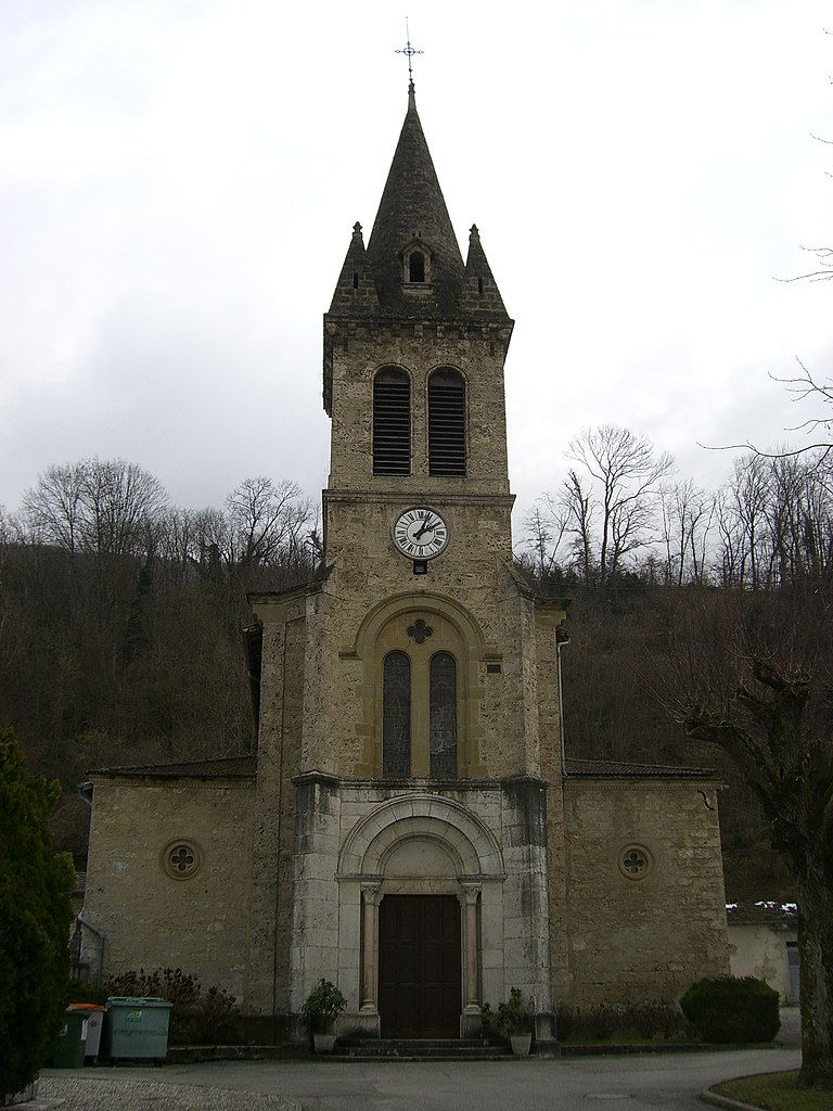
Beaulieu (Beaulieu)

- commune in Isère, France
 Hiking in Beaulieu
Beaulieu in Isère is a charming destination for hiking enthusiasts, nestled in the foothills of the French Alps. The area is known for its beautiful landscapes, rolling hills, and proximity to the Chartreuse Mountains. Here are some highlights to consider if you're planning to hike in Beaulieu:
Trail Options:
-
Les Aiguilles de la Morgane: This trail offers stunning views of the surrounding mountains and valleys. It's a moderate hike that can take a few hours to complete, providing a mix of forest paths and rocky terrain.
-
Le Chemin de la Réserve Naturelle: This route takes you through a protected natural reserve, perfect for those interested in flora and fauna. Keep your eyes peeled for local wildlife and enjoy the serene environment.
-
Sentier des Crêtes: This is a scenic ridge trail that provides panoramic views of the Isère Valley and beyond. It’s a great choice for experienced hikers looking for a rewarding trek.
-
Lac de Paladru: Although a bit further from Beaulieu, the trails around Lake Paladru offer beautiful lakeside views and a chance to enjoy water activities.
Things to Bring:
- Footwear: Sturdy hiking boots are essential due to varying terrain.
- Clothing: Dress in layers, as temperatures can change rapidly.
- Water and Snacks: Always stay hydrated and pack energy-boosting snacks.
- Map/GPS: While trails are often marked, it's good to have a map or a GPS device for navigation.
Safety Tips:
- Check the Weather: Mountain weather can be unpredictable, so check forecasts before heading out.
- Stay on Marked Trails: Stick to established paths to protect the environment and ensure your safety.
- Inform Someone: Let someone know your plans and expected return time, especially on longer hikes.
Best Time to Hike:
- The best hiking season in Beaulieu is typically from late spring to early fall (May to October), when the weather is mild and the trails are usually in good condition.
Local Tips:
- Consider visiting the local tourist office for maps, guided hikes, and recommendations tailored to your experience level.
- Explore the local culture and cuisine post-hike—trying regional dishes can be a delightful way to round off your hiking experience.
Whether you're a seasoned hiker or a beginner, Beaulieu offers an excellent backdrop for enjoying nature and getting some exercise. Enjoy your hiking adventure!
- Country:

- Postal Code: 38470
- Coordinates: 45° 11' 33" N, 5° 23' 32" E


- GPS tracks (wikiloc): [Link]
- Area: 8.79 sq km
- Population: 623
- Wikipedia en: wiki(en)
- Wikipedia: wiki(fr)
- Wikidata storage: Wikidata: Q1008931
- Wikipedia Commons Category: [Link]
- Freebase ID: [/m/03g_749]
- GeoNames ID: Alt: [6614106]
- SIREN number: [213800337]
- BnF ID: [15257862p]
- INSEE municipality code: 38033
Shares border with regions:


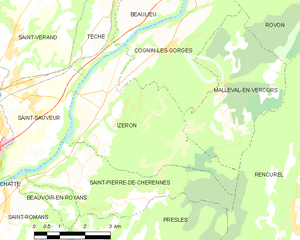
Cognin-les-Gorges
- commune in Isère, France
Hiking in Cognin-les-Gorges
Cognin-les-Gorges, located in the French Alps, is a charming destination for hiking enthusiasts. The area is known for its stunning natural landscapes, including picturesque gorges, rugged mountains, and diverse flora and fauna. Here are some highlights for hiking in Cognin-les-Gorges:...
- Country:
- Postal Code: 38470
- Coordinates: 45° 10' 15" N, 5° 24' 42" E
- GPS tracks (wikiloc): [Link]
- Area: 12.52 sq km
- Population: 639
- Web site: [Link]


Têche
- commune in Isère, France
Hiking in Têche
Têche is a beautiful region that is often celebrated for its picturesque landscapes, diverse ecosystems, and extensive trail networks, making it an excellent destination for hiking enthusiasts. Although specific details may vary, here are general aspects to consider when hiking in Têche:...
- Country:
- Postal Code: 38470
- Coordinates: 45° 10' 58" N, 5° 22' 53" E
- GPS tracks (wikiloc): [Link]
- Area: 5.03 sq km
- Population: 578
- Web site: [Link]
Izeron
- commune in Isère, France
Hiking in Izeron
Izeron is a charming village located in the Isère department of southeastern France, not far from the Vercors National Park. The surrounding area is characterized by its beautiful landscapes, diverse flora and fauna, and a variety of hiking trails that cater to different skill levels....
- Country:
- Postal Code: 38160
- Coordinates: 45° 8' 48" N, 5° 22' 33" E
- GPS tracks (wikiloc): [Link]
- Area: 17.19 sq km
- Population: 701
- Web site: [Link]


Vinay
- commune in Isère, France
Hiking in Vinay
Vinay, located in the Isère department of the Auvergne-Rhône-Alpes region in France, is a charming village surrounded by beautiful natural landscapes, making it a great spot for hiking enthusiasts. Here are a few key points to consider when hiking in and around Vinay:...
- Country:
- Postal Code: 38470
- Coordinates: 45° 12' 36" N, 5° 24' 13" E
- GPS tracks (wikiloc): [Link]
- Area: 16.01 sq km
- Population: 4200
- Web site: [Link]

Saint-Vérand
- commune in Isère, France
Hiking in Saint-Vérand
Saint-Vérand is a charming village located in the Isère department of the Auvergne-Rhône-Alpes region in southeastern France. It is nestled in the foothills of the Alps and offers a variety of hiking opportunities that showcase the stunning natural landscapes of the area....
- Country:
- Postal Code: 38160
- Coordinates: 45° 10' 23" N, 5° 19' 54" E
- GPS tracks (wikiloc): [Link]
- AboveSeaLevel: 290 м m
- Area: 17.83 sq km
- Population: 1727
- Web site: [Link]