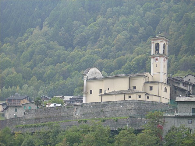
Berbenno di Valtellina (Berbenno di Valtellina)
.svg)
- Italian comune
 Hiking in Berbenno di Valtellina
Berbenno di Valtellina, located in the Valtellina Valley of Northern Italy, is a beautiful area that offers a variety of hiking opportunities. Surrounded by the stunning Alps and characterized by its charming villages, verdant landscapes, and rich cultural heritage, it is an ideal destination for hikers of all levels.
Trail Options
-
Sentiero del Sole: This trail offers a beautiful panoramic view of the Valtellina Valley and is relatively easy, making it suitable for families and beginners. The landscape features vineyards, historical buildings, and unique flora and fauna.
-
Monte Cucco: A more challenging hike, this route takes you up Monte Cucco, where you'll be rewarded with spectacular views of the surrounding mountains and valleys. The trail is marked and provides ample opportunities to observe local wildlife.
-
Val Malagna: This hike explores a picturesque side valley, leading you through forests and along streams. You can witness cascading waterfalls and enjoy the serenity that this area provides.
-
Cima di Piazzo: A moderately difficult hike that offers stunning views and a sense of accomplishment upon reaching the summit. This trail is best suited for more experienced hikers.
General Tips
-
Best Time to Hike: Spring (April to June) and early autumn (September to October) are ideal for hiking in this region, as the weather is generally mild, and the trails are less crowded.
-
Weather Considerations: Always check the local weather before heading out, as conditions can change rapidly in the mountains.
-
Local Amenities: Berbenno di Valtellina has local shops and restaurants where you can stock up on supplies or enjoy a meal after your hike.
-
Safety: It’s essential to wear appropriate footwear, stay hydrated, and let someone know your hiking plans. Carry a map or a GPS device, as some trails may not be well marked.
Cultural Aspects
Hiking in Berbenno di Valtellina also allows you to immerse yourself in the local culture. You might encounter ancient churches, traditional stone houses, and possibly even local festivals depending on the time of your visit.
Overall, Berbenno di Valtellina offers a perfect blend of outdoor activities and cultural experiences, making it a fantastic choice for hikers seeking both adventure and tranquility.
- Country:

- Postal Code: 23010
- Local Dialing Code: 0342
- Licence Plate Code: SO
- Coordinates: 46° 10' 0" N, 9° 45' 0" E


- GPS tracks (wikiloc): [Link]
- AboveSeaLevel: 370 м m
- Area: 35.6 sq km
- Population: 4151
- Web site: http://www.comune.berbenno.so.it
- Wikipedia en: wiki(en)
- Wikipedia: wiki(it)
- Wikidata storage: Wikidata: Q39479
- Wikipedia Commons Category: [Link]
- Freebase ID: [/m/0gj2ks]
- GeoNames ID: Alt: [6536121]
- VIAF ID: Alt: [236121134]
- OSM relation ID: [46952]
- archINFORM location ID: [16436]
- UN/LOCODE: [ITBDV]
- ISTAT ID: 014007
- Italian cadastre code: A787
- LombardiaBeniCulturali toponym ID: 10000011
Shares border with regions:
Postalesio
- Italian comune
Hiking in Postalesio
Postalesio is a charming destination for hikers, located in the Valtellina valley in northern Italy. It's surrounded by the stunning Alps, and offers a range of hiking trails that cater to different skill levels, from gentle walks to more challenging routes....
- Country:
- Postal Code: 23010
- Local Dialing Code: 0342
- Licence Plate Code: SO
- Coordinates: 46° 10' 0" N, 9° 47' 0" E
- GPS tracks (wikiloc): [Link]
- AboveSeaLevel: 516 м m
- Area: 10.58 sq km
- Population: 666
- Web site: [Link]


Colorina
- Italian comune
Hiking in Colorina
It seems there might be a slight typing error in your question regarding "Colorina." If you meant Colorado, there are numerous amazing hiking opportunities in the state. Here are some highlights:...
- Country:
- Postal Code: 23010
- Local Dialing Code: 0342
- Licence Plate Code: SO
- Coordinates: 46° 9' 0" N, 9° 44' 0" E
- GPS tracks (wikiloc): [Link]
- AboveSeaLevel: 385 м m
- Area: 17.84 sq km
- Population: 1423
- Web site: [Link]
Cedrasco
- Italian comune
Hiking in Cedrasco
Cedrasco is a small municipality located in the Valtellina valley in the Lombardy region of Italy. It is surrounded by stunning natural scenery, making it a great destination for hiking enthusiasts. Here are some highlights about hiking in and around Cedrasco:...
- Country:
- Postal Code: 23010
- Local Dialing Code: 0342
- Licence Plate Code: SO
- Coordinates: 46° 9' 0" N, 9° 46' 0" E
- GPS tracks (wikiloc): [Link]
- AboveSeaLevel: 287 м m
- Area: 14.42 sq km
- Population: 442
- Web site: [Link]

Torre di Santa Maria
- Italian comune
Hiking in Torre di Santa Maria
Torre di Santa Maria, located in the beautiful region of Lombardy in northern Italy, is an excellent destination for hiking enthusiasts. Nestled in the Valtellina valley, it is surrounded by stunning landscapes, including mountains, valleys, and lush forests....
- Country:
- Postal Code: 23020
- Local Dialing Code: 0342
- Licence Plate Code: SO
- Coordinates: 46° 14' 0" N, 9° 51' 0" E
- GPS tracks (wikiloc): [Link]
- AboveSeaLevel: 795 м m
- Area: 44.24 sq km
- Population: 752
- Web site: [Link]
Buglio in Monte
- Italian comune
Hiking in Buglio in Monte
Buglio in Monte is a picturesque village located in the Lombardy region of Italy, in the province of Sondrio. The area is known for its stunning natural landscapes, making it an excellent destination for hiking enthusiasts....
- Country:
- Postal Code: 23010
- Local Dialing Code: 0342
- Licence Plate Code: SO
- Coordinates: 46° 11' 0" N, 9° 41' 0" E
- GPS tracks (wikiloc): [Link]
- AboveSeaLevel: 577 м m
- Area: 27.71 sq km
- Population: 2012
- Web site: [Link]
Ardenno
- Italian comune
Hiking in Ardenno
Ardenno, located in the Valtellina region of northern Italy, offers a beautiful setting for hiking enthusiasts. The area is known for its stunning landscapes, rich flora and fauna, and traditional alpine villages. Here are some key points to consider when hiking in Ardenno:...
- Country:
- Postal Code: 23011
- Local Dialing Code: 0342
- Licence Plate Code: SO
- Coordinates: 46° 10' 0" N, 9° 39' 0" E
- GPS tracks (wikiloc): [Link]
- AboveSeaLevel: 266 м m
- Area: 17.14 sq km
- Population: 3270
- Web site: [Link]
Fusine
- Italian comune
Hiking in Fusine
Fusine, located in the Julian Alps of northeastern Italy, is a stunning destination for hiking enthusiasts. The area is known for its picturesque landscapes, crystal-clear alpine lakes, and diverse flora and fauna. Here are some highlights and tips for hiking in Fusine:...
- Country:
- Postal Code: 23010
- Local Dialing Code: 0342
- Licence Plate Code: SO
- Coordinates: 46° 8' 58" N, 9° 44' 59" E
- GPS tracks (wikiloc): [Link]
- AboveSeaLevel: 285 м m
- Area: 37 sq km
- Population: 575
- Web site: [Link]