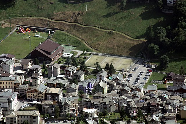
Torre di Santa Maria (Torre di Santa Maria)
.svg)
- Italian comune
 Hiking in Torre di Santa Maria
Torre di Santa Maria, located in the beautiful region of Lombardy in northern Italy, is an excellent destination for hiking enthusiasts. Nestled in the Valtellina valley, it is surrounded by stunning landscapes, including mountains, valleys, and lush forests.
Hiking Trails
-
Val Fontanedo: This picturesque trail offers a variety of options, ranging from easy walks to more challenging hikes. The route features scenic views of the valley and the surrounding peaks.
-
Sentiero Valtellina: A long-distance trail that stretches through the Valtellina valley, it passes by Torre di Santa Maria. This well-marked path is perfect for those looking for a multi-day hike or shorter sections depending on your skill level and time available.
-
Monte Disgrazia: For those seeking a more challenging hike, trails leading towards Monte Disgrazia provide incredible panoramic views. These hikes are more suited for experienced hikers due to the elevation and terrain.
Tips for Hiking in Torre di Santa Maria
-
Best Time to Visit: The best hiking seasons are typically late spring (May to June) and early autumn (September to October), when the weather is mild and the trails are less crowded.
-
Gear Up: Wear sturdy hiking boots and bring layers, as temperatures can vary significantly throughout the day. A good backpack with water, snacks, and a first-aid kit is essential.
-
Navigation: While many trails are well-marked, having a map or GPS device can be helpful. It’s wise to download the trail maps beforehand in case of spotty mobile reception.
-
Safety First: Always check the weather conditions before heading out and inform someone of your hiking plans. Make sure to stay on marked trails to preserve the environment and ensure your safety.
Wildlife and Nature
Torre di Santa Maria and its surroundings are rich in flora and fauna. You may spot various bird species and wildlife like deer and foxes. Enjoy the biodiversity and take the time to appreciate the natural beauty, but remember to respect the local ecosystem.
Local Culture
After a long day of hiking, you can experience the local culture by visiting nearby towns. Don’t miss out on tasting traditional Valtellina dishes, such as pizzoccheri (buckwheat pasta) and local cheeses.
In summary, Torre di Santa Maria offers a fantastic hiking experience for all levels, with its striking natural beauty and diverse trails. Enjoy your adventure!
- Country:

- Postal Code: 23020
- Local Dialing Code: 0342
- Licence Plate Code: SO
- Coordinates: 46° 14' 0" N, 9° 51' 0" E


- GPS tracks (wikiloc): [Link]
- AboveSeaLevel: 795 м m
- Area: 44.24 sq km
- Population: 752
- Web site: http://www.comune.torredisantamaria.so.it
- Wikipedia en: wiki(en)
- Wikipedia: wiki(it)
- Wikidata storage: Wikidata: Q39281
- Wikipedia Commons Category: [Link]
- Freebase ID: [/m/0gj3x8]
- GeoNames ID: Alt: [6536129]
- VIAF ID: Alt: [242317577]
- OSM relation ID: [47030]
- ISTAT ID: 014067
- Italian cadastre code: L244
Shares border with regions:


Montagna in Valtellina
- Italian comune
Hiking in Montagna in Valtellina
Montagna in Valtellina, located in the Sondrio province of Lombardy, Italy, is an excellent destination for hiking enthusiasts. This area is part of the Valtellina Valley, which is known for its stunning landscapes, charming villages, and rich cultural heritage....
- Country:
- Postal Code: 23020
- Local Dialing Code: 0342
- Licence Plate Code: SO
- Coordinates: 46° 11' 0" N, 9° 54' 0" E
- GPS tracks (wikiloc): [Link]
- AboveSeaLevel: 567 м m
- Area: 44.97 sq km
- Population: 3041
- Web site: [Link]
Postalesio
- Italian comune
Hiking in Postalesio
Postalesio is a charming destination for hikers, located in the Valtellina valley in northern Italy. It's surrounded by the stunning Alps, and offers a range of hiking trails that cater to different skill levels, from gentle walks to more challenging routes....
- Country:
- Postal Code: 23010
- Local Dialing Code: 0342
- Licence Plate Code: SO
- Coordinates: 46° 10' 0" N, 9° 47' 0" E
- GPS tracks (wikiloc): [Link]
- AboveSeaLevel: 516 м m
- Area: 10.58 sq km
- Population: 666
- Web site: [Link]
Buglio in Monte
- Italian comune
Hiking in Buglio in Monte
Buglio in Monte is a picturesque village located in the Lombardy region of Italy, in the province of Sondrio. The area is known for its stunning natural landscapes, making it an excellent destination for hiking enthusiasts....
- Country:
- Postal Code: 23010
- Local Dialing Code: 0342
- Licence Plate Code: SO
- Coordinates: 46° 11' 0" N, 9° 41' 0" E
- GPS tracks (wikiloc): [Link]
- AboveSeaLevel: 577 м m
- Area: 27.71 sq km
- Population: 2012
- Web site: [Link]


Berbenno di Valtellina
- Italian comune
Hiking in Berbenno di Valtellina
Berbenno di Valtellina, located in the Valtellina Valley of Northern Italy, is a beautiful area that offers a variety of hiking opportunities. Surrounded by the stunning Alps and characterized by its charming villages, verdant landscapes, and rich cultural heritage, it is an ideal destination for hikers of all levels....
- Country:
- Postal Code: 23010
- Local Dialing Code: 0342
- Licence Plate Code: SO
- Coordinates: 46° 10' 0" N, 9° 45' 0" E
- GPS tracks (wikiloc): [Link]
- AboveSeaLevel: 370 м m
- Area: 35.6 sq km
- Population: 4151
- Web site: [Link]


Chiesa in Valmalenco
- Italian comune
Hiking in Chiesa in Valmalenco
Chiesa in Valmalenco is a beautiful destination for hiking, located in the Italian Alps within the Lombardy region. It is characterized by stunning landscapes, rich biodiversity, and a variety of trails suitable for hikers of all levels. Here’s an overview of what you can expect when hiking in Chiesa in Valmalenco:...
- Country:
- Postal Code: 23023
- Local Dialing Code: 0342
- Licence Plate Code: SO
- Coordinates: 46° 16' 0" N, 9° 51' 0" E
- GPS tracks (wikiloc): [Link]
- AboveSeaLevel: 800 м m
- Area: 107.6 sq km
- Population: 2482
- Web site: [Link]

Caspoggio
- Italian comune
Hiking in Caspoggio
Caspoggio is a charming village located in the Valtellina valley in the Lombardy region of northern Italy, known for its stunning natural landscapes and outdoor recreational opportunities. Hiking in and around Caspoggio provides breathtaking views, diverse trails, and the chance to explore the rich flora and fauna of the area....
- Country:
- Postal Code: 23020
- Local Dialing Code: 0342
- Licence Plate Code: SO
- Coordinates: 46° 16' 0" N, 9° 52' 0" E
- GPS tracks (wikiloc): [Link]
- AboveSeaLevel: 1098 м m
- Area: 7.31 sq km
- Population: 1377
- Web site: [Link]
Spriana
- Italian comune
Hiking in Spriana
Spriana, a charming village in the Lombardy region of Italy, is set against the stunning backdrop of the Italian Alps. It offers a variety of hiking opportunities suitable for all skill levels, with scenic trails that showcase the natural beauty of the area....
- Country:
- Postal Code: 23020
- Local Dialing Code: 0342
- Licence Plate Code: SO
- Coordinates: 46° 13' 0" N, 9° 52' 0" E
- GPS tracks (wikiloc): [Link]
- AboveSeaLevel: 754 м m
- Area: 7.69 sq km
- Population: 87
- Web site: [Link]


Castione Andevenno
- Italian comune
Hiking in Castione Andevenno
Castione Andevenno is a charming village located in the Valtellina valley in the Lombardy region of Italy. It offers several hiking opportunities that appeal to various skill levels, providing breathtaking views of the surrounding mountains and countryside....
- Country:
- Postal Code: 23012
- Local Dialing Code: 0342
- Licence Plate Code: SO
- Coordinates: 46° 10' 0" N, 9° 48' 0" E
- GPS tracks (wikiloc): [Link]
- AboveSeaLevel: 468 м m
- Area: 17.03 sq km
- Population: 1575
- Web site: [Link]
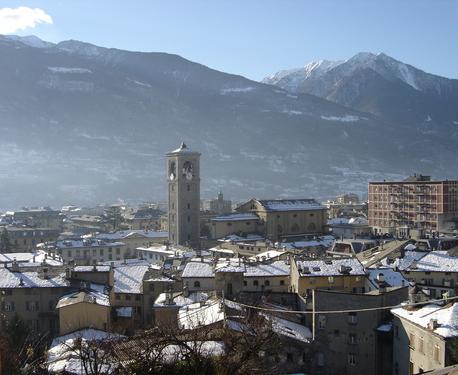

Sondrio
- Italian city in Valtellina
Hiking in Sondrio
Sondrio, located in the Lombardy region of northern Italy, offers a variety of stunning hiking opportunities, particularly in the surrounding Valtellina Valley and the adjacent Stelvio National Park. Here are some highlights and essential information for hiking in the Sondrio area:...
- Country:
- Postal Code: 23100
- Local Dialing Code: 0342
- Licence Plate Code: SO
- Coordinates: 46° 10' 11" N, 9° 52' 12" E
- GPS tracks (wikiloc): [Link]
- AboveSeaLevel: 360 м m
- Area: 20.88 sq km
- Population: 21642
- Web site: [Link]