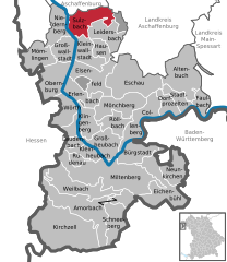
Bessenbach (Bessenbach)

- municipality of Germany
 Hiking in Bessenbach
Bessenbach, located in Bavaria, Germany, is a charming area with beautiful natural surroundings perfect for hiking enthusiasts. Here are some highlights of hiking in and around Bessenbach:
Trails:
-
Local Routes: There are several well-marked trails that cater to various skill levels. These trails often wind through lush forests, rolling hills, and picturesque landscapes, offering stunning views and a peaceful atmosphere.
-
Scenic Views: Many trails provide panoramic views of the surrounding countryside, making them great spots for photography or simply soaking in the beauty of nature.
-
The Main Hiking Trail: Close to Bessenbach, you can access sections of the "Main Hiking Trail," which stretches for hundreds of kilometers along the Main River. It consists of diverse terrains and landscapes.
Flora and Fauna:
- The region is rich in biodiversity, and while hiking, you can encounter a variety of local wildlife, including birds, deer, and smaller animals.
- The varied ecosystems provide opportunities to see beautiful wildflowers and lush vegetation.
Accessibility:
- Bessenbach is easily reachable by public transport or car, making it a convenient destination for day hikes or weekend getaways.
Other Activities:
- In addition to hiking, the area offers cycling routes and is close to historical sites and small villages, providing cultural experiences alongside outdoor activities.
Tips for Hikers:
- Weather: Always check the weather forecasts before setting out, as conditions can change quickly.
- Gear: Wear proper hiking boots and carry essential gear like water, snacks, a map, and sunscreen.
- Respect Nature: Stay on marked paths to preserve the natural environment and wildlife.
Whether you're looking for a leisurely walk in nature or a more strenuous hike, Bessenbach offers a range of opportunities for outdoor enjoyment!
- Country:

- Postal Code: 63856
- Local Dialing Code: 06095
- Licence Plate Code: AB
- Coordinates: 49° 58' 0" N, 9° 16' 0" E


- GPS tracks (wikiloc): [Link]
- AboveSeaLevel: 195 м m
- Area: 29.99 sq km
- Population: 4831
- Web site: https://www.bessenbach.de/
- Wikipedia en: wiki(en)
- Wikipedia: wiki(de)
- Wikidata storage: Wikidata: Q331237
- Wikipedia Commons Category: [Link]
- Freebase ID: [/m/02q06p2]
- GeoNames ID: Alt: [3274991]
- VIAF ID: Alt: [245059341]
- OSM relation ID: [379883]
- GND ID: Alt: [4225404-8]
- Historical Gazetteer (GOV) ID: [BESACHJN49PX]
- Bavarikon ID: [ODB_A00000233]
- German municipality key: 09671112
Shares border with regions:

Sulzbach am Main
- human settlement in Germany
Hiking in Sulzbach am Main
Sulzbach am Main, located in Bavaria, Germany, offers a range of scenic hiking opportunities for outdoor enthusiasts. The region is characterized by diverse landscapes, including forests, hills, and river valleys, making it an ideal destination for nature lovers. Here are some features and trails you can explore in and around Sulzbach am Main:...
- Country:
- Postal Code: 63834
- Local Dialing Code: 06028
- Licence Plate Code: MIL
- Coordinates: 49° 54' 28" N, 9° 9' 24" E
- GPS tracks (wikiloc): [Link]
- AboveSeaLevel: 123 м m
- Area: 19.93 sq km
- Population: 7071
- Web site: [Link]


Mespelbrunn
- municipality of Germany
Hiking in Mespelbrunn
Mespelbrunn is a picturesque village located in Bavaria, Germany, and is particularly well-known for its charming castle, Schloss Mespelbrunn, set amidst the lush forests of the Spessart mountain region. Hiking around Mespelbrunn offers a delightful combination of natural beauty, historical sites, and peaceful trails....
- Country:
- Postal Code: 63875
- Local Dialing Code: 06092
- Licence Plate Code: AB
- Coordinates: 49° 55' 0" N, 9° 17' 0" E
- GPS tracks (wikiloc): [Link]
- AboveSeaLevel: 269 м m
- Area: 15.53 sq km
- Population: 2073
- Web site: [Link]


Laufach
- municipality of Germany
Hiking in Laufach
Laufach, located in Bavaria, Germany, is a charming town that offers a wonderful opportunity for hiking enthusiasts. Surrounded by beautiful landscapes, lush forests, and scenic views, there are several trails and paths suitable for various skill levels....
- Country:
- Postal Code: 63846
- Local Dialing Code: 06093
- Licence Plate Code: AB
- Coordinates: 50° 1' 0" N, 9° 18' 0" E
- GPS tracks (wikiloc): [Link]
- AboveSeaLevel: 180 м m
- Area: 15.60 sq km
- Population: 5176
- Web site: [Link]