Aschaffenburg (Landkreis Aschaffenburg)
- district in Bavaria, Germany
Aschaffenburg, located in Bavaria, Germany, is known for its beautiful landscapes and proximity to the Spessart mountain range, making it a great destination for hiking enthusiasts. The region offers a mix of nature, historic sites, and charming villages, providing a variety of hiking experiences.
Hiking Trails
-
Spessart Nature Park: The Spessart region, which borders Aschaffenburg, offers numerous well-marked hiking trails. You can find routes that vary in difficulty, allowing both beginners and experienced hikers to find suitable paths.
-
Bayerischer Landweg: This is a longer-distance hiking trail that runs through numerous Bavarian landscapes, including the ones near Aschaffenburg. It is divided into stages, making it easy to explore parts of this trail.
-
Main Hiking Trail (Main Wanderweg): This trail follows the Main River and provides scenic views of the river valley, vineyards, and castles. It's suitable for leisurely walks and day hikes.
-
The Areas Around Aschaffenburg: Hiking through the forests around Aschaffenburg can be very rewarding, with opportunities to see local wildlife and enjoy the natural beauty of the region. Trails often lead to viewpoints with stunning vistas.
Highlights
-
Schloss Johannisburg: After a day of hiking, consider visiting this historic castle in Aschaffenburg. It’s an iconic landmark and offers a glimpse into the history of the area.
-
Pompejanum: This is a reconstructed Roman villa that offers another historical perspective to your visit. It’s set in a beautiful park, making for a nice break after hiking.
-
Scenic Views: Lookouts and viewpoints along the trails provide excellent opportunities for photography, especially during sunset.
Tips for Hiking in Aschaffenburg
-
Weather: Check the weather forecast before your trip, as conditions can change rapidly in the mountains.
-
Trail Maps: Make sure to carry a map or use a mobile app for navigation. Trails are generally well-marked but having a map can be helpful for planning your route.
-
Gear: Wear good hiking shoes and bring water, snacks, and weather-appropriate clothing. A first aid kit is also advisable.
-
Local Guides: Consider joining a guided hike for a more in-depth experience, especially if you want to learn about local flora, fauna, and history.
With its beautiful scenery and rich cultural history, hiking in and around Aschaffenburg can be a refreshing and enjoyable experience. Whether you're looking for a challenging trek or a leisurely stroll, there's something for everyone in this lovely Bavarian district.
- Country:

- Capital: Aschaffenburg
- Licence Plate Code: ALZ; AB
- Coordinates: 50° 4' 48" N, 9° 10' 12" E


- GPS tracks (wikiloc): [Link]
- AboveSeaLevel: 246 м m
- Area: 699.00 sq km
- Population: 152367
- Wikipedia en: wiki(en)
- Wikipedia: wiki(de)
- Wikidata storage: Wikidata: Q10471
- Wikipedia Commons Category: [Link]
- Wikipedia Commons Maps Category: [Link]
- Freebase ID: [/m/01btxr]
- GeoNames ID: Alt: [2955273]
- VIAF ID: Alt: [132558659]
- OSM relation ID: [62497]
- GND ID: Alt: [4003193-7]
- archINFORM location ID: [2319]
- Library of Congress authority ID: Alt: [n83034098]
- TGN ID: [7061376]
- Bavarikon ID: [ODB_A00000231]
- NUTS code: [DE264]
- BabelNet ID: [01228770n]
- German district key: 09671
Includes regions:

Kahl am Main
- municipality of Germany
Kahl am Main, situated in the Landkreis Aschaffenburg in Bavaria, Germany, offers some scenic hiking opportunities, especially for those who enjoy exploring the natural beauty along the Main River and the surrounding landscapes....
- Country:

- Postal Code: 63796
- Local Dialing Code: 06188
- Licence Plate Code: AB
- Coordinates: 50° 4' 5" N, 9° 0' 24" E


- GPS tracks (wikiloc): [Link]
- AboveSeaLevel: 110 м m
- Area: 10.63 sq km
- Population: 7030
- Web site: [Link]


Geiselbach
- municipality of Germany
Geiselbach, a small town in Bavaria, Germany, is known for its picturesque landscapes and proximity to natural parks, making it an appealing spot for hiking enthusiasts. Here are some key points to consider for hiking in and around Geiselbach:...
- Country:

- Postal Code: 63826
- Local Dialing Code: 06024
- Licence Plate Code: AB
- Coordinates: 50° 7' 0" N, 9° 12' 0" E


- GPS tracks (wikiloc): [Link]
- AboveSeaLevel: 274 м m
- Area: 12.44 sq km
- Population: 1646
- Web site: [Link]


Wiesen
- municipality in Bavaria, Germany
Wiesen is a picturesque village located in the Bavarian region of Germany, specifically in the district of Berchtesgadener Land. The area offers a range of hiking opportunities suitable for various skill levels. Here are some highlights and tips for hiking in and around Wiesen:...
- Country:

- Postal Code: 63831
- Local Dialing Code: 06096
- Licence Plate Code: AB
- Coordinates: 50° 7' 0" N, 9° 22' 0" E


- GPS tracks (wikiloc): [Link]
- AboveSeaLevel: 397 м m
- Area: 5.64 sq km
- Population: 1050
- Web site: [Link]

Bessenbach
- municipality of Germany
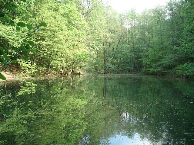
Bessenbach, located in Bavaria, Germany, is a charming area with beautiful natural surroundings perfect for hiking enthusiasts. Here are some highlights of hiking in and around Bessenbach:...
- Country:

- Postal Code: 63856
- Local Dialing Code: 06095
- Licence Plate Code: AB
- Coordinates: 49° 58' 0" N, 9° 16' 0" E


- GPS tracks (wikiloc): [Link]
- AboveSeaLevel: 195 м m
- Area: 29.99 sq km
- Population: 4831
- Web site: [Link]

Alzenau
- municipality of Germany
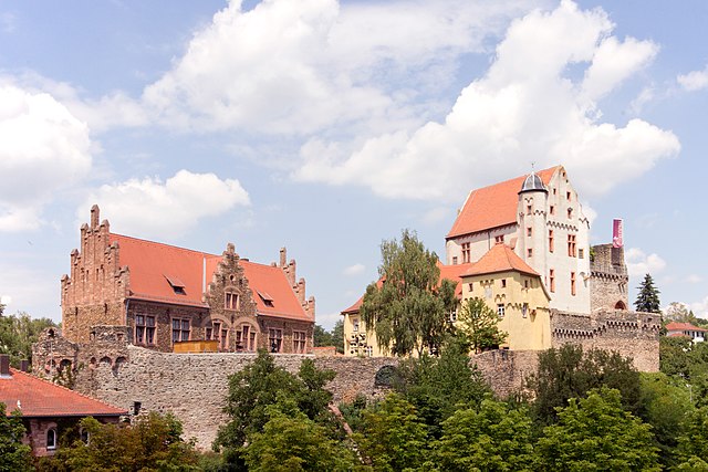
Alzenau, located in the Lower Franconia region of Bavaria, Germany, is a great destination for hiking enthusiasts. The area is characterized by beautiful landscapes, including vineyards, forests, and charming villages. Here are some highlights and tips for hiking in and around Alzenau:...
- Country:

- Postal Code: 63755
- Local Dialing Code: 06023
- Coordinates: 50° 4' 0" N, 9° 4' 0" E


- GPS tracks (wikiloc): [Link]
- AboveSeaLevel: 126 м m
- Area: 59.33 sq km
- Population: 15711
- Web site: [Link]


Hösbach
- human settlement in Germany
Hösbach, located in Bavaria, Germany, offers a range of beautiful hiking opportunities that cater to various skill levels. The area is characterized by picturesque landscapes, including forests, hills, and scenic vistas over the surrounding countryside....
- Country:

- Postal Code: 63768
- Local Dialing Code: 06024; 06021
- Licence Plate Code: AB
- Coordinates: 50° 0' 0" N, 9° 12' 0" E


- GPS tracks (wikiloc): [Link]
- AboveSeaLevel: 144 м m
- Area: 30.58 sq km
- Population: 11925
- Web site: [Link]


Großostheim
- human settlement in Germany
Großostheim is a charming municipality located in the Aschaffenburg district of Bavaria, Germany. While it may not be as widely known for hiking as some of the larger national parks, it offers some lovely trails and natural scenery that can be explored by hikers of varying skill levels....
- Country:

- Postal Code: 63762
- Local Dialing Code: 06026
- Licence Plate Code: AB
- Coordinates: 49° 55' 0" N, 9° 5' 0" E


- GPS tracks (wikiloc): [Link]
- AboveSeaLevel: 137 м m
- Area: 44.31 sq km
- Population: 13514
- Web site: [Link]


Heinrichsthal
- municipality of Germany
Heinrichsthal is a charming area located in Germany, primarily known for its picturesque landscapes and hiking opportunities. Situated in the vicinity of the Bavarian Forest, it offers various trails that cater to different skill levels, from leisurely walks to more challenging treks....
- Country:

- Postal Code: 63871
- Local Dialing Code: 06020
- Licence Plate Code: AB
- Coordinates: 50° 4' 0" N, 9° 21' 0" E


- GPS tracks (wikiloc): [Link]
- AboveSeaLevel: 436 м m
- Area: 4.52 sq km
- Population: 892
- Web site: [Link]


Stockstadt am Main
- human settlement in Germany
Stockstadt am Main is a charming village located in Bavaria, Germany, nestled near the Main River. While the village itself may not be widely recognized as a major hiking destination, it offers access to beautiful natural areas for hiking and outdoor activities. Here are some highlights for hiking in and around Stockstadt am Main:...
- Country:

- Postal Code: 63809–63811
- Local Dialing Code: 06027
- Licence Plate Code: AB
- Coordinates: 49° 58' 47" N, 9° 3' 50" E


- GPS tracks (wikiloc): [Link]
- AboveSeaLevel: 117 м m
- Area: 18.86 sq km
- Population: 7980
- Web site: [Link]


Heigenbrücken
- municipality of Germany
Heigenbrücken is a small town located in the Spessart region of Bavaria, Germany. It’s known for its beautiful landscapes, making it a great destination for hiking enthusiasts. Here are some details about hiking in the area:...
- Country:

- Postal Code: 63869
- Local Dialing Code: 06020
- Licence Plate Code: AB
- Coordinates: 50° 2' 0" N, 9° 23' 0" E


- GPS tracks (wikiloc): [Link]
- AboveSeaLevel: 273 м m
- Area: 6.70 sq km
- Population: 2332
- Web site: [Link]


Heimbuchenthal
- municipality of Germany
Heimbuchenthal is a charming village located in the Spessart region of Bavaria, Germany, known for its beautiful landscapes and outdoor recreational opportunities. Here are some key points about hiking in Heimbuchenthal:...
- Country:

- Postal Code: 63872
- Local Dialing Code: 06092
- Licence Plate Code: AB
- Coordinates: 49° 53' 0" N, 9° 18' 0" E


- GPS tracks (wikiloc): [Link]
- AboveSeaLevel: 234 м m
- Area: 17.15 sq km
- Population: 2106
- Web site: [Link]


Mainaschaff
- municipality of Germany
Mainaschaff is a small town located in Bavaria, Germany, near the city of Aschaffenburg. It's known for its picturesque landscapes, including the banks of the Main River, which provide beautiful hiking opportunities. Here’s a rundown of what you can expect when hiking in and around Mainaschaff:...
- Country:

- Postal Code: 63814
- Local Dialing Code: 06021
- Licence Plate Code: AB
- Coordinates: 49° 59' 0" N, 9° 5' 0" E


- GPS tracks (wikiloc): [Link]
- AboveSeaLevel: 114 м m
- Area: 7.31 sq km
- Population: 6743
- Web site: [Link]


Dammbach
- community in Bavaria, Germany
Dammbach is a picturesque village located in the Franconian region of Bavaria, Germany. Its natural surroundings offer a variety of hiking opportunities that cater to different skill levels. Here are some key points to consider when planning a hiking trip in and around Dammbach:...
- Country:

- Postal Code: 63874
- Local Dialing Code: 06092
- Licence Plate Code: AB
- Coordinates: 49° 51' 0" N, 9° 18' 0" E


- GPS tracks (wikiloc): [Link]
- AboveSeaLevel: 269 м m
- Area: 18.48 sq km
- Population: 1883
- Web site: [Link]


Mömbris
- municipality of Germany
Mömbris is a charming town located in Bavaria, Germany, known for its beautiful natural surroundings. The region offers various hiking trails that cater to different skill levels and preferences. Here are some key points about hiking in and around Mömbris:...
- Country:

- Postal Code: 63776
- Local Dialing Code: 06029
- Licence Plate Code: AB
- Coordinates: 50° 4' 0" N, 9° 10' 0" E


- GPS tracks (wikiloc): [Link]
- AboveSeaLevel: 180 м m
- Area: 35.92 sq km
- Population: 10830
- Web site: [Link]

Karlstein am Main
- municipality of Germany
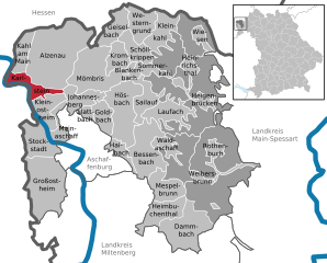
Karlstein am Main, located in Bavaria, Germany, is a charming town known for its picturesque landscapes and outdoor activities, particularly hiking. The area offers a variety of trails that cater to different skill levels, making it a great destination for both beginners and experienced hikers....
- Country:

- Postal Code: 63791
- Local Dialing Code: 06188
- Licence Plate Code: AB
- Coordinates: 50° 2' 56" N, 9° 1' 6" E


- GPS tracks (wikiloc): [Link]
- AboveSeaLevel: 110 м m
- Area: 12.68 sq km
- Population: 7056
- Web site: [Link]


Blankenbach
- municipality of Germany
Blankenbach is a small municipality located in the Odenwald region of Germany, known for its scenic landscapes, lush forests, and hiking opportunities. If you're considering hiking in Blankenbach, here are some key points to keep in mind:...
- Country:

- Postal Code: 63825
- Local Dialing Code: 06024
- Licence Plate Code: AB, ALZ
- Coordinates: 50° 4' 0" N, 9° 14' 0" E


- GPS tracks (wikiloc): [Link]
- AboveSeaLevel: 190 м m
- Area: 3.95 sq km
- Population: 1277
- Web site: [Link]


Glattbach
- municipality of Germany
Glattbach, a charming village located in Bavaria, Germany, offers beautiful hiking opportunities amid picturesque landscapes. The area features a variety of trails suitable for different skill levels, from easy family walks to more challenging routes for experienced hikers....
- Country:

- Postal Code: 63864
- Local Dialing Code: 06021
- Licence Plate Code: AB
- Coordinates: 50° 0' 20" N, 9° 8' 50" E


- GPS tracks (wikiloc): [Link]
- AboveSeaLevel: 182 м m
- Area: 3.54 sq km
- Population: 3255
- Web site: [Link]


Kleinostheim
- municipality of Germany
Kleinostheim is a charming municipality located in Bavaria, Germany, nestled along the banks of the Main River. It offers several opportunities for hiking enthusiasts looking to explore the scenic beauty of the region. Here are some aspects to consider when hiking in and around Kleinostheim:...
- Country:

- Postal Code: 63801
- Local Dialing Code: 06027
- Licence Plate Code: AB
- Coordinates: 50° 0' 0" N, 9° 4' 0" E


- GPS tracks (wikiloc): [Link]
- AboveSeaLevel: 114 м m
- Area: 13.89 sq km
- Population: 7212
- Web site: [Link]

Westerngrund
- municipality of Germany
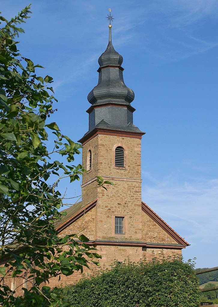
Westerngrund, a charming village in Bavaria, Germany, offers a variety of hiking opportunities for nature enthusiasts and outdoor adventurers. Nestled in the scenic region of the Spessart Forest, it provides a rich experience through lush woodlands, rolling hills, and picturesque landscapes....
- Country:

- Postal Code: 63825
- Local Dialing Code: 06024
- Licence Plate Code: AB
- Coordinates: 50° 6' 0" N, 9° 15' 0" E


- GPS tracks (wikiloc): [Link]
- AboveSeaLevel: 241 м m
- Area: 10.4 sq km
- Population: 1584
- Web site: [Link]


Kleinkahl
- municipality of Germany
Kleinkahl is a picturesque village located in Bavaria, Germany, and is part of the district of Aschaffenburg. The area surrounding Kleinkahl offers beautiful hiking trails that showcase the natural beauty of the region, including forests, hills, and views of the Spessart Mountains....
- Country:

- Postal Code: 63828
- Local Dialing Code: 06024
- Licence Plate Code: AB
- Coordinates: 50° 7' 0" N, 9° 16' 0" E


- GPS tracks (wikiloc): [Link]
- AboveSeaLevel: 233 м m
- Area: 11.86 sq km
- Population: 1582
- Web site: [Link]


Krombach
- municipality of Germany
Krombach, located in Bavaria, Germany, is a charming area that offers various hiking opportunities, particularly for those looking to explore the beautiful landscapes of upper Franconia. Here are some insights into hiking in the region:...
- Country:

- Postal Code: 63829
- Local Dialing Code: 06024
- Licence Plate Code: AB
- Coordinates: 50° 5' 0" N, 9° 13' 0" E


- GPS tracks (wikiloc): [Link]
- AboveSeaLevel: 240 м m
- Area: 10.65 sq km
- Population: 1772
- Web site: [Link]

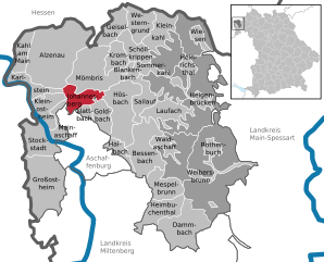
Johannesberg
- municipality of Germany
Johannesberg, a charming district located near Aschaffenburg in Bavaria, Germany, is not as widely known for hiking as some other regions, but it offers several beautiful trails and scenic views that are perfect for outdoor enthusiasts. Here’s what you can expect when hiking in and around Johannesberg:...
- Country:

- Postal Code: 63867
- Local Dialing Code: 06021
- Licence Plate Code: AB
- Coordinates: 50° 2' 0" N, 9° 8' 0" E


- GPS tracks (wikiloc): [Link]
- AboveSeaLevel: 372 м m
- Area: 13.63 sq km
- Population: 3391
- Web site: [Link]
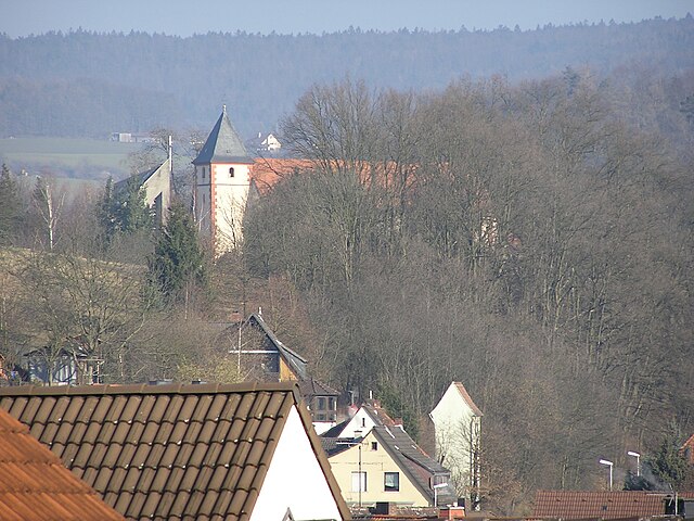

Sailauf
- municipality of Germany
Sailauf, located in the Bavarian region of Germany, offers beautiful hiking opportunities amidst picturesque landscapes. Nestled near the Spessart Forest, the area features a mix of lush woodlands, rolling hills, and scenic views. Here are a few highlights and tips for hiking in Sailauf:...
- Country:

- Postal Code: 63877
- Local Dialing Code: 06093; 06024
- Licence Plate Code: AB
- Coordinates: 50° 1' 0" N, 9° 15' 0" E


- GPS tracks (wikiloc): [Link]
- AboveSeaLevel: 178 м m
- Area: 13.82 sq km
- Population: 3205
- Web site: [Link]


Sommerkahl
- municipality of Germany
Sommerkahl is a beautiful area located in the Bavarian region of Germany, known for its scenic landscapes and outdoor activities, particularly hiking. This area offers a variety of trails that cater to different skill levels, making it a great destination for both novice and experienced hikers....
- Country:

- Postal Code: 63825
- Local Dialing Code: 06024
- Licence Plate Code: AB
- Coordinates: 50° 4' 0" N, 9° 16' 0" E


- GPS tracks (wikiloc): [Link]
- AboveSeaLevel: 226 м m
- Area: 5.46 sq km
- Population: 1053
- Web site: [Link]

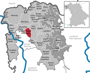
Goldbach
- market community in Aschaffenburg, Bavaria, Germany
Goldbach is a charming village located in Bavaria, Germany, known for its picturesque landscapes and access to beautiful hiking trails. The region offers a mix of rolling hills, lush forests, and scenic views of the surrounding countryside, making it a great destination for hikers of all levels....
- Country:

- Postal Code: 63773
- Local Dialing Code: 06021
- Licence Plate Code: AB
- Coordinates: 49° 59' 20" N, 9° 11' 11" E


- GPS tracks (wikiloc): [Link]
- AboveSeaLevel: 148 м m
- Area: 10.97 sq km
- Population: 9145
- Web site: [Link]


Mespelbrunn
- municipality of Germany
Mespelbrunn is a picturesque village located in Bavaria, Germany, and is particularly well-known for its charming castle, Schloss Mespelbrunn, set amidst the lush forests of the Spessart mountain region. Hiking around Mespelbrunn offers a delightful combination of natural beauty, historical sites, and peaceful trails....
- Country:

- Postal Code: 63875
- Local Dialing Code: 06092
- Licence Plate Code: AB
- Coordinates: 49° 55' 0" N, 9° 17' 0" E


- GPS tracks (wikiloc): [Link]
- AboveSeaLevel: 269 м m
- Area: 15.53 sq km
- Population: 2073
- Web site: [Link]


Schöllkrippen
- human settlement in Germany
Schöllkrippen is a picturesque village located in Bavaria, Germany, surrounded by beautiful landscapes that offer excellent hiking opportunities. The area is characterized by rolling hills, forests, and stunning viewpoints, making it a fantastic destination for nature lovers and outdoor enthusiasts....
- Country:

- Postal Code: 63825
- Local Dialing Code: 06024
- Licence Plate Code: AB
- Coordinates: 50° 4' 0" N, 9° 13' 59" E


- GPS tracks (wikiloc): [Link]
- AboveSeaLevel: 206 м m
- Area: 12.64 sq km
- Population: 3197
- Web site: [Link]

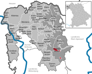
Weibersbrunn
- municipality of Germany
Weibersbrunn is a charming village located in the Bavarian region of Germany, surrounded by beautiful landscapes that are perfect for hiking enthusiasts. Here’s a general overview of hiking in Weibersbrunn:...
- Country:

- Postal Code: 63879
- Local Dialing Code: 06094
- Licence Plate Code: AB
- Coordinates: 49° 56' 0" N, 9° 22' 0" E


- GPS tracks (wikiloc): [Link]
- AboveSeaLevel: 358 м m
- Area: 2.89 sq km
- Population: 1934
- Web site: [Link]


Rothenbuch
- municipality of Germany
Rothenbuch, situated in Bavaria, Germany, is a lovely destination for hiking enthusiasts. Nestled in the Spessart mountain range, it offers a variety of scenic trails suitable for all levels of hikers....
- Country:

- Postal Code: 63860
- Local Dialing Code: 06094
- Licence Plate Code: AB
- Coordinates: 49° 58' 0" N, 9° 24' 0" E


- GPS tracks (wikiloc): [Link]
- AboveSeaLevel: 359 м m
- Area: 7.05 sq km
- Population: 1764
- Web site: [Link]


Waldaschaff
- municipality of Germany
Waldaschaff is a charming village located in the Ashke Valley in Bavaria, Germany, known for its picturesque landscapes and scenic hiking trails. Hiking in this area offers a wonderful opportunity to explore nature and enjoy the breathtaking views of the lush forests, rolling hills, and the nearby Spessart Nature Park....
- Country:

- Postal Code: 63857
- Local Dialing Code: 06095
- Licence Plate Code: AB
- Coordinates: 49° 58' 0" N, 9° 18' 0" E


- GPS tracks (wikiloc): [Link]
- AboveSeaLevel: 192 м m
- Area: 6.59 sq km
- Population: 3692
- Web site: [Link]


Laufach
- municipality of Germany
Laufach, located in Bavaria, Germany, is a charming town that offers a wonderful opportunity for hiking enthusiasts. Surrounded by beautiful landscapes, lush forests, and scenic views, there are several trails and paths suitable for various skill levels....
- Country:

- Postal Code: 63846
- Local Dialing Code: 06093
- Licence Plate Code: AB
- Coordinates: 50° 1' 0" N, 9° 18' 0" E


- GPS tracks (wikiloc): [Link]
- AboveSeaLevel: 180 м m
- Area: 15.60 sq km
- Population: 5176
- Web site: [Link]


Haibach, Lower Franconia
- municipality of Germany
 Hiking in Haibach, Lower Franconia
Haibach, located in Lower Franconia, Germany, offers a beautiful setting for hiking enthusiasts. The area is characterized by its picturesque landscapes, rolling hills, and lush forests, making it an ideal spot for both leisurely walks and more challenging hikes....
- Country:

- Postal Code: 63808
- Local Dialing Code: 06021
- Licence Plate Code: AB
- Coordinates: 49° 58' 3" N, 9° 11' 49" E


- GPS tracks (wikiloc): [Link]
- AboveSeaLevel: 280 м m
- Area: 7.36 sq km
- Population: 7688
- Web site: [Link]


Huckelheimer Wald
- unincorporated area in Germany
Huckelheimer Wald, located in the Rhineland-Palatinate region of Germany, offers a picturesque setting for hiking enthusiasts. This area is characterized by its lush woodlands, rolling hills, and diverse wildlife, making it an excellent destination for nature lovers....
- Country:

- Coordinates: 50° 7' 42" N, 9° 15' 58" E


- GPS tracks (wikiloc): [Link]


Schöllkrippener Forst
- unincorporated area in Germany
 Hiking in Schöllkrippener Forst
Schöllkrippener Forst, located in Bavaria, Germany, is a beautiful natural area ideal for hiking enthusiasts. This forested region offers a variety of trails that cater to different skill levels, making it an excellent destination for both novice and experienced hikers. Here are some key points to know about hiking in Schöllkrippener Forst:...
- Country:

- Coordinates: 50° 5' 30" N, 9° 17' 59" E


- GPS tracks (wikiloc): [Link]
Geiselbacher Forst
- former unincorporated area in Germany
Geiselbacher Forst, located in the Odenwald region of Germany, is a beautiful area for hiking enthusiasts. The forest is known for its lush greenery, diverse fauna, and scenic trails, making it an ideal place for nature lovers and outdoor adventurers....
- Country:

- Coordinates: 50° 8' 13" N, 9° 12' 52" E


- GPS tracks (wikiloc): [Link]


Rothenbucher Forst
- unincorporated area in Germany
Rothenbucher Forst is a beautiful forest area located in Bavaria, Germany, known for its lush landscapes and diverse ecosystems. It offers a variety of hiking trails suitable for different skill levels, making it a great destination for both beginners and experienced hikers. Here are some highlights and tips for hiking in Rothenbucher Forst:...
- Country:

- Coordinates: 49° 58' 42" N, 9° 25' 7" E


- GPS tracks (wikiloc): [Link]
Forst Hain im Spessart
- unincorporated area in Germany
 Hiking in Forst Hain im Spessart
Forst Hain im Spessart is a wonderful location for hiking, situated in the Spessart forest region in Bavaria, Germany. Known for its picturesque landscapes, dense woodlands, rolling hills, and diverse flora and fauna, this area provides an excellent setting for outdoor enthusiasts of all skill levels....
- Country:

- Coordinates: 50° 0' 7" N, 9° 21' 31" E


- GPS tracks (wikiloc): [Link]


Sailaufer Forst
- unincorporated area in Germany
Sailaufer Forst is a beautiful forest area that provides a wonderful environment for hiking and nature exploration. If you're planning to hike there, here are some key points to consider:...
- Country:

- Coordinates: 50° 2' 30" N, 9° 17' 58" E


- GPS tracks (wikiloc): [Link]


Heinrichsthaler Forst
- unincorporated area in Germany
 Hiking in Heinrichsthaler Forst
Heinrichsthaler Forst, located in Germany, is a beautiful area known for its dense forests, scenic landscapes, and tranquil nature. As a hiking destination, it offers a variety of trails suitable for different skill levels, making it a great option for both novice hikers and experienced adventurers....
- Country:

- Coordinates: 50° 3' 31" N, 9° 19' 47" E


- GPS tracks (wikiloc): [Link]


Waldaschaffer Forst
- unincorporated area in Germany
Waldaschaffer Forst, located near the town of Waldaschaff in Bavaria, Germany, offers a variety of hiking opportunities for outdoor enthusiasts. This forested area is characterized by its stunning natural beauty, diverse ecosystems, and well-maintained trails, making it an excellent destination for hikers of all skill levels....
- Country:

- Coordinates: 49° 57' 22" N, 9° 19' 37" E


- GPS tracks (wikiloc): [Link]


Wiesener Forst
- unincorporated area in Germany
Wiesener Forst, located in the picturesque region of Baden-Württemberg, Germany, offers a delightful hiking experience characterized by its lush forests, scenic trails, and diverse wildlife. Here's what you can expect when hiking in this beautiful area:...
- Country:

- Coordinates: 50° 7' 5" N, 9° 19' 51" E


- GPS tracks (wikiloc): [Link]


Rohrbrunner Forst
- unincorporated area in Germany
Rohrbrunner Forst, located in Germany, is a beautiful area for hiking that offers a mix of natural landscapes, tranquility, and a variety of trails suitable for different skill levels. Here are some key points to consider when hiking in Rohrbrunner Forst:...
- Country:

- Coordinates: 49° 54' 23" N, 9° 23' 12" E


- GPS tracks (wikiloc): [Link]
Shares border with regions:

Main-Spessart
- district in Bavaria, Germany
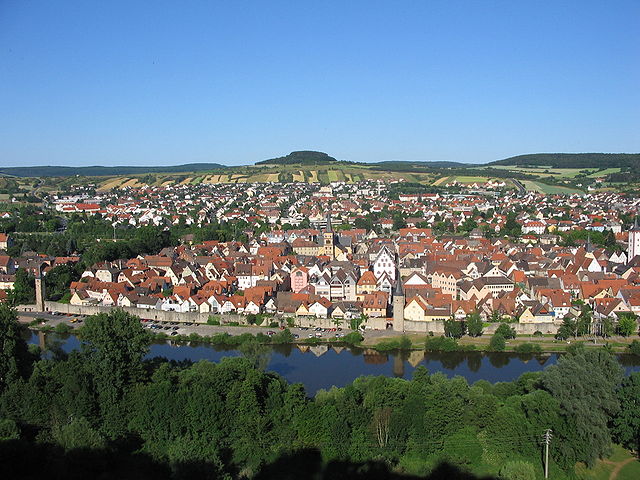
Main-Spessart is a beautiful region located in Bavaria, Germany, known for its scenic landscapes, charming villages, and rich cultural heritage. It's a fantastic destination for hiking enthusiasts, offering a variety of trails that cater to different skill levels. Here’s what you can expect when hiking in Main-Spessart:...
- Country:

- Capital: Karlstadt am Main
- Licence Plate Code: MSP
- Coordinates: 49° 55' 12" N, 9° 45' 0" E


- GPS tracks (wikiloc): [Link]
- AboveSeaLevel: 313 м m
- Area: 1321.4186 sq km
- Population: 125915
- Web site: [Link]


Miltenberg
- district in Bavaria, Germany
Miltenberg, located in the Bavaria region of Germany, is a charming town nestled along the Main River and surrounded by picturesque landscapes, making it an excellent destination for hiking enthusiasts. Here are some highlights about hiking in the Miltenberg district:...
- Country:

- Capital: Miltenberg
- Licence Plate Code: MIL
- Coordinates: 49° 45' 0" N, 9° 15' 0" E


- GPS tracks (wikiloc): [Link]
- AboveSeaLevel: 224 м m
- Area: 716.00 sq km
- Population: 114255
- Web site: [Link]

Aschaffenburg
- town in Bavaria, Germany
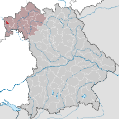
Aschaffenburg is a charming town located in Bavaria, Germany, and is surrounded by beautiful landscapes that offer great opportunities for hiking. The region is characterized by its mix of cultural heritage and natural beauty, making it an ideal destination for outdoor enthusiasts....
- Country:

- Postal Code: 63739–63743
- Local Dialing Code: 06021
- Licence Plate Code: AB
- Coordinates: 49° 58' 0" N, 9° 9' 0" E


- GPS tracks (wikiloc): [Link]
- AboveSeaLevel: 138 м m
- Area: 62.57 sq km
- Population: 68986
- Web site: [Link]

Main-Kinzig-Kreis
- district in Hesse, Germany
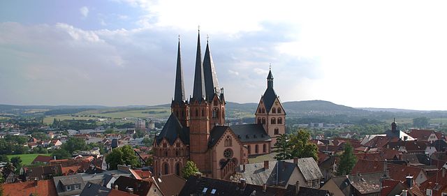
Main-Kinzig-Kreis, located in the state of Hesse, Germany, offers a diverse array of hiking opportunities suitable for various skill levels and preferences. The region is characterized by beautiful landscapes, including forests, rivers, hills, and quaint villages, making it a great destination for outdoor enthusiasts. Here are some highlights:...
- Country:

- Capital: Gelnhausen
- Licence Plate Code: MKK
- Coordinates: 50° 12' 4" N, 9° 11' 51" E


- GPS tracks (wikiloc): [Link]
- AboveSeaLevel: 202 м m
- Area: 1397.52 sq km
- Population: 407619
- Web site: [Link]
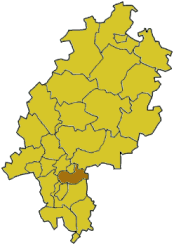
Offenbach
- district in Hesse, Germany
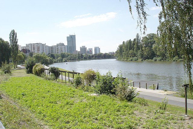
Offenbach, located in the state of Hesse, Germany, is surrounded by scenic areas that offer a variety of hiking opportunities. Although it is an urban district, its proximity to nature parks and the countryside makes it a great base for hikers....
- Country:

- Capital: Offenbach am Main
- Licence Plate Code: OF
- Coordinates: 50° 1' 6" N, 8° 47' 8" E


- GPS tracks (wikiloc): [Link]
- AboveSeaLevel: 143 м m
- Area: 356.29 sq km
- Population: 336265
- Web site: [Link]
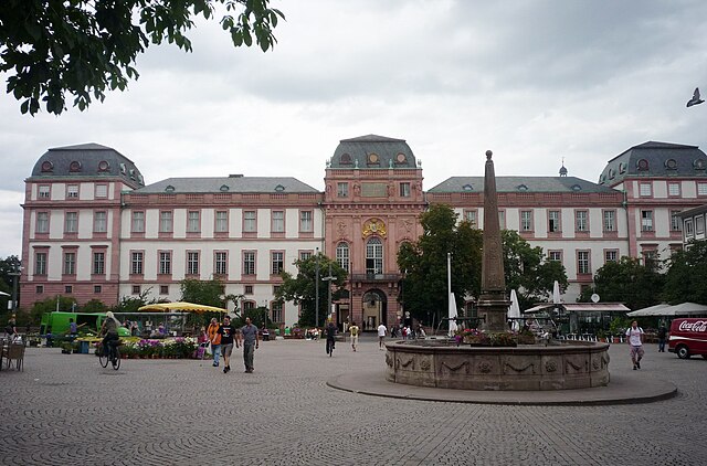

Darmstadt-Dieburg
- district in Hesse, Germany
Darmstadt-Dieburg is a lovely region in Hesse, Germany, known for its scenic landscapes, rich history, and a number of excellent hiking trails. Here are some highlights and tips for hiking in this area:...
- Country:

- Capital: Darmstadt
- Licence Plate Code: DI; DA
- Coordinates: 49° 53' 54" N, 8° 40' 32" E


- GPS tracks (wikiloc): [Link]
- AboveSeaLevel: 203 м m
- Area: 658.51 sq km
- Population: 284413
- Web site: [Link]
