Laufach (Laufach)
- municipality of Germany
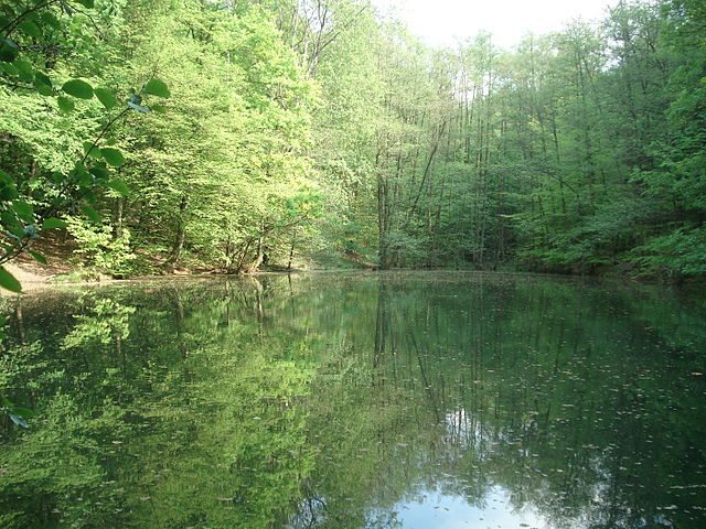
Laufach, located in Bavaria, Germany, is a charming town that offers a wonderful opportunity for hiking enthusiasts. Surrounded by beautiful landscapes, lush forests, and scenic views, there are several trails and paths suitable for various skill levels.
Hiking Trails
-
Waldweg (Forest Path): This is a popular trail that meanders through the local woods, making it ideal for a relaxing day hike. The trail is well-marked and generally easy, suitable for families and beginners.
-
Main Hiking Trail: Laufach is situated near the Main river, and hikers can connect to trails along the riverbanks. This trail offers beautiful views of the water and surrounding countryside.
-
Hiking to Heiligkreuz: This trail leads to a small chapel with a viewpoint that offers stunning panoramas of the area, perfect for a picnic break.
Points of Interest
- Nature Reserves: The area around Laufach features several nature reserves, making it a great spot for birdwatching and observing local wildlife.
- Local Culture: As you hike, you may come across historical landmarks and learn about the rich culture of the region.
Tips for Hiking in Laufach
- Weather Preparedness: Always check the weather before you head out. Conditions can change quickly, especially in mountainous areas.
- Proper Gear: Wear sturdy hiking shoes and carry essential gear, including water, snacks, and a first aid kit.
- Trail Maps: While many trails are well-marked, having a map or a GPS-enabled device can help you stay oriented.
- Respect Nature: Stick to designated trails to preserve the local flora and fauna.
Conclusion
Hiking in Laufach offers a blend of natural beauty and cultural experiences. Whether you're a seasoned hiker or just looking for a leisurely walk, there's something for everyone. Enjoy the fresh air and the scenic views that this lovely Bavarian town has to offer!
- Country:

- Postal Code: 63846
- Local Dialing Code: 06093
- Licence Plate Code: AB
- Coordinates: 50° 1' 0" N, 9° 18' 0" E


- GPS tracks (wikiloc): [Link]
- AboveSeaLevel: 180 м m
- Area: 15.60 sq km
- Population: 5176
- Web site: http://www.laufach.de
- Wikipedia en: wiki(en)
- Wikipedia: wiki(de)
- Wikidata storage: Wikidata: Q539764
- Wikipedia Commons Category: [Link]
- Freebase ID: [/m/02q06vy]
- GeoNames ID: Alt: [2880146]
- VIAF ID: Alt: [130305602]
- OSM relation ID: [379885]
- GND ID: Alt: [4270538-1]
- Library of Congress authority ID: Alt: [n89146892]
- Bavarikon ID: [ODB_A00000250]
- German municipality key: 09671139
Shares border with regions:


Bessenbach
- municipality of Germany
Bessenbach, located in Bavaria, Germany, is a charming area with beautiful natural surroundings perfect for hiking enthusiasts. Here are some highlights of hiking in and around Bessenbach:...
- Country:

- Postal Code: 63856
- Local Dialing Code: 06095
- Licence Plate Code: AB
- Coordinates: 49° 58' 0" N, 9° 16' 0" E


- GPS tracks (wikiloc): [Link]
- AboveSeaLevel: 195 м m
- Area: 29.99 sq km
- Population: 4831
- Web site: [Link]


Sailaufer Forst
- unincorporated area in Germany
Sailaufer Forst is a beautiful forest area that provides a wonderful environment for hiking and nature exploration. If you're planning to hike there, here are some key points to consider:...
- Country:

- Coordinates: 50° 2' 30" N, 9° 17' 58" E


- GPS tracks (wikiloc): [Link]

