
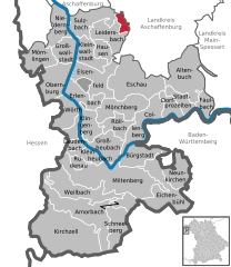
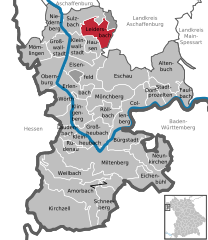
Mespelbrunn (Mespelbrunn)

- municipality of Germany
 Hiking in Mespelbrunn
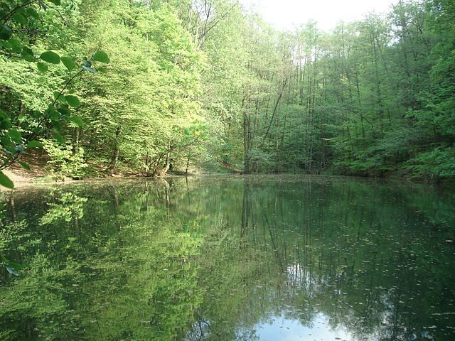
Mespelbrunn is a picturesque village located in Bavaria, Germany, and is particularly well-known for its charming castle, Schloss Mespelbrunn, set amidst the lush forests of the Spessart mountain region. Hiking around Mespelbrunn offers a delightful combination of natural beauty, historical sites, and peaceful trails.
Hiking Trails
-
Mespelbrunn Castle Trails: One of the most popular hiking routes starts at the castle, allowing hikers to explore the surrounding woodlands and scenic spots. There are well-marked trails that lead through the forests, often offering stunning views of the castle itself.
-
Spessart Nature Park: The village is situated near the Spessart Nature Park, which features a variety of hiking trails ranging in difficulty. The park is home to diverse flora and fauna, and the well-maintained paths provide options for both casual walks and more challenging hikes.
-
Historical Paths: Some trails in the area highlight historical aspects of the region, such as ancient trade routes or sites of historical significance.
Trail Features
- Difficulty Levels: Trails range from easy walks suitable for families to more challenging routes for experienced hikers.
- Scenic Views: Whether you’re walking through dense forests or along ridges, you’ll encounter beautiful landscapes, including views of the dramatic hills and valleys of the Spessart.
- Wildlife: Look out for local wildlife, including deer, wild boar, and a variety of birds, which can often be spotted along the trails.
Best Time to Hike
The best time for hiking in Mespelbrunn is during the spring and early fall. These seasons typically offer pleasant weather and vibrant natural scenery, with blooming flowers in spring and colorful foliage in fall.
Practical Tips
- Trail Maps: It’s advisable to pick up a trail map from local information centers or online sources to help navigate the area.
- Gear: Wear appropriate hiking boots and carry water, as some trails can be steep or uneven.
- Weather Check: Always check the weather forecast before heading out, as conditions can change rapidly in mountainous regions.
Conclusion
Hiking in and around Mespelbrunn is a rewarding experience that combines the beauty of nature with the allure of history. Whether you are looking to enjoy a leisurely walk or an adventurous trek, this area has something to offer for everyone.
- Country:

- Postal Code: 63875
- Local Dialing Code: 06092
- Licence Plate Code: AB
- Coordinates: 49° 55' 0" N, 9° 17' 0" E


- GPS tracks (wikiloc): [Link]
- AboveSeaLevel: 269 м m
- Area: 15.53 sq km
- Population: 2073
- Web site: http://www.mespelbrunn.de
- Wikipedia en: wiki(en)
- Wikipedia: wiki(de)
- Wikidata storage: Wikidata: Q516376
- Wikipedia Commons Category: [Link]
- Freebase ID: [/m/02q06wm]
- GeoNames ID: Alt: [3274989]
- VIAF ID: Alt: [234267923]
- OSM relation ID: [387604]
- GND ID: Alt: [4281492-3]
- archINFORM location ID: [14591]
- MusicBrainz area ID: [61bd6d23-ab2e-49dc-b2e4-5115e36b0e8d]
- WOEID: [15002712]
- TGN ID: [1100311]
- Bavarikon ID: [ODB_A00009266]
- German municipality key: 09671141
Shares border with regions:

Hohe Wart
- unincorporated area in Germany
Hiking in Hohe Wart
Hohe Wart is a high point located in the rugged terrain of the Palatinate Forest in Germany. It's part of the larger Palatine region, which offers a wealth of hiking opportunities, scenic views, and diverse flora and fauna. Hiking in the area around Hohe Wart can be a fantastic experience for both seasoned hikers and beginners alike....
- Country:
- Coordinates: 49° 54' 0" N, 9° 15' 0" E
- GPS tracks (wikiloc): [Link]

Bessenbach
- municipality of Germany
Hiking in Bessenbach
Bessenbach, located in Bavaria, Germany, is a charming area with beautiful natural surroundings perfect for hiking enthusiasts. Here are some highlights of hiking in and around Bessenbach:...
- Country:
- Postal Code: 63856
- Local Dialing Code: 06095
- Licence Plate Code: AB
- Coordinates: 49° 58' 0" N, 9° 16' 0" E
- GPS tracks (wikiloc): [Link]
- AboveSeaLevel: 195 м m
- Area: 29.99 sq km
- Population: 4831
- Web site: [Link]


Heimbuchenthal
- municipality of Germany
Hiking in Heimbuchenthal
Heimbuchenthal is a charming village located in the Spessart region of Bavaria, Germany, known for its beautiful landscapes and outdoor recreational opportunities. Here are some key points about hiking in Heimbuchenthal:...
- Country:
- Postal Code: 63872
- Local Dialing Code: 06092
- Licence Plate Code: AB
- Coordinates: 49° 53' 0" N, 9° 18' 0" E
- GPS tracks (wikiloc): [Link]
- AboveSeaLevel: 234 м m
- Area: 17.15 sq km
- Population: 2106
- Web site: [Link]

Leidersbach
- municipality of Germany
Hiking in Leidersbach
Leidersbach is a small town located in Bavaria, Germany, and it offers some great hiking opportunities in its scenic surroundings. While it may not be as widely known as larger hiking destinations, the area is characterized by beautiful landscapes, rolling hills, and forests that provide a peaceful environment for outdoor activities....
- Country:
- Postal Code: 63849
- Local Dialing Code: 06092; 06028
- Licence Plate Code: MIL
- Coordinates: 49° 54' 0" N, 9° 13' 0" E
- GPS tracks (wikiloc): [Link]
- AboveSeaLevel: 196 м m
- Area: 19.81 sq km
- Population: 4788
- Web site: [Link]


Waldaschaffer Forst
- unincorporated area in Germany
Hiking in Waldaschaffer Forst
Waldaschaffer Forst, located near the town of Waldaschaff in Bavaria, Germany, offers a variety of hiking opportunities for outdoor enthusiasts. This forested area is characterized by its stunning natural beauty, diverse ecosystems, and well-maintained trails, making it an excellent destination for hikers of all skill levels....
- Country:
- Coordinates: 49° 57' 22" N, 9° 19' 37" E
- GPS tracks (wikiloc): [Link]


Rohrbrunner Forst
- unincorporated area in Germany
Hiking in Rohrbrunner Forst
Rohrbrunner Forst, located in Germany, is a beautiful area for hiking that offers a mix of natural landscapes, tranquility, and a variety of trails suitable for different skill levels. Here are some key points to consider when hiking in Rohrbrunner Forst:...
- Country:
- Coordinates: 49° 54' 23" N, 9° 23' 12" E
- GPS tracks (wikiloc): [Link]